ASEAN Geospatial Summit Back to Programme
About the Summit
ASEAN Geospatial Summit is the first ever initiative taken in geospatial industry to bring together South East Asian national mapping organisations and space agencies at one platform. The forum is being organised as an integral part of GeoSmart Asia 2015 – the premier event for the Asia Pacific bringing together geospatial professionals from different industry domains in the region.
Introduction
South East Asia region faces several common challenges and opportunities, thus offering greater options for collaboration and partnerships in exploiting technology and practices while addressing the challenges and carrying forward their quest for development. Reliable and accurate geospatial data is the foundation for all kinds of information systems. Realising the need for greater cooperation and collaboration in the field of geospatial information in South Asia region, Geospatial Media is taking initiative to bring together ASEAN geospatial information leaders at one platform. In view of current focus on strengthening and collaboration in this region to transform South East Asia into a global power, ASEAN Geospatial Summit is being organised as an integral part of GeoSmart Asia, on September 30, 2015 in Kuala Lumpur, Malaysia.
Objectives
- Bring together key stakeholders of geospatial information – national mapping organisations, space agencies, SDIs (spatial data infrastructure) and apprise them with latest developments in geospatial technology
- Facilitate interaction between geospatial information providers and geospatial technology providers
- Offer opportunities for collaboration and strengthening partnerships amongst South East Asian countries in the application of geospatial technologies
- Explore business opportunities of geospatial data for geospatial information providers
Target Audience
- Survey & mapping agencies
- Space agencies
- Geospatial technology providers
- SDIs
Speakers

Datuk Sr Ahmad Fauzi Bin Nordin
Director General of Survey & Mapping
Department of Survey & Mapping
Malaysia
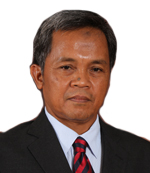
Dr. Nurwadjedi
Deputy of Geospatial Thematic Information
Badan Informasi Geospasial
Indonesia

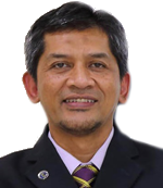
Dr Noordin Bin Ahmad
Director General
Malaysia Space Agency (ANGKASA)
Malaysia


Vu Tien Quang
Chief of Technology and Assessment Office
Department of Surveying and Mapping
Vietnam

Masanobu Tsuji
Director-Bangkok Office
Japan Aerospace Exploration Agency & Executive Secretary
Asia Pacific Regional Space Agency Forum
Japan

Dr Zaffar Sadiq Mohamed-Ghouse
Manager - Business, Research & International Relations
CRC for Spatial Information, Australia
&
Director, Surveying Spatial Sciences Institute
Australia

Dedi Irawadi
Director for Remote Sensing Technology and Data Centre
National Institute of Aeronautics and Space (LAPAN)
Indonesia