Introduction
GeoIntelligence Asia Pacific is the flagship conference of Geospatial Media for geospatial intelligence community in Asia Pacific. Started in Malaysia in 2015, the conference is fast expanding to reach out to national security and public safety agencies in South East Asia and Pacific. As the nations in Asia Pacific look at strengthening their military capabilities and readiness , geospatial intelligence will be the game changer in ensuring this transformation. By bringing together the experts from industry and academia, GeoIntelligence Asia Pacific provides an opportunity for geointelligence users to be updated with latest technology solutions in the field
Theme
GeoInt: Enhancing Combat Potential & Homeland Security
It is an established fact that Command, Control, Communications and Intelligence (C3I) play an important role in modern warfare. Effective C3I is only possible if intelligence is useful and actionable. Geospatial Intel¬ligence (GeoInt) lays the critical foundation of this intelligence as it involves amalgamation of all types of intelligence like location intelligence, Imagery Intelligence, Communications Intelligence, Signal Intelligence and Human Intelligence. Geospatial technology is also vital for facilitating multi-source information sharing and integration across agencies and organisations by providing a common platform upon which other information is based. It is these capabilities that make GeoInt an effective and indispensable tool for enhancing combat potential and homeland security.
Speakers

Chief Technology Officer
Luciad
Belgium
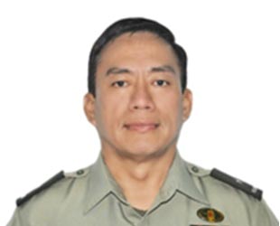
Chief of Command Center
Armed Forces of the Philippines
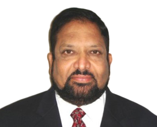
Vice President Sales, Middle East, Africa and South Asia, DEIMOS IMAGING, an UrtheCast Company, USA

Director, Member Services-Asia & the Americas, Open Geospatial Consortium, Canada

National Security Lead – APAC
Esri
Singapore

Solution Engineer
Esri
Singapore

President
Special Operations Solutions
USA

Director, School of Engineering & Technology
Noida International University
India

Head - Technology Department
Defence Mapping Agency
Vietnam
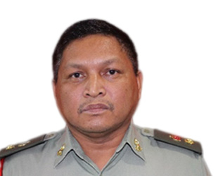
Defense Geospatial Division
Department of Survey & Mapping (JUPEM)

Founder and Director, C-SIGMA LLC
Advisor, Multinational Maritime Security Centre of Excellence United States

Director - Research and Technical Development Division
Malaysian Meteorological Department

VP, Business Development
Planet Labs
Germany
Director - Geospatial Information Science Research Centre, Universiti Putra Malaysia, Malaysia

Consultant, Strategic & Defence Issues for SouthEast Asia, Malaysia

Senior Research Officer, Science & Technology Research Institute for Defence, Malaysia
Why Attend
- Competitive advantage from insights and improved productivity of core assets
- First responder support to humanitarian operations
- Ability to map human movements, across time, space and terrain for tactical planning
- A powerful use of civic planning, humanitarian missions, industrial surveillance, precision war, conflict resolution, homeland security
- Logistics support for military operations, disaster response, civic emergencies, and so on
- Provide insights to help avert dangers, counter conflicts, predict opportunities or adapt to shifting conditions
- Use of advanced sensor technology and multiple types of geospatial data to help visualise events
- Intelligence applied to a map of terrorist hideouts
- Data mined from geo-tagged tweets, satellite image of the terrain and drone surveliiance
Target audience
- Defence Ministries
- Defence Forces - Army, Navy, Air Force
- Internal Security Forces
- SAARC Defence Forces
- ASEAN Defence Forces
- Disaster Management Authorities
- Multilateral Cooperative Agencies
- Paramilitary Forces
- Internal Security agencies
- Police Force
- Specialised Forces
- Solution Providers
- Global Defence Suppliers
- Local Defence Services & security
Programme Overview
FOCUS AREAS
Warfare is no longer confined to a defined battlefield in terms of time and location. Surprise is a key element of modern warfare. Threats can occur from anywhere at anytime. The need is thus to gather information about all such possible threats before the adversaries strike. This is possible only through 24x7 surveillance. The session will focus on advances in geospatial technology aiding modern surveillance, ensuring effective integration of all elements of a joint force and various solutions, techniques and implementation for enhancing effectiveness of combat identification.
Cross border infiltration, illegal smuggling of arms and drugs, human trafficking etc., are some of the major challenges that border security forces face everyday. GeoIntelligence aids in integrated technologies for enhanced border surveillance, meeting threats due to border infiltration and offers comprehensive solution to detect and to counter intrusion. Further, Asia Pacific nations have long and contested maritime boundaries. They depend on fish as food from the oceans. Trade is almost exclusively over the seas . Maritime and coastal security is pivotal for the economies of these nations. Geointelligence is essential to ensure this security.
Ensuring safety of its citizens, controlling crimes, tackling insurgency, and protecting critical infrastructure like airports, railways, roads etc., are some of the major chal¬lenges facing homeland and security agencies across the region. In such a scenario, the most critical requirement for operational commanders and ground forces is actionable insights and real time data. Changing nature of threats require an up-to-the-minute situational awareness. Spatial information has a critical role to play in this process, as it provides an insight into the relationship between statistics, demographics, political boundaries and other influencing factors. It also is a powerful tool to visualize patterns in disrupting incidents like where and when they most often occur, helping forces to prioritize and position their resources.
Geospatial technology is finding applications in practically every field of human activity, in areas like robotics, unmanned systems, 3D printing, big data analytics, human terrain analysis etc. A plethora of hi-tech sensors are making online, on-demand information a reality. Digital maps are being developed as applications to ensure mobile availability of geospatial information to entire lifecycle of security – from planning to execution. A number of geospatial technology trends and solutions are emerging that are putting the all-important actionable information in the hands of security personnel.
PAST PARTICIPANTS
- Defence Mapping Agency, Vietnam
- Defence Staff Intelligence Division, Malaysia
- Defence Technology Institute, Thailand
- High Commission of India in Malaysia
- Malaysian Army
- Malaysian Maritime Enforcement Agency
- Malaysian Institute of Defence & Security
- MIMOS Berhad
- Ministry of Defence, Malaysia
- National Defence University of Malaysia
- Royal Malaysian Air Force
- Science & Technology Research Institute for Defence, Malaysia
- Bentley Systems
- Telekom Malaysia
- Indian Army
- Maritime Institute of Malaysia
- Defence Research and Development Organisation, India
And many more...
Exhibition
The exhibition at GeoSmart Asia + GeoIntelligence Asia Pacific is the preferred source for geospatial technology updates by the security and safety community in the Asia Pacific region. The joint exhibition for GeoSmart Asia and GeoIntelligence Asia Pacific offers a seamless reach into the civilian and defence domains. Avail this extremely cost effective opportunity to showcase your geospatial offerings and expand your market.
EXHIBITION RATE
USD 400 per sq mtr* * plus taxeswrite to exhibition@geosmartasia.org for exhibition proposal and the latest floor plan.
GeoIntelligence Asia Pacific and GeoSmart Asia 2016 at a glance
REGISTRATION FEES
To Register click here or write to registration@geosmartasia.org.
GeoIntelligence Asia Pacific secretariat
4.17, Level 4, Wisma Central, 147 Jalan Ampang, 50450 Kuala Lumpur, Malaysia
Tel: 60-122386377, Fax: +60 3 2181 7661,
info@geosmartasia.org
