Speaker's Biographies & Abstracts
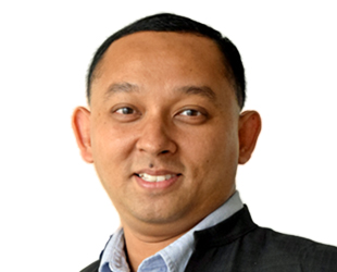
Dr. Rishiraj works as technical officer focusing on climate risk management in the Climate Change and Climate Risk Management department. He previously worked as senior geographic information system coordinator and technical officer (GIS) in ADPC's duty station in Dhaka, Bangladesh. Previously, Mr. Rishiraj has worked with the CGIAR research program on climate change, agriculture and food security. He has also served as visiting researcher and consultant for several international organizations under Consultative Group on International Agricultural Research. Dr. Rishiraj is an external referee for the National Research Council of Government of Romania and a reviewer for several international journals. He has published several papers in reputed journals internationally. Dr. Rishiraj holds a Bachelor's Degree in agriculture, a Master's Degree in geoinformatics and Ph.D. in applied geoinformation and earth observation.

Kim Cohen has been in the building industry for nearly 40 years, starting as a drafting assistant with Australia’s largest telecommunications company Telstra and moving through all disciplines of construction from survey, mechanical electrical and architectural.
After 15years with Telstra, Kim worked with multiple architectural and shop fitting firms on a variety of projects. This experience has given Kim a broad understanding of the Industry. Now working with Australia’s largest International Airport, Kim leads the team in Building Assets and Services and for the past 4 years has been developing a GIS platform.
Abstract Self-service portal enhances GIS platform at Sydney AirportSydney airport may well be one of the oldest continually operating airports in the world, but when it comes to how Sydney airport capture, record and disseminate their data, they are far from old. Join this presentation to find out just how Sydney Airport are using the latest technology incorporating a GIS platform to create a single source of truth which improves efficiencies, enhances safety and provides information mobility for the organisation. The GIS platform has been enhanced by implementing a self-service portal. This portal is fast proving to be an efficient collaboration platform between the airport design team and other departments and is finding a widespread acceptance amongst the users. With links to financial and planning databases, it gives the airport staff the information at their fingertips when they need it, where they need it, enabling them to make informed decisions on the spot, enhancing their ability to react to safety or operation concerns promptly.
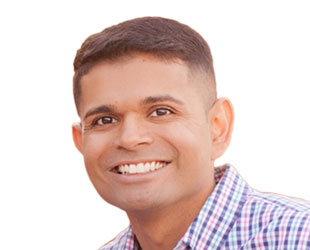
Manan Patel founded Special Operations Solutions, LLC (SOS) in 2008 to provide aerial surveillance solutions. SOS has grown to support key U.S. government, commercial, and international customers. SOS has been named to the Inc500 list of America’s fastest growing private companies from 2012-2014.
Prior to SOS, Mr. Patel worked with the U.S. government as an Electronics Engineer where he received the NVESD Technical Achievement Award, U.S. Army Commanders Civilian Medal, and Global War on Terrorism Medal for his efforts. During this time, Mr. Patel was instrumental in the development, enhancement, and implementation of innovative and critical technologies for U.S. forces.
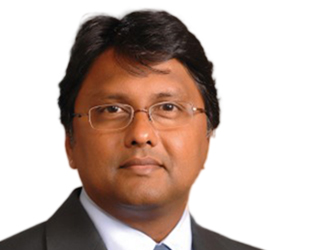
Dr. Navulur has over 23 years of experience in the Geospatial industry. He is the Sr. Director of Global Strategic Programs at DigitalGlobe. He obtained his doctorate from Purdue University in US. He is the author of the book entitled “Multi-Spectral Image Analysis Using Object Oriented Paradigm”. He is adjunct professor at the Universities of Denver and Colorado. Dr. Navulur recently took on the responsibility of President of DigitalGlobe Foundation.
Abstract Fueling Location Analytics from Satellite ImageryThe foundational elements of location analytics include location, context and time. The author will discuss how satellite imagery, collected at finest scale of 50cm, globally is deal for fueling the location data. He will also discuss the nuances of converting location data that is analytical ready and how this can be done at scale. The presentation will cover some piratical examples of how satellite imagery can be used for location analytics.
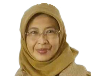
Dr. Ahyani Raksanagara graduated from Universitas Indonesia specializing in public health. She has more than 29 years experience in health science. Since 1988 until 2004 she worked as a doctor and became a head in primary health care. Since 2011 until 2017 dr. Ahyani became a head of health agency. During her time in daily activities she is also member of road safety team specially for health data and information. In 2017 she became a head of communication and informatics agency that responsible for smart city and open data.
Abstract Towards smarter bandung
Most of the world's population today lives in cities. By 2035, the population of the cities in Indonesia is expected to grow 66.6%. In West Java, about 89.3% people live in urban areas. In last 3 years Bandung had been starting smart city programs. We already realize that city can't managed using business as usual, we need something new "new way, new strategy, new policy ".
Due to resource constraints, there will be a problem in the future to provide all the services to the citizen. To continue to serve and improve the standard of living and growing population, it is necessary to develop smart cities. The Smart City aims to make optimal and sustainable use of all resources, while maintaining an appropriate balance between social and environmental. In the Smart City, maximum use is made of ICT to improve the functioning, management, and supervision of the variety of systems and services. The main categories that define smart cities are include the quality of the environment, transportation and traffic, information and communication systems, government, economics, human resources, security, and emergency preparedness.
To actualize Bandung smart city we already equipped with different electronic elements employed by several applications, like street cameras for observation systems, sensors for weather systems and sensors for air pollution monitoring. To deliver all those information we already using IoT and geospatial model as user interface. We also already have map 1:1000 scale and this is the first and the best map that Indonesia ever had for the city level.
Mr. Gopal Valecha is currently working with DIMTS (Delhi Integrated Multi -Modal Transit Systems Ltd, a JV of Delhi Govt.) as Asst. Vice President (IT) Business Development. He has a vast experience in working with Government bodies/Departments at state and central level , Industry associations & corporates . He has been advising them on adoption of various technologies like RFID, GPS, Barcoding, AFCS, e-tolling, digital payments, data analytics and global best practices & standards in urban transportation and supply chain.
He has been instrumental in driving various national level e-governance initiatives. Prior to joining DIMTS he was working with BCIL, GS1 India, Ministry of Commerce, T-Mobile in England & Scotland and various other leading companies.
He has over 19 years of experience with more than 15 years in Business Development & Consulting. He has done B.Tech in Electronics & Telecommunications, MBA in Sales & Marketing and Supply Chain Management certification from IIT Delhi.
Dr Zaffar Sadiq Mohamed-Ghouse is currently the Director (NSW) - Business Development, Research & International Relations at CRC for Spatial Information (Australia's peak research organisation for Spatial) and is also the President-Elect of the Surveying Spatial Sciences Institute (SSSI), Australia. He has 19 years of experience in client management, strategic consulting studies, business development, project management, systems review and integration for Utility Industry and Government, design, development and management of spatial databases, review data framework policies, develop spatial analyses techniques and technology including GIS applications development for major clients in Australia, New Zealand, Indonesia and India. He has lead several Multi-Million Dollar National Mapping projects for State and Federal governments in Australia. Zaffar has published research papers at International and National levels focusing on GIS applications to support such areas as: spatial data infrastructure, data quality, groundwater management, water resources, rural administration; asset management; field data capture; public health management and disaster management. He holds a pivotal role as an adviser to various National and International spatial organisations. He is also a member of several boards and technical committees in Australia and overseas. Zaffar on behalf of Standards Australia contributed to the ISO 19157 Spatial Data Quality Standards. Zaffar is a recipient of the “Young Professional Award” by the Surveying Spatial Sciences Institute, Australia. He is also a recipient of the Australian Cooperative Research Centre for Spatial Information’s full Doctorate Scholarship.
Abstract Open Spatial AnalyticsGlobally, the open data agenda and policy of governments has resulted in the availability, both to businesses and the public, of complex spatial data of varying quality. Voluminous spatial data is available through government portals. However, analysis of the information provided through these data portals is limited: simple spatial analysis tools are only available to the user through the portals, and the end users are often required to perform complex spatial queries in order to resolve a business or an end user problem. The next challenge is to provide the means of performing real-time analysis through spatial data portals, including the currency of the spatial data available through open data initiatives. To facilitate the spatial analysis of data, end users would benefit from a virtual spatial analytic workbench to use through a web platform. The workbench could host open geoprocessing/ analytic tools that end users can customise to interact with the open spatial data in order to generate rapid outputs. The open spatial analytics tools could be managed through the creative commons licence process, with the user community maintaining the tools and versioning. The advent of open source statistical software such as ‘R’, coupled with spatial analysis processes may provide a powerful geostatistical analysis platform for end users to work with the open data.
Jason‘s 30 years in the architectural business has seen him work for leading design practices such as Atkins, RMJM, Aedas, Rocco and Arup Associates. He has been responsible for commercial, hotel, transportation, infrastructure and mixed-use redevelopment projects in Europe, the Middle East and throughout the Asia Pacific region. Completed work such as The Landmark (Hong Kong Land) and Hong Kong Station (MTR), allow Jason to bring practical on-site experience into the design of subsequent mega-projects like Doha Metro, the 1-million sqm Sands Casino, Macau (Parcel 7&8) and Admiralty Station. Jason specialises in combining commercial and transportation building types through Transport Oriented Development (TOD). Jason has been invited to speak on many occasions on the topic of TOD and innovative architecture, including high profile conferences in Hong Kong, China, Singapore, Malaysia, India, Indonesia and Australia.
AbstractAs part of our work in Future Proofing Cities (FPC), Atkins and University College London looked at various factors and actions which affect our ability to create robust centres of population. The FPC report provides a new practical framework to help cities tackle the environmental risks to their long-term prosperity and growth.
Within this framework, population growth, densification, public transportation and funding are issues connected through the design, development and management of the public realm.
This short presentation looks at two initiatives which could improve the infrastructure of a city through latest technologies, and thereby improve how our cities respond to change:
• The creation of an Estate Sensor Grid represents a hard, physical product producing flexible and intuitive outputs. This provides the city with a management tool not only building awareness of how the city perform, but facilitating improved efficiency, reducing costs and improved quality of life.
• Mobility as a Service (MaaS) is a new way of thinking, in terms of providing interconnected public transport within our communities. Atkins has carried out trials to evaluate the effectiveness of such systems, and how the public respond to this new way of thinking.
The above snapshot of our work serves to promote interest and conversation into the opportunities and impact technology has in society.
Wilfred Lau is an Arup Fellow and a Director of the global consultancy firm Arup. He has over thirty year experience in managing and delivering large-scale multidisciplinary projects in Asia. He led Arup's consulting activities across East Asia and was Arup Global Transport Planning Leader from 2001 to 2016. He was the Chairman of the Association of Consulting Engineers of Hong Kong. In recent years, Wilfred focuses on development of cities in Asia, advising governments on development and delivery of future generation of cities and new towns. He developed the smart green resilient planning philosophy and is author of the book “Smart Green Resilient”.
Abstract From smart district to smart green resilient city
While developing a green field smart city is not an easy task, implementing smart city initiative in an existing city could be more than challenging. In addition to adopting and implementing technologies to be contextual and locational specific, there are additional hurdles in the social, organizational and institutional sectors. In a dense city environment, there might not be space to equip legacy infrastructure systems with sensors and new utilities. Obtaining the financing and agreement in retrofitting an aging building stock to smart green buildings under multiple ownership system in existing city could be a lengthy process.
The Government of Hong Kong is committed to develop Hong Kong into a smart city and is using the district of Kowloon East as a pilot area for its implementation. This talk will briefly discuss the issues faced in the six elements of smart city, namely, smart mobility, smart living, smart environment, smart people, smart government and smart economy. Examples from the trial projects of Kowloon East will be referenced to illustrate the transformation of an old district Kowloon East to a future Smart Green Resilient City of Hong Kong.
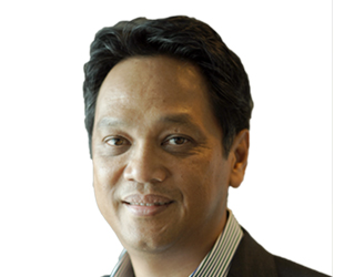
Robert Toba Siahaan has been the Head of Geoscience Data for Group Technical Data since September 2012.
Data Management – Geoscience, Group Technical Data is functioned to manage the execution of Geoscience (Geology, Geophysics and Geospatial ) data operation and services to PETRONAS Exploration and Development projects domestic and international by providing correct Geoscience data , technical expertise, fit-for-purpose technologies, delivery of best practices and producing staffs of high technical capabilities in order to ensure a well-managed geoscience data to be used by PETRONAS to support the Exploration & Production (E&P) Global business growth sustenance and reduce HSE risk.
He was previously involved with Geoscience Data industry since beginning his career started with:
» 1984 as Exploration Geologist with Shell Sarawak
»1989 as Processing Geophysicist with Digicon, KL
» 1997 as Senior Processing Geophysics, Shell UK
» 2001 as Data Management Geoscientist with Schlumberger Information Solution, KL
» 2004 as Seismic Data Repository Consultant with PETRONAS
» 2006 as Technical Consultant – Seismic Data Management with Shell Houston US
PiriGIS is PETRONAS’ web GIS portal launched in 2006. Currently, Group Technical Data (GTD), PETRONAS has been managing and revamping PiriGIS with technology to cater the ever growing demand for spatial analytics that are able to cross multiple disciplines from Upstream to Downstream. One of the latest PiriGIS’ spatial analytics package tailored for engineering is PETRONAS Technical Equipment Mapping (PTEM). PTEM is an integrated database for major topside equipment that consists of essential data from mechanical, electrical, instruments and control that emphasised on equipment models and brands. With PTEM, users are able to view the outlook and demography of equipment installed and perform analytics from end to end front end engineering, procurement, maintenance and planning. This technology is a catalyst for informed decision, cost effectiveness, work simplification and standardisation.

Technology enables National or City governments around the globe to improve various aspects of daily life. Smart-City is currently the next urban model for most of countries in the world. For the developing countries, Smart-City can be the most effective tool model to solve urban problems because of the uncontrolled fast urban population growth and for the developed countries, Smart-City can be the model for next economic growth and energy efficient. Smart-City platform is the system to collect data and information from all around city and to provide these data and information in exact time and exact people with the form of service or solution. (1) how to collect many different data and information; (2) how to store and manage data and information and how to transform those to service; (3) how to provide service to citizens. And for better service, cloud, IoT, big-data and other cutting-edge technology will be important. IFEZ, Korea’s renowned Smart City, shows you the answer by embedding the innovative technologies to build intelligent and connected communities.
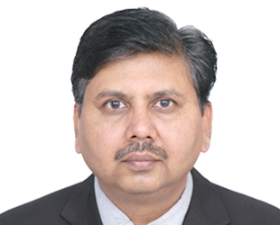
Gujarat International Finance Tec-City (GIFT) is envisaged as India's first major & super tall Central Business District International Finance Service Centre project which would be designed as the focal point of India's booming financial services market. In terms of scale and sheer physical scope, GIFT is being developed as a New Smart City which is intended to be at par or above with presently acknowledged globally benchmarked financial centers.
For effective planning and execution of Smart City, GIFT is using uses ESRI's ArcGIS to view and analyze large datasets in three dimensions. GIFT is successfully tapping the power of GIS for range of applications, few to name them are - land resources, environment, infrastructure planning, logistics, disaster management etc.
GIS have provided GIFT City with its own powerful set of tools capable of supporting comprehensive planning and management. It also provides the ability to integrate multiple data sources for analysis and provides GIFT City with a management and planning tool for sustainable and smart growth. GIS is working as an operational and affordable information system for planning, implementation, operation & Maintenance in GIFT.
All data/information of each division/department like – Planning, Engineering- power, water, district cooling, solid waste management, have been incorporated on GIS. This is reducing the redundancy while increasing the efficiency and accurateness, as all the data is passing through one standardized workflow.
Mr. Dharmadhikari will share his experiences on how the land parcel can be converted into a new Smart City, what are the challenges being faced and how it can be mitigate, how the GIS can be effectively use as a tool to develop the new smart city.
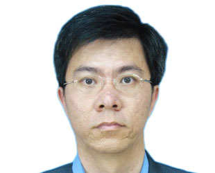
Dr. Teoh Chin Chuang has obtained his Bachelor of Engineering (Agricultural) in 1998 and PhD (GIS and Geomatic Engineering) in 2005 from Universiti Putra Malaysia. He is the Deputy Director of Engineering Research Centre at Malaysia Agricultural Research and Development Institute (MARDI). His research areas of interest are remote sensing, image processing and analysis and computer vision system. Currently, he involved in the research related with precision farming for mechanized rice production.
Abstract Using ICT to Improve Rice FarmingRice is a staple food for more than 3 billion people in the world. In 2014, the rice self-sufficiency level for Malaysia was about 72%. Total paddy planted area in 2014 was 689,732 hectares with a total production of about of 2.6 million tonnes. Land preparation, water management, nutrient management, crop health management and harvesting are essential steps in rice cultivation. Malaysian Agricultural Research and Development Institute (MARDI) is currently developing and verifying ICT for rice production in Muda Agricultural Development Authority (MADA) granary areas.
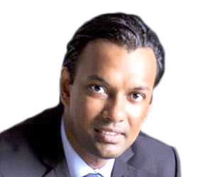
Dr. Viraj’s expertise lies in technology transfer and innovation and has gathered a wealth of knowledge and experience in the field through working for elite organisations such as the University of Oxford and University of Warwick as well as private companies.
Prior to being appointed as the CEO of PlaTCOM Ventures, Dr. Viraj held the position of Senior Vice President and Head of Innovation Business Opportunities (IBO) at Agensi Inovasi Malaysia (AIM), the parent organisation of PlaTCOM Ventures Sdn Bhd.
Before moving to Malaysia, Dr. Viraj worked for Oxford University Innovation – the technology transfer company of the University of Oxford. He was involved in consulting to and advising governments, companies and research organisations on technology development, technology transfer and commercialisation, Intellectual Property management and discovery, commercialisation strategy and business planning. Dr. Viraj was also involved business development, project design and delivery, as well as training and coaching in technology transfer and commercialisation. During his time at Oxford University Innovation, Dr. Viraj delivered projects and technology transfer training to UK and global clients from Spain, Mexico, Columbia, Japan, Malaysia, Russia, Czech Republic, Serbia, Korea, India and China.
Prior to joining Oxford University Innovation, Dr. Viraj worked as a Business Development Manager at Warwick Ventures – the commercial arm of the University of Warwick - where he was involved in technology transfer and commercialisation of university research. Before migrating to the UK, he spent 10 years in Australia where Dr. Viraj gained much experience in the field of innovation management. He was also the co-founder and CEO of a successful biotech startup in Melbourne, Australia.
Dr. Viraj holds a PhD in Molecular Biotechnology, a Graduate Diploma in Applied Microbiology and Biotechnology - both from RMIT University in Australia, and a Bachelor of Science Degree in Microbiology from the University of Bangalore, India.

Mr Van Helvert is currently working as a manager at the Geo-Information department of the Dutch Cadastre (‘Kadaster’). He has obtained broad experiences in geo-related business, and has been working on different national and international projects within Europe and South-America. Nowadays his areas of interest are innovation and improvement of geo-related business models and (production) processes.
He has a University degree Physical Geography at University of Amsterdam, extended with postgraduates at Wageningen University and ITC Enschede (The Netherlands).
Abstract The customers’ role in the improvement of topographic informationThe Cadastre, Land Registry and National Mapping Agency of the Netherlands (in short: Kadaster) is responsible for the Topographic Map of the Netherlands in the scale ranges from 1:10.000 to 1:1.000.000. The quality of these geo-data sets has been improved seriously over the past four years.
This was initiated by vast process adjustments: The data actuality has been increased from four years to about one year. Business results (like costs, efficiency and customer satisfaction) also developed in a positive way. The introduction of a LEAN-methodology and the increase of customer-relationship and involvement were the key-issues in the adjusted production processes. (Technical) innovation led to automatic generalisation to small scaled visualisations, which resulted in a complete topographic family of different scales within the same 1-year-actuality range.
The success of this process-improvement has led to an awareness of the stakeholders on different levels, ranging from Ministries to common citizens, and is now used as a blueprint for other departments within the organisation.
Liyang heads the geospatial planning and development department responsible for delivering the geospatial data policies, programs and mechanisms for Singapore's National Spatial Data Infrastructure. His diverse portfolio includes carrying out geospatial master-planning, strategic workforce planning, driving data sharing, to implementing capacity building and geospatial innovation programs. He has also been invited to speak at the Master of Public Policy program at the Lee Kuan Yew School of Public Policy; and for the Centre for Liveable Cities, Singapore. Liyang graduated with a MBA at the Singapore Management University in 2016 and is a recipient of the SMU’s scholarship for community impact.
Sr. Khairul Faizi B Mohd Taib has been the Head of Geospatial Data for Data Management: Geosciences, Group Technical Data, PETRONAS since September 2015.
Geospatial Data section is functioned to manage the execution of Geospatial data operations, technology and services to PETRONAS domestics and international by providing quality geospatial database, geomatics technical expertise, leveraging technologies, delivery of best practices and producing staffs of high technical capabilities in order to ensure geospatial data integrated and to be used by PETRONAS in effective way for business growth sustenance and reduce project risk.
He was previously involved with Geoscience Data industry since beginning his career started with:
» 1997 as Digital Cartographer / Hydrographic Surveyor with Fugro Geodetic (Malaysia) Sdn. Bhd.
» 2007 as Senior Geoscientist (Geomatics) with PETRONAS Carigali Sdn. Bhd.
Petroliam Nasional Berhad (PETRONAS) established in 1974, is Malaysia’s fully integrated oil and gas multinational ranked among the largest corporations on FORTUNE Global 500®. As the custodian of Malaysia’s national oil and gas resources, we explore, produce and deliver energy to meet society’s growing needs. The growing demand for energy inspires and strengthens our purpose to steadily drive for new solutions and push boundaries towards a sustainable energy future. We apply innovative approaches to technology which helps us unlock and maximize energy sources from even the most remote and difficult environments. Our fully integrated value chain spans from exploration to marketing, logistics to technological infrastructures, with operations in over 50 countries around the world. ‘Big Data’ is an emerging technology in oil and gas industry and over the years, PETRONAS experienced the reality of challenges in managing various data types especially the Upstream data types such as seismic, wells, production data, pipelines and platform. Challenges from data management perspectives include data legacy from several vendors, multiple data type, data formats, data attribute and data quality. To overcome this, the Geospatial Information System (GIS) is being utilized to consolidate thousands of seismic surveys, wells, pipelines and platform data through the data standardization process. Geospatial Data Policy is established to maintain data integrity and its geospatial components. This effort is to ensure data standardisation compliance, best practices for geospatial data management and most importantly preparing the data for seamless analytics and predictive models.
Antonio Della Pelle is the Managing Director of Enerdata and a chartered chemical engineer working in the oil, gas, coal, electricity, renewables and emissions sectors. A recognised energy professional with over 20 years of worldwide experience particularly in refining, petrochemicals, power, gas and LNG, in South East Asia, North Asia and Oceania. Antonio has been involved in Energy Smart Cities projects and IoT & Utilities projects. He is also a board member of the IChemE Energy Centre (UK).
Abstract Smart-Energy Cities and Future Energy Demand DropSmart Cities allow to have more efficient way to generate, distribute and use the energy within the city. It must be said, certain cities are as big as “countries”, and local planning started to diverge from National Planning. The urban customer behaviour is very different from the rural customer behaviour and this is reflected on how energy is used and consumed. Enerdata will transport us to the future, look at 10-20 years from now and what will be the new customer energy behaviours and why energy demand is set to drop.

Maurits van der Vlugt is recognised as one of Australia’s leading authorities in the field of spatial data infrastructures and web delivery of location data. Maurits has a long career in consulting government and the private sector on location-intelligence strategies, digital technology frameworks, planning and implementation. With 25 years’ experience in Europe, the USA and Australia, he has developed an extensive international network.
Abstract Where the streets have no name - Innovations in Addressing70% of countries do not have a consistent, national addressing system. This hinders mail and service delivery, economic development, and disaster relief efforts. Until recently, if we wanted to reference locations we had to revert to using coordinates. But humans don't remember or communicate strings of up to 16 digits particularly well. And getting it wrong can be expensive, or even worse. In the last few years, several initiatives have emerged that tackle this issue, usually with some type of coding system to replace coordinates. This talk presents what3words as the more well-known example of such solutions. This presentation looks at the pros and cons of innovative addressing solutions, and how they can and will save money and lives, and how they deliver significant economic and social benefits, contributing to our prosperity.
Shreya invests in organizations that create economic opportunity and improve the livelihoods of millions of people living at the base of the pyramid. As part of Omidyar Network’s India-based team, she leads the firm’s investments in Property Rights in India where her interests are in supporting scalable models that can help provide more secure land and housing rights to economically vulnerable and marginalized people, including smallholder farmers and people living in urban slums. Shreya joined Omidyar Network in April 2011 after spending four years at The Boston Consulting Group. As a consultant at BCG, she developed strategies to drive growth and enhance operational efficiencies for clients across a range of sectors, including insurance, industrial goods, and medical devices. Shreya received an MBA from the Indian Institute of Management, Ahmedabad and a B.Tech in electrical engineering from the Indian Institute of Technology, Bombay.
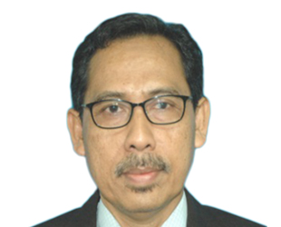
Sr Mohamad Kamali bin Adimin started his career with Department Survey and Mapping Malaysia on September 1983. He currently serves as the Director of Survey and Mapping in the State of Selangor. He has a wide range of experience in land survey, mapping, GIS, NSDI as well as geoinformation standard development at the national and international level. He also has been involved in the international arena that related to international land boundary with the neighbouring countries. He was also attached to the Malaysian Center for Geospatial Data Infrastructure (MaCGDI). Among his contribution is the establishment of MyGDI as the Malaysian SDI. Sr Kamali holds B.Sc. in Survey (Land) (Hons.) from University Technology of Malaysia (UTM) and a Professional Master Degree in Geoinformatics from ITC, Netherlands. In a professional affiliation, Sr Kamali is a Fellow of the Royal Institute of Surveyors Malaysia (FRISM).
Abstract Spurring Nation's Economy through SmartKADASTERIn pursuance of achieving developed-nation status by 2020, Government of Malaysia has initiate a dynamic plan of transformation. The inception of various government policies through the Economic Transformation Programme (ETP) is expected to spur economic development of Malaysia. Needless to say, for the implementation of the ETP, it will require the use of geospatial information. For instance, one out of twelve (12) National Key Economic Areas (NKEA) launched under ETP is the development of Greater Kuala Lumpur/Klang Valley which will assuredly in need of geospatial information. Therefore, to fully harness the existing geospatial information, it must be paired with an efficient and exhaustive geospatial infrastructure. Service Oriented Architecture (SOA) concept and web-portal based dissemination allow the integration of heterogenous data sources. Department of Survey and Mapping Malaysia (DSMM) has initiated SmartKADASTER, a multi-purpose cadastral based spatial analysis platform. Through SmartKADASTER, a web portal known as SmartKADASTER Interactive Portal (SKiP) was established with one of the capability is to disseminate and share geospatial information via SOA. Consequently, accessing, sharing and using geospatial information can be simplified with ample provision of geospatial infrastructure. On top of that, user adopting level to geospatial knowledge can be strengthen due to data accessibility. Easy access to geospatial information will enhance businesses and workflow management which eventually lead to the escalation of decision making and enabling efficiencies that will thrive nation's economy.
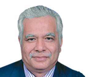
Dr Ahamad Zakaria graduated from University of Newcastle-Upon-Tyne, England in 1982. He went for further study in University of New South Wales, Sydney, Australia. From that University, he obtained Master of Science (M.Sc) in GIS/LIS. Now he is Director of Survey & Mapping, Department of Survey & Mapping Selangor Darul Ehsan. Before he was posted here 4 years ago, he was Director of Survey & Mapping, Department of Survey & Mapping, Pahang.
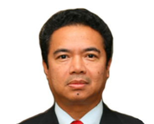
Dr. Yunus started his survey career in 1985 with his appointment as the Assistant Director of Survey at the Department of Survey and Mapping Malaysia, soon after his graduation from University of Newcastle upon Tyne in 1984, United Kingdom. He was admitted to the Master of Philosophy, at the same university in 1996 and a Doctor of Philosophy (PhD) atthe University of Nottingham, United Kingdom in 2008. Dr. Yunus is currently the Division Director of Survey at the Utility Mapping Division. He is also affiliated to the Royal Institution of Surveyors Malaysia as a Fellow.
Abstract Policy And Policy Change For Underground Utility Mapping In Meeting The Challenges Of 4th Industrial Revolution And TN50Data and information are considered the new gold in the ICT era. Whoever holds them is king, which makes data collection, storage and management crucial. Those who know in using them as new business commodity and therefrom formulate future strategies could garner very lucrative financial income and new economic market. This scenario is becoming more pressing as the nation is facing the dawn of the 4th industrial revolution. JUPEM could and should join the bandwagon by taking advantage of its role as the sole repository body mandated by the government to collect and manage the data from 5 main utility providers in addition to its own data. Without data no physical virtual or spatial development could start. In keeping up with the 4th industrial revolution towards achieving the objectives of TN50 it is imperative for JUPEM to re-strategize its practices and approaches towards data collection storage management and dissemination. Collection and safe keeping of underground utility data must be given due importance for a start. Data provided by providers must meet certain standards and updated continuously. The issues of proprietary and intellectual property rights over data must be clarified and settled. The idea and practices of government as service provider to the public thus should be free of charge or charged minimally would be a thing in a past and would have to change too. What is clear, whenever JUPEM inserts additional or adds new value to the collected data, the data would belong to JUPEM and could be commercialised. These actions are in line with the 4th revolution in embedding human skills and digital technology to generate income. The proposed TN50 policy visualises in having a lean administration thus reduction of employees, where multitasking and multi-skill are expected reduction in governmental financial budget and departments are given liberty to partially finance their operations. In the near future JUPEM could not afford to limit its concern with issues on challenges and cost of acquiring and managing data any more. JUPEM needs to go beyond in strengthening and improvising its current games to accommodate the influx of technology, new lifestyle and governmental expectations in order to survive and thrive.
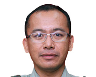
Brig Jen Sr Dr Mohd Zambri bin Mohamad Rabab is currently the Director of Defence Geospatial Division at Defence Geospatial Division of the Department of Survey and Mapping Malaysia.
The main responsibility of his division is to obtain and provide geospatial information and services to the Malaysian Armed Forces (MAF). He has a lot of experiences through direct involvement in the development of geospatial capability for bespoke MAF systems as well as MAF Network Centric Operation systems. He has also been involved in the development of Defence Geospatial Transformation Plan that is called uGeo for Defence programme.
He obtained his basic degree in Land Surveying from University Technology of Malaysia in 1994. He then furthered his doctorate study in Applied Remote Sensing at University Putra Malaysia and graduated in 2002. In 2002, he was sponsored by the Malaysian Armed Forces to enrol a Master degree in Defence Geographic Information at Cranfield University.
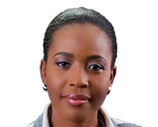
Valrie Grant is the founder and Managing Director of GeoTechVision, an ICT and Spatial Technologies company in Kingston Jamaica and Georgetown Guyana which is focused on delivering value through innovative solutions. With over 15 years of experience as a Geospatial Analyst, GIS Manager, Technical Instructor, Spatial Technologies and Policy Consultant with engagements spanning several territories across the Caribbean region. Valrie is helping government and corporate entities develop data driven solutions to address organizational challenges and meet corporate goals.
Valrie pioneered the formation of the Caribbean URISA Chapter and is the current president. She serves as a member of the GIS Management Institute (GMI) Committee, is a director of URISA International and has affiliations and memberships with several other geospatial bodies including GSDI, Land Information Council of Jamaica (LICJ) and Jamaica GIS Society (JAMGISS). Valrie currently serves on the Technical Committee for the United Nations Global Geospatial Information Management (UN-GGIM): Americas, Caribbean Geospatial Project. Her geospatial expertise is well respected across the Caribbean and Latin American region as well as within the international community. She is the immediate president of WENC-Guyana chapter and is the chairman of the Small Business Council (Guyana).
Her academic background includes: a BSc. Degree in Geology from the University of West Indies and a MSc. in Geographic Information Systems (GIS) and Environment from the Manchester Metropolitan University and studies in Entrepreneurship. She is also a certified GIS Professional (GISP) and an Accredited WINC Infodev/WorldBank AP Facilitator for the Caribbean. As a WINC AP facilitator and the Commonwealth Business woman Ambassador she is very involved in helping entrepreneurs. Her Flagship initiative dubbed FundRiseHER™ during her tenure as commonwealth Business woman Ambassador is geared towards fostering capital access for women entrepreneurs in the Caribbean.
Abstract Location Intelligence Enhances Profitability
There is a growing reliance on location information for Smarter Resource and Operations Management. Location information applications provides:
• Spatial Context
• Business-Critical Forecasting System
• An analysis engine
Location Intelligence is being used throughout the lifecycle of asset recovery management, planning and analysis, field mobility, operational awareness and stakeholder engagement. The presentation will highlight use cases in Asset Recovery, route optimization and fleet management.
Harnessing the power of location intelligence helps with streamlining asset information, facilitating better planning, analysis and more efficient means of sharing information in and out of the field as well as providing a comprehensive view of operations. Location intelligence gives businesses a competitive edge in the marketplace by providing profitable solutions.
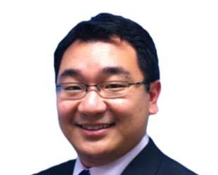
Lawrence is a chartered civil and geotechnical engineer and has over 20 years of experience in underground construction in Hong Kong at urban areas on both TBM and Drill and Blast tunnels employed by client, consultant and contractor firms. He is now currently working as Senior Construction Engineer in MTR Corporation and responsible for new railway extension on Admiralty South Overrun tunnel of Shatin Central Line with Drill and Blast method. He also worked two drill and blast tunnel projects in South Island Line, Lai Tung Tunnel at Ap Lai Chau and Nam Fung Tunnel at Wong Chuk Hang in the past 6 years in MTR Corporation.
AbstractArtificial Neural Network (ANN) model is widely used over the world for analyzing and optimizing difference engineering problems. In this research, the author use multi-layers perception (MLP) to analyze and predict the tunnel blast vibration on making use of the past blasting records.
This presentation also focuses on the application of Genetic Algorithm (GA), which is widely used over the world for analyzing and optimizing different engineering problems, to optimize the blasting parameters and improve the blast performance for tunnel blasting when excavating a tunnel with limitation on blast vibration constraints by using the recent blasting experiences in MTR’s South Island Line project.
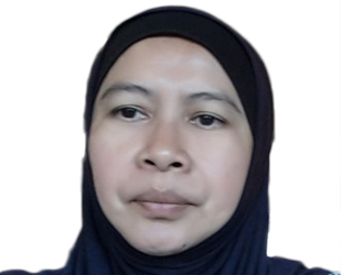
Tenaga Nasional Berhad (TNB) has embarked on enriching its GIS solutions suite for its business operations. A distribution station was chosen as a pilot project to run the business processes using GIS. This paper will focus on GIS being the fulcrum single source of truth for assets, networks and customers with other silos software through integration. GIS is now being prepared to become platform for other smart technology for example ADMS, AMI, Mobile workforce and others. GIS improves the quality of services offered to customers through smart technology. GIS solutions made TNB become a smart utility company by reducing emergency response time, reduced network outage, informed decision making and assist workforce management.

Quah Beng Chieh is Head of Marketing at FARO Asia Pacific (headquartered in Singapore). He spearheads the marketing function across Asia Pacific (including regional offices in China, India and Japan), with responsibilities in marketing, communications, public relations, product marketing and market development. Mr. Quah has an extensive background in marketing and branding high technology products. Prior to joining FARO, he held various marketing management positions in product marketing, regional marketing, business development, and channel marketing with Hypertherm Asia, Creative Technology, Sony Marketing Asia-Pacific, and Hexon Technology. Mr. Quah has a Bachelor in Mechanical and Production Engineering from Nanyang Technological University (Singapore).
Abstract Digital Engineering Our Way to A More Efficient Project WorkflowCurrent business environment cultivates a growing appetite for speed, where business demands are to be satisfied as efficiently, and as cost-effectively, as possible. At the same time, businesses are inundated by a tremendous load of data. How do businesses then harness the data to zero in to the crucial points, and thus make the right decisions quickly? Adoption of industrial digitalization has been gaining ground, with no small consideration to Industry 4.0. Digitalization transforms the way industrial projects are managed from beginning to end, and it empowers businesses with greater clarity on project progression. This brings about improved efficiency and control over budget.

Nurizana is a Meteorological Officer at National Climate Center (NCC), Malaysian Meteorological Department (MMD). She started her career as a meteorological forecaster for aviation before joining NCC as a coordinator of Fire Danger Rating System (FDRS). Additionally, she is the officer incharge of ArcGIS software due to the important growth in GIS technology and earth observation at MMD. NCC as the custodian to Malaysian Meteorological data has produced many geoinformatic climate products. Beside the Agroclimatic Outlook reports she is also involve in other NCC GIS product’s as well. She shares her knowledge and experience using ArcGIS to her colleagues as an internal trainer at MMD. Nurizana holds a Bachelor’s Degree in Physic from University of Malaya, 2005 and Master’s in Climate Change from University of East Anglia, 2015.
Abstract FIRE DANGER RATING SYSTEM (FDRS)Fire Danger Rating System (FDRS) is a general indicator of many factors affecting the physical aspects of fire. It's indicate the probabilities for a fire to start, spread and how intense it will be. In addition, it can be applied for monitoring and early warning of fire risk areas. Hence, the main objective of implementing the FDRS at Malaysian Meteorological Department (MMD), is to provide an early warning of forest fires potential. In Southeast Asia the peat forest has been assess as a potential fire risk area, which can cause tick haze if it burns. The early warning indicator from FDRS provide information's to fire manager's agency, which can assist firefighting operations before it becomes critical. FDRS used at MMD is adapted from the Canadian Forestry Service (CFS), which is implemented in cooperation with the Canadian International Development Agency (CIDA) after a large forest fires and transboundary haze occurrence in ASEAN, 1997. FRDS products are officially shared among users at MMD website starting from 2001 until the present. Additionally, MMD is not only responsible for generating FDRS for Malaysia, but MMD is responsible to generate the FDRS codes for the ASEAN Countries. The FDRS codes are generated everyday using a geospatial software. Six codes are interpolated from fire weather parameters, such as temperature, relative humidity, wind speed and precipitation amounts. The codes are named as Fine Fuel Moisture Code (FFMC), DUFF Moisture Code (DMC), Drought Code (DC), Initial Spread Index (ISI), Build Up Index (BUI) and Fire Weather Index (FWI).

The Malaysian Meteorological Department (MMD) is an important member of the Malaysian National Oil Spill Contingency Plan (MNOSCP). MMD's main role is to provide advice on the expected weather and sea conditions to enable the safe and efficient planning of any activities relating to an oil spill incident especially those that involve field operations. MMD's other role is operationalising the MMD-JMA Oil Spill Model (MJOSM) in order to generate forecasts of the trajectory of the oil spill. The MJOSM was adapted for use in the Malaysian waters from the Japan Meteorological Agency (JMA)'s Oil Spill Model. The MJOSM can also be used to forecast the trajectory of a drifting object such as a boat, which has a stalled engine, to facilitate Search and Rescue (SAR) operation. The MJOSM had been successfully used in the past to forecast oil spill trajectories for oil spill incidents which occurred in The Straits of Malacca,the world's second-busiest waterway. The main inputs of the MJOSM are current, wave, surface wind and the location and type of the oil spill. Based on these inputs, the MJOSM will produce oil spill trajectory forecasts which are displayed on a high resolution map.
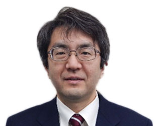
Geospatial Information Authority of Japan (GSI), as a national organization, has collected and developed basic surveying/mapping information, and based on it, private sectors has built a variety of business. Positioning, which is the base of survey, is greatly owed to GNSS. Our "GEONET" (The GNSS Earth Observation Network system) started the service in 1994, which are composed of about 1300 control points and analysis system, and is used for investigating crustal movement as well as public surveying. Some companies distribute raw data with some information of accuracy, and they estimate a prospective use as unmanned construction and agriculture. In addition, airborne laser survey with GNSS receivers has been executed by about a billion yen per year. DEM, collected by laser survey, is an important information for disaster mitigation. Moreover, MSS (Mobile Mapping System; Usually cameras, a laser scanner GNSS receivers are set on a car) has greatly contributed to updating large scale maps. In addition, fundamental map data by GSI have been used in various fields. Social effect of mapping and surveying will be shown, focusing on the methodology of an effective outreach.
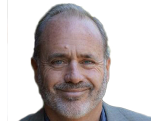
Mr. Sorensen is the founder, President and CEO of the GPC Group, a full service Geographic Information Systems and Information Systems (GIS/IS) consulting consortium focused on the planning, design, implementation and provision of operations support for "GeoSmart Solutions that Matter". Mark has over 34 years of experience in the application of GIS and related technology to urban and regional planning and resource science, policy, and management, in the United States and abroad. Having served as the Advisor or Project Manager for over 230 GIS projects in 68 countries, Mr. Sorensen has directed GIS work covering a diverse range of topics and client types. Most recently, Mark has been working with other global partners towards the development of "Smart Development Infrastructure" (SDI+) to apply spatial data infrastructure (SDI) principles to the special needs of developing countries, "fragile states" and small island developing states (SIDS). Mark is also a founding partner in two sister companies, GPC Global Information Systems llc (GPC-GIS) based in Abu Dhabi, United Arab Emirates, and the Geospatial Consultancy Services llc (GCS) based in Kabul, Afghanistan. He is also CEO of the Earth Council Alliance, a private non-profit organization based in Washington D.C.
Abstract SDI+ - Smart Development Infrastructure for Sustainable Development and InvestmentTraditional Spatial Data Infrastructure (SDI) necessarily focused on the "supply side" perspective of making commonly needed accurate and authoritative data available across government and the public. As data has become more generally available, the challenge is now shifting to ensuring that this valuable asset is used to achieve maximum positive impact. This is critically important in developing economy situations where effective, coordinated spatial planning and investment is crucial to the achievement of sustainable development goals and aspirations. This presentation proposes an extension of the traditional SDI approach to an SDI+ (Smart Development Infrastructure) model that adds a proactive function for connecting geospatial data and technical resources to those government and societal activities where they can do the most good, and how these principle are being applied in three international case examples.
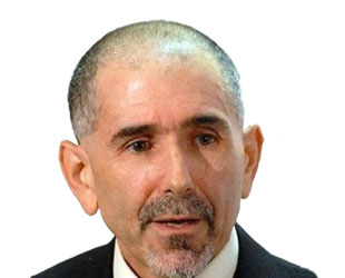
Location intelligence (LI) is no long just a market segment dedicated solely to understanding the applications and use cases of geospatial technology for businesses and commercial entities. There are at least three horizontal technology segments including location analytics, operational geoprocessing, location intelligence visualization ("LIViz"). Location analytics looks to support the integration of geospatial technology with business intelligence. This may entail the application of spatial statistics, map algebra and other forms of spatial modeling. Operational geoprocessing takes transactional data, data in motion or data lakes and provides standard geospatial operations such as geocoding, distance calculations or geoenrichment to large volumes, sometimes called "big data." LIViz is the "view" into both location analytics and operational geoprocessing. Maps are still important in many use cases. The ability to understand the proximity relationships among and between data entities helps us to better interpret geographical phenomenon. Today, both the traditional geospatial technology and the business intelligence solution provides are creating and melding new visualizations types to better support the ability to discern geospatial relationships. In all, the growth of the opportunities in each segment is creating some very interesting competitive dynamics, as well.
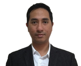
Ryan is a FARO BIM/CIM Sales Engineer handling the 3D Documentation product line which includes the terrestrial and handheld laser scanners ensuring creation of complete solutions and awareness for their diverse applications. He holds a Bachelor's Degree in Geodetic Engineering from the University of the Philippines and has ten years of extensive experience handling different spatial technologies in the fields of GNSS, GIS and Surveying.

Bandwork GPS Solutions Sdn Bhd has been serving the geospatial industry with leading-edge technologies and solutions across diverse field of applications, including land surveying, mapping, construction, agriculture & etc. They also provide consultation, support, trainings and seminars to government officials and private sector employees on a regular basis. Bandwork GPS Solutions Sdn Bhd has been appointed by FARO as the Malaysia Distributor for 3D Documentation products.
Mr Jackson Cham holds a Bachelor of Engineering (Hons) Degree from The University of Adelaide, Australia. He is a certified trainer for FARO Laser Scanning Products with FARO Asia Pacific. He has been leading implementation of innovative laser scanning solutions for geospatial applications and projects in Malaysia.
Surveying is getting ever more challenging today as technology advances and design getting more sophisticated.
Laser scanning has revolutionized the field of land surveying to meet the uphill requirements.
Laser Scanning Technology enables us to help our clients in planning and to execute the most demanding projects, and allow customers to analyze every component of the facility or site. The versatile technology can be applied to a variety of advanced land surveying needs, including change detection, 3D drawing/ model creation, pre-project scanning, virtual reality 3D visualization and more.

Mohd Harris Ismail is actively involved in BIM consultation, research, teaching and training. He is currently a BIM Director and checker for several Mega Projects in Malaysia through Ascension Technology Sdn. Bhd. Previously he was a Deputy Director of the IBS Center and helms the Construction IT Department in CIDB facilitating the development of cutting edge technology for Malaysia's construction industry.
Abstract IMPROVED PROJECT DELIVERY WITH BIM TECHNOLOGYBIM delivers benefits throughout the building project lifecycle. Make better design decisions, build more efficiently, and manage and maintain building portfolios more effectively. BIM process supports architects throughout the lifecycle of design. This presentation will touch on how BIM able to helps you:
- Take your design from concept to reality with improved quality and efficiency
- Gain a competitive edge to grow your business
- Realize your creative vision with innovative technology solutions that enable impactful design and asset management
Building Information Modeling (BIM) technology have helped countless firms in diverse industries operate more productively, produce higher-quality work, attract more talent, and win new business. With the direction of Malaysia government to mandate BIM through RMK-11, now is the time to consider implementing BIM for sustainability of our future business. The presentation will also covers current practices and examples of real projects implementing BIM technology and effective methodology in Malaysia construction industry.
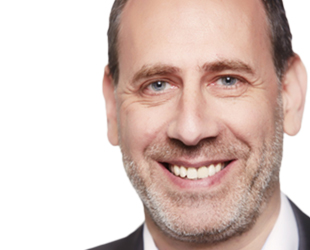
Laurent Michel is Chief Marketing Officer at Intersec. For the last 20 years, he has successfully worked in mobile and internet business, in France and abroad, with responsibilities including product management, strategic partnerships and marketing. He is a highly skilled executive, specialized in developing new businesses in high-tech services. Thanks to a mix of curiosity and pragmatism, he has been able to assess complex markets and successfully manage challenging projects.
Abstract Unlocking new revenue streams with location
For the past 10 years, Intersec has been enabling mobile operators to leverage geolocation data for the creation of new services by providing them with solutions to:
- scale up geolocation from individual to mass-scale and in real time
- create actionable contextual insights with fast data
- add intelligence to monetize new services
For the last 2 years, we have applied our solutions to the Smart Cities area, leveraging data from various sources.
We worked on a 1st Tactical Urbanism experience in Paris City, in partnership with Cisco, for the refurbishing project of the "Place de la Nation" (huge square in Paris).
Given our ability to make sense of massive amounts of data from very different sources, our unique technology was just what Paris City needed to take an informed decision, based on facts for the refurbishing of the Square.
We also helped RATP-Dev, operator of the Open-Tour tourist buses in Paris to better understand their customers by gathering and analyzing data: based on Wi-Fi on board, Bus GPS tracking and ticketing revenue, Intersec recalculates on-board densities, providing RATP Dev with insights on stop (hops in/out) and buses frequency.
We wish to share our experience as we believe other cities and companies could benefit from it.
What you'll get:
- An understanding of what can be done and what it takes to leverage Geolocation data
- A panel of real world use cases to monetize location data
- Reference benefits from actual experience
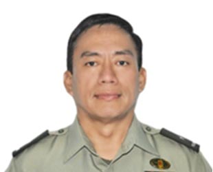
Brigadier General Ricardo A Nepomuceno is presently the Chief, Armed Forces of the Philippines Command Center (AFPCC). As a Command and Control facility at the GHQ level, the AFPCC provides the AFP leadership with situational awareness and common operational picture to facilitate direction, control, coordination and monitoring of current administrative, combat and civil assistance operations. BGen Nepomuceno has distinguished himself as Commander of the 1003rd Infantry Brigade, 10th ID by sustaining the gains of the Internal Peace and Security Operations in Davao del Norte and Davao City which consequently led to the declaration of these areas as Peaceful and Ready for Further Development. He also served as Commander of the 80th Infantry Battalion, 2nd ID which was tasked to secure the National Capital Region where he led his unit in clearing and securing the Makati Commercial and Business District from mutinous soldiers.
Abstract GEOGRAPHIC INFORMATION SYSTEM IN THE AFP, AN INSTRUMENT FOR COLLABORATIVE PLANNING, EXECUTION AND RESPONSEThe presentation is focused on the GIS utilization of the AFP for the conduct of collaborative planning, execution and response which will be expressed on the discussions of the AFP's usage of GIS in various AFP operations. At the early part of the briefing, the transitory background of the Philippine geography and demography will be discussed along with the AFP's constitutional mandate. The AFP Command Operations and Management System or AFPCOMS will be introduced to postulate the beginning of the GIS utilization in the AFP and relate the significance of the GIS in the over-all operations management system. The main body of the presentation discusses known AFP operations that utilized GIS data and GIS mapping products for the situational awareness and common operating picture during planning, execution and monitoring of operations. The presentation will also discuss the usefulness of the GIS for coordination and collaboration among government agencies in the Philippines for security operations during regular staging of political, cultural, and religious events and in the conduct of HADR operations when disasters strike the country. Finally, the presentation will provide overview on the AFP's vision and future plan on the development and optimization of the utilization of GIS technology for the AFP's operational needs and for collaboration of essential data among government agencies and key stake holders for the enhanced sharing of information.
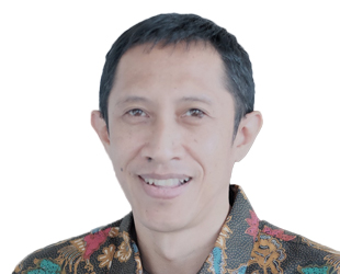
T. Nirarta 'Koni' Samadhi, Country Director, World Resources Institute (WRI) Indonesia. WRI is a global research organization. Global Forest Watch (GFW) is one of the tool developed by WRI in collaboration with more than 70 partners to enable everyone monitor the forest dynamics almost real time including fire and haze hazards.
For five years until December 2014 he was a Deputy Minister at the President's Delivery Unit for Development Monitoring and Oversight (UKP4). UKP4 supports the President of Indonesia to monitor and facilitate the delivery of national priority development programs. As a Chair of Working Group on Forest and Peatlands Moratorium Monitoring at National REDD+ Task Force (2010) he facilitates the One Map Movement (2011) which currently evolving into One Map Policy.
Sustainable development is a concept that balance economic development, social benefits and environmental conservation to achieve equitable, viable benefits for global humanity and is bearable for our mother Earth.
First part of the presentation will introduce Indonesia as one of the largest natural resource-based economy countries that suffers from side impacts of national development, such as severe drought season, forest and land fires, loss of biodiversity, high carbon emissions from land sector, increasing risk of floods to major Indonesian cities, threat to food security and others.
This will continue to the explanation about the importance of geospatial infrastructure and information, key components, and its enabling conditions which are critical to support national development in Indonesia, as the country is geographically an archipelago, whereas information access and connectivity are important to deliver equal development to more than 13,400 islands across the country.
How to properly structure and manage geospatial data and information is subsequently explained, describing Law No. 4/2011 on National Geospatial Information. Also, five pillars of National Geospatial Information Network (Jaringan Informasi Geospasial Nasional/JIGN) including institutions, policy, technology, common standard and human resources, set out under Presidential Regulation No. 27/2014, are further explained and the challenges are also explored.
The issues of data transparency as key critical component to generate robust information and accountable public policies are thus laid out, providing several examples from current WRI projects, such as Global Forest Watch and One Map policy initiative at landscape level.
Keywords: sustainable development, geospatial information, natural-resources based economy, data transparency

Recently, the number of natural disaster occurrence is increasing because of abnormal changes of weather in Korea. In Korea the storm and flood insurance system is in effect to prevent these natural disasters. The national storm and flood insurance Premium rate is very low and the risk of adverse selection resides because of choosing by who lives in high risk area. To solve these problems, the storm and flood insurance rate map are required. In this study, the prototype of storm and flood insurance premium rate map of the Ulsan, Korea was made and the method of GIS analysis for the insurance premium rate calculating and the procedure of the Ulsan storm and flood insurance rate map were researched.

Mr Asep is lecturer in surveying in Department of Geodesy and Geomatics, at Bandung Institute of Technology. He is a member of Surveying and Cadastre Research Group in Earth Science and Engineering Faculty.
Abstract Assets Data Inventory Based on Building Information ModellingA building has assets such as structure and property inside the building. Assets investigation and identification require assets management process. Commonly, assets management process still use conventional method. This method has weaknesses in spatial and information updating. In recent years, the spatial data acquisition technologies developed fastly. One of the technologies is Building Information Modeling (BIM) from Laser Scanning data. Given both technologies, the building or structure may be modelled in three-dimension from point cloud data. In some countries, such technologies was implemented in office complex and public facilities modelling, and further may be used for the process of building assets management. According to a number of literatures, the application of BIM to the process of assets management may increase efficiencies of time, energy, and cost. In addition, the application of BIM increases accuracy in terms of spatial and easy to identify assets location as well. By using Laser Scanner, the three-dimension data on the entire contents of building may be taken and then used to construct a three-dimension model. The complete three dimension model than integrated with assets data, to construct three dimension assets information.

Deric Tay is the Asia Sales and Distribution Manager based in Singapore, for Trimble's Geospatial Division. He works with Trimble's customers and distribution partners throughout the region delivering geospatial solutions utilizing surveying, mapping, and spatial imaging technologies. Prior to Trimble, Deric worked for the Sony Electronics throughout Asia as a Sales Manager in the field of manufacturing He holds a Degree in Marketing Management in Business from University of Otago, New Zealand.
Abstract Enabling Sustainability and Productivity with Geospatial TechnologyAbstract Employing the newest technologies for geospatial data collection, processing, and later to aid better decision making is becoming an essential part of the technology investment strategies of both government and private enterprise. Often, however, technology investment is viewed in a narrow silo focusing on a single project or job, and broader societal benefits are not highlighted. With a number of its latest offerings, Trimble is cultivating a portfolio that enables the real benefits of geospatial information to be realized that increase productivity and sustainable plantation. His talk will primary focus on oil palm plantation management.
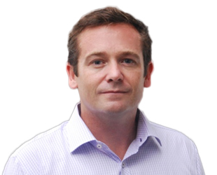
Mr. Brett Dixon joined Esri in 2012 and is currently the company's General Manager for Asia Pacific. His role sees him interact with many customers from across the region, providing him a unique insight into regional geospatial trends and challenges across many industries.
Mr. Brett Dixon is a former Australian Army officer who has worked in the geospatial intelligence domain for the past 19 years.
Previously, he was engaged as a senior consultant by the Australian Defence Force, providing strategic and operational advice on future Defence geospatial intelligence and C4ISR capabilities. For this work he was awarded a Chief of Defence Force Commendation in 2012. Mr. Dixon has contributed to the development of enterprise geospatial strategies and concepts, as well as managing the implementation of systems which realise those objectives. He has worked closely with organizations in National & State Government, Public Safety and Utilities.
Mr. Dixon completed his Master of Engineering Science at the University of New South Wales focusing on Geographic Information Systems and Remote Sensing

Rizky Firmansyah holds bachelor degree from Geophysical Engineering Institut Teknologi Bandung. After graduated, he worked in IT & Mapping Consultant as programmer for one year and a half. Six months after then, he became GIS Manager whom responsible for developing Web GIS application both in back and front-end environment. Currently, he is managing spatial datasets to collecting and collating from open and proprietary sources and producing relevant web map application.
Abstract Large Scale Deforestation Drivers Analysis using GIS and Contextual Information: a Case Study of IndonesiaIndonesia's rainforests has suffered from the second highest deforestation among other tropical countries reported by FAO (Global Forest Resources Assessment 2015). This marks the concern of Government Indonesia to release the Moratorium Policy in 2011 to combat deforestation and reducing emission of greenhouse gases. We are interested to study: 1) major drivers of deforestation in Indonesia and how much forest cover loss annually from 2001 to 2015; and 2) the effectiveness of the moratorium policy. The initial data we used are: global tree cover loss, primary forest cover, and degraded forest produced by University of Maryland. We analyzed the data in GIS environment overlaying tree cover loss and forest cover with timber plantation, logging concession, mining, and oil palm concession which are available through Global Forest Watch platform. We found that the trend of deforestation in Indonesia fluctuated and reaching its peak in 2012 with annual forest loss 928.000 ha, and diminished until 2015. Surprisingly, in Papua, the trend increased steadily and reached the highest rate in 2015 with 106.000 ha forest loss. The major drivers of deforestation are mainly due to agriculture expansion, oil palm plantation, logging, and mining suggesting that the moratorium had little effect on forest protection.

Alzheimer disease (AD) is a type of dementia that affects the multiple functions of the brain cells, resulting in impaired memory, thinking and behavior change. In Malaysia, based on UN data projected population of over 30 million, the number of AD person are estimated at 123,000 in the year 2015. Furthermore, more than 60% have tendency of wandering and it increase the risk of getting lost and hurt for the AD person. The concern about the safety and well-being of AD person are constantly rising nowadays. The National Space Agency (ANGKASA) has developed a tracking, tracing and trigger system using satellite technology for the AD person and daycare center. The movement of the AD person will be monitored using a wrist watch enabled with GPS while the guardian will be able to track and monitor in real time via their smart devices. Since the GPS signal is weak and not available in an indoor environment and therefore, the system integrates GPS and Wi-Fi network capability to determine the location of AD person for the both indoor and outdoor environment. Apart from that, the system is able to set up movement zone and an alert will be sent to the guardian immediately once the AD person cross the zone during the time of monitoring. The system also provide a real-time monitoring for daycare center to monitor all user movement simultaneously under their supervision. The project is funded by MOSTI Social Innovation program under the Ministry of Science, Technology and Innovation (MOSTI) aims to benefit the community at the grassroots level by exploiting space technology.
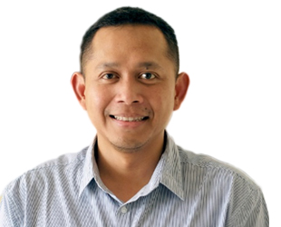
Arief Wijaya is the Climate and Forests Senior Manager of WRI Indonesia, working mainly on Open Climate Network, NDC Partnership, Global Forest Watch, Forest Legality and Global Restoration Initiative. His work focuses on tropical forest landscapes and their impacts on climate change, drivers of deforestation and forest degradation, MRV REDD+, and national GHG accounting.
Prior to joining WRI, he worked at Thünen Institute of International Forestry and Forest Economics in Hamburg, Germany and focused on the analysis of drivers of deforestation/reforestation and spatial modeling of tropical landscape dynamics in the Philippines and Ecuador. Previously, he spent 4 years working at Center for International Forestry Research (CIFOR) based in Indonesia, and is responsible to integrate socio-economic and spatial data for analyzing drivers of deforestation and forest degradation in Indonesia, Vietnam, Peru, Brazil, Cameroon and Zambia. He was also an observer of UN Climate negotiations, following the progress of REDD+ and climate change mitigation negotiations.
He holds a PhD in Geoinformatics from Technical University Bergakademie Freiberg, Germany and MSc in Natural Resources Management from International Institute of Geo-Information Science and Earth Observation (ITC) The Netherlands.
Geospatial information is a form of infrastructure for decision-making that supports various societal and environmental activities. The cost of supplying the information is greatest to the first user, the cost of disseminating information to additional users is relatively small.
The presentation begins with the explanation about added value of geospatial information for potential cost savings and benefits from using additional spatial information in the decision-making processes.
Further, we will provide several examples from forest management sector in Indonesia, laying out several monitoring platforms for forest and land fires and illegal forest harvesting in protected areas in Sumatera Island of Indonesia. Additionally, another example on the use cases of geospatial information during Super Typhoon Haiyan natural disaster in the Philippines will also be presented.
Innovational applications of geospatial information and infrastructure, which are mainly driven by the information provision involving careful examination of spatial and temporal scientific, technical, and economic data is proposed and explained in the subsequent section.
Challenges and potentials for the improvement of geospatial information infrastructure in both addressing natural resources and disaster management issues in SE Asia region will be presented – contrasting limited data and human skills, increasing public data availability, and leadership and data transparency issues.
Keywords: geospatial information, natural resources management, disaster management, innovation applications
The ability to share information across large infrastructure projects is critical to leverage the benefits that can be derived from the adoption of advancing technology. This is necessary to realize a seamless 5D BIM concept, where the impact of design changes can be seen immediately on the time and cost for the project In his talk Chris Gibson will show how this information can be shared, the benefits that are derived and he will show how augmented reality is being integrated into the construction continuum.
Metro Manila, as the National Capital Region, is one of the fastest urbanizing metropolis in Asia. It is home to around 12.9 Million population based on the 2015 household population survey which balloons to more than 15 million during daytime spread over its 17 local government units. The meropolis is highly densed with a population density of 20,785 persons per sq. km. compared to the country's 337 persons per sq. km. far higher than the population density of other major cities in the world.
Metro Manila faces a number of challenges brought about by urban concentration within the boundary of the region, resulting in an urban form characterized by a highly built-up metropolis with land use pattern generally classified as residential unvoidably imposing too much pressure on land use and service facilities. It is therefore imperative that investments be continuously made on integrating complex data and information through innovative solutions that will allow data capture, storage, management and processsing with the use of most appropriate and cost-effective technology platform.
Metro Manila is now moving forward towards a 'smart metropolis' for a more efficient and effective management of resource assets and infrastructures of member LGUs in the pursuit of excellence in service provision and delivery. This will also enable the development of smart urban spaces through cohesive and integrated infrastructures that will promote procesing, access, and delivery of service expected in a 'smart metropolis'.
Since its compilation in 2011, recognized as best practice by no less than the President of the Philippines in 2012, ADB-JICA-WB signed a joint agreement using the tool for "Institutionalization of Community Participation in Procurement and Harmonization with Development Partners". The AGT is now a full-blown tool that complement project management in public agriculture, urban/rural development public infrastructure projects.
Ensuring the continuity and broadening of scope of the good practices
- Full integration of the scientific planning, programming and allocation and decision-making in the whole project implementation process.
- Encompassing project conceptualization, safeguards requirement, project appraisal and validation, proposal preparation, procurement process, actual implementation, M&E, contract management and operations and maintenance.
- Data from implementation are being translated into various platforms of documentations from actual fieldwork, print and online and web-based system.
To date, the PRDP has saved about Php 2.2 Billion Pesos (us$ 49 million) from 34 proposed subprojects. Of which, about 1.3 Billion Pesos (us$ 29 million) worth of proposed subprojects (14 subprojects) have been deferred and requested for justification due to absence of road influence area, over estimation of Feasibility Study data, parallelism of proposed roads and on a holistic view, will not be able to contribute to the achievement of the development objective of the PRDP.
Moreover, eleven (11) subprojects were cancelled and nine (9) subprojects were re-designed due to overlapping, duplication of road influence area and parallelism with major roads of amounting to Php 871 Million Pesos (us$ 19.40 million).

Dr. Sasagawa is an executive technical adviser of PASCO CORPORATION. He completed his B.Eng. in 1980 and M.Eng. in 1982 from the Hokkaido University. He obtained PhD. Eng., from the same Hokkaido University in 2005. He joined PASCO in 1982 and remained engaged in the dissemination of GIS of 1980 in Japan. In the 1990s, he dealt with the system development for urban planning GIS of the main large cities of Japan and standardization of photogrammetry digital mapping, such as Census Mapping System of the country. He led the introduction of advanced aircraft sensors ADS40, UCD, LIDAR etc. in 2000s, and the automation of the digital photogrammetry. He established the Satellite Business Division in 2005 for the sales of TerraSAR-X imageries, commercialization and applications. From 2006 to 2013, he served as a part-time lecturer at the Graduate School of Tokyo University. From 2005 to 2016, he remained engaged as one of the Board of Directors of PASCO CORPORATION. Presently, he is in-charge as a consultant for the Cabinet Office, Government of Japan.
Abstract Pilot experiment of i-Construction based on Continuously Operating Reference Stations in Thailand
The Continuously Operating Reference Stations (CORS) network is the most important system to establish a national geodetic datum and to perform its maintenance. In addition, CORS network has advantage for the infrastructure of the next generation of the social system for high-precision positioning information. Especially it is useful for construction management.
In this presentation, the results will be reported regarding the Pilot experiment in Thailand. Motor grader as an example of the i-Construction, that is a Machine Control (MC), was conducted in 2015 as a pilot experiment of CORS utilization.
In Japan, the i-Construction activity has started from this year by the Ministry of Land, Infrastructure and Transport. All management of construction processes are controlled using 3D data from initial survey to maintenance, that represents like the CIM. Most important process is MC for the utilization of absolute coordination by CORS.
In the future, on operation start of the Quasi Zenith Satellite System (QZSS) in 2018, a way forward has been confirmed to create a direction and environment in which the industrial cluster of Japanese companies can be formed to advance the usage of QZSS.

Christopher Yuen has worked with Laser Technology Inc. for over 10 years, specializing in the Asia region. He constantly works with local governments and organizations supplying product and project support across various industries including construction, slope maintenance, electricity, forest and resource management, telecommunications, traffic and highway, utilities, and general mapping. He also likes snowboarding, playing volleyball, and eating ice cream.
Abstract Bringing Freedom to Mobile Mapping – New Mapping Techniques with Android and GNSSHow can one man do the job of 10?
- With limited budget and resources, we will show how a small department can create a low-costs mobile mapping system utilizing Android, lasers, and GNSS.
- We want to break the chains of high equipment costs, time-consuming personnel training, and post-processing time.
- We will show the advantages of new advanced, high accuracy point-and-shoot lasers with an Android-based mapping software versus UAVs, scanners, and total stations.
Dr. Hazman is a PhD holder in Conservation and Traditional Arts/Architecture, University of Wales at Prince's School of Traditional Arts, London United Kingdom; Master Degree in Visual Islamic and Traditional Arts, University of Wales at Prince's School of Traditional Arts, London United Kingdom; Bachelor degree in Arts Architectural Stained Glass at Swansea Institute of Higher Education, University of the West of England, Wales, United Kingdom and also a Diploma holder in Architectural Studies, University Technology Malaysia. His early training was as an architect and an educator with vast experience in project management, national and international seminar & event, collaborative research and consultancy.
Abstract Digital Data Creation of Masjid Negara Kuala Lumpur Heritage Conservation Management Plan through 3D Terrestrial Laser Scanning (3D-TLS)
The presentation consists of two parts as follows:
1. Digital Data Creation through 3D-TLS that review Data Reliability on Masjid Negara 3D-TLS that consists of the following:
- Accuracy
- Completeness/Comprehensive
- Availability
- Accessibility
2. Data Management for Masjid Negara Conservation Management Plan that discusses the followings setups:
- Initial & Preliminary setup
- Digital Creation Operational setup
- Hardware & software Specification
- System compatibility
- BIM Industry Standard
- Data Maintenance & Management
- Big Data
- Salvage Value
Bob Dylan's song 'The times they are a changin'' from 1964 has become an iconic song to describe the ever changing nature of time. Today we live in the information age and we are dealing with the ever changing nature of digital data. Big data, Fast data, Historic data, Realtime data are all extremely relevant in the GeoIntelligence domain. It is surprising how universal Dylan's lyrics are. Not just with respect to the change of society over time, but also the change of data and how we deal with data and time in today's geospatial and intelligence communities.
Thomas Gaisecker finished his studies with master degree in geography with focus on geoinformatics at the University of Salzburg. From 1995 to 2003 he was CEO of ICRA and from 2000 to 2003 also partner of NextGIS. Since 2003 he is with RIEGL Laser Measurement Systems, now as Senior Manager International Sales and responsible for sales, training and support working with RIEGL distribution partners worldwide. He is an expert for Terrestrial Laser Scanning / UAS-based laser scanning and applications in mining.
Abstract Unmanned Laser Scanning – RiCOPTER with high-performance LiDAR SensorsHaving successfully introduced the first survey grade UAV LiDAR sensor VUX-1UAV, and even a dedicated UAV carrying platform, the RiCOPTER, RIEGL expands its UAV product portfolio further: The VUX-1 series now comprises three different variants of the sensor to perfectly targeting specific demands depending on application and carrier platform. With the new miniVUX-1UAV RIEGL presents another miniaturized waveform LiDAR sensor, perfectly suited for integration in sUAV or to complete multiple sensor platforms. Offering attractive performance specs, like, e.g., 360° field of view, up to 5 target returns per laser pulse or a high measuring rate of 100,000 meas./sec, the miniVUX-1UAV is especially well suited for standard surveying tasks but also for special purposes like snowfield or ice-surface mapping. Straightforward integration is enabled by the integration kit prepared by RIEGL for several types of off-the-shelf UAVs. RIEGL's portfolio for Unmanned Laser Scanning also includes the bathymetric depth finder RIEGL BDF-1. It allows to measure profiles below water surface, such providing important information for coastal mapping, river environment monitoring or to ensure save ship-berthing. We present different use cases to highlight the respective advantages of the mentioned LiDAR systems and discuss the expectable outcome, also in comparison with conventional surveying methods.
An alumnus of HBTI, Kanpur, Prof. Neeta Awasthy has 12 years of consultancy and 17 years of rich academic experience. Presently, she is working as Director of School of Engineering and Technology, Noida International University. An amalgamation of Electronics and Computer Science, she is the best fit for problems which are multidisciplinary, resource extensive and data extensive.
She has guided more than a dozen scholars during their M.Tech. and Ph.D.. She uses Digital Signal Processing as backend and Neural Network as a predictor, classifier and identifier in most of her works. Her works are being regularly published in acclaimed journals in India and abroad. She has published three books. She is also a consultant in the field of Quality improvement of Technical Education, energy, innovations & Entrepreneurship, apart from data analytics.
Big Data Analytics (BDA), is being used from time immortal to gain intelligence, out of a set of data presented and processed contextually. Performing data analytics on context-free data will only yield sporadic correlations. BDA has been helping business organisations to create insight to take more informed decisions about supply chain, to increase revenue and to optimize operations. Presently, BDA is being used for security extensively. With 2.5 billions of gigabyte data being produced everyday, out of which the major resource guzzler being the video data being produced by millions of CCTV camera; AI algorithms are the only solution to recognition patterns for preventive and actionable intelligence. Defence and National Security takes away one eighth of India's budget. Hence, before burdening that, we need to check on to the following questions: What are we looking forward in a BDA (understanding or preventive or predictive)? and the What are the different types of challenges and concerns which should be brainstormed upon before implementing BDA in defence organizations? At the same time Are we prepared for unexpected results? What do we do with the outliers? And will we implement the results without the privacy, societal and ethical concerns? This paper will help defence organisations to decide before spending in costly BDA tools. This is a review paper, based on papers from IEEE and scopus database since the turn of century(2000).
Aswadi Yusof is the GIS Manager for the Klang Valley Mass Rapid Transit project. He is currently implementing and managing Geographic Information System for the Sungai Buloh-Serdang-Putrajaya (SSP) Line project.
Aswadi has over 16 years’ experience applying geospatial information and technology for infrastructure project, consumer retail, business planning, power and energy, engineering design and environmental projects for various global corporation clients mainly in Australia, South East Asia, Middle East and United Kingdom.
His expertise includes Business Geo-Planning and Geo-Analytics, Geo-Information Development and Data Management, Enterprise GIS Design and Integration, Remote Sensing Satellite Ground Receiving Station and Airborne Laser Mapping operation.
Abstract ADVANCING GEOSPATIAL ENGINEERING IN KVMRT SSP LINE PROJECTThe MRT Sungai Buloh–Serdang–Putrajaya (SSP) Line is the second Klang Valley Mass Rapid Transit (KVMRT) line which is currently under construction. The line will serve a corridor with a population of around 2 million people stretching from Sungai Buloh to Putrajaya. The SSP alignment is 52.2km of which 13.5km is underground. A total of 37 stations, 11 of them underground, will be built. Mass Rapid Transit Corporation (MRTC) as the owner and developer for the MRT SSP Line embraces the latest advances in geospatial engineering technology and incorporate them into the implementation of the project. Notably, MRTC has mandated Building Information Modelling (BIM) maturity Level 2 throughout the design, construction and asset management and operation stages for SSP Line. Applications of other advances in geospatial engineering technology employed in the project such Reality Modelling and Geographical Information System (GIS) integrated with the BIM process will be highlighted and explained.
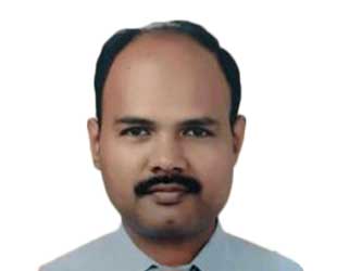
Sugarcane one of the major economic crops in Thailand, grown over an area of 1.75 mln ha. Mitr Phol Group the largest sugar producers in Asia contributes 20% sugar production in Thailand. Raw material supplied from contract farming of 360,000 ha to six mills of Mitr Phol in Thailand. Monitoring and managing the field operations from contract agreement to delivering cane and improving productivity and profitability are key functions for sustainability of sugar business. Thus accurate and timely farm and crop information are vital for informed decision making and crop advisory to farmers which is the next generation farm management or “Smart farming”
Our initiatives on geospatial technologies started in 2002, initially it was standalone SIMS (Sugarcane Information Management System), later developed into web GIS system and then to an android mobile application. This has resulted in various benefits to industry and farmers. Few examples are accurate area and production estimation with more than 95% accuracy, reduce turnaround time for loan approval from 15 days to 3 days electronically, save staff time on administrative work and targeted agronomic advisory for crop improvement.
Recently Mitr Phol also implementing modern farm practices and smart farming in larger corporate farms using GPS guidance tractors (controlled traffic), contour planting, crop monitoring using UAV (unmanned aerial vehicle) and weather sensors. Mitr Phol Sugar has a long-term vision to implement these advanced technologies to small farms also with modifications to make it economically feasible. With Thailand government also promoting the adoption of PA, there is opportunity for next generation farm management to be driven by information based decision and precise management for efficient resource management, optimized productivity without harming environment.
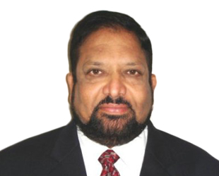
Dr. Rao S. Ramayanam, is currently working as Vice President Sales, Middle East, Africa and South Asia for UrtheCast, a Canadian Space company. He is an accomplished senior executive in international sales, business development and marketing with more than 25 years of working experience in international companies and organizations including UrtheCast, DigitalGlobe, GeoEye, Space Imaging, The World Bank, APSRAC (India) and National Remote Sensing Center (India).
He achieved amazing success in the sales of High Resolution Satellite Imagery, Access, Ground Station to International Defense & Intelligence and Commercial Markets. He has extensive experience in cloud based and onsite large enterprise system sales and turn-key project management in Remote Sensing (RS) and GIS applications. His interpersonal skills and team building on a global level helped in establishing 40 member channel partner network in Middle East and Africa and establishing business relationships in 50+ countries world wide.
He has developed several remote sensing applications and got the recommendations implemented at the grass root level for micro level planning, disaster management, drought management, irrigation using surface water resources, ground water mapping and management, etc. in the State of Andhra Pradesh where successive Chief Ministers have utilized his services to develop the state. He has been awarded the Astronautical Society of India award for his contributions to remote sensing applications. He has been supporting several customers including the government customers, oil & gas industry customers, construction & real estate industry and environmental industries spread across Middle East, Africa and South Asia.
Abstract UrtheCast’s High-Resolution Imagery, HD video and Synthetic Aperture Radar from Space for Smart Earth ObservationsUrtheCast Corp. is a Vancouver-based technology company that serves the rapidly evolving geospatial and geoanalytics markets with a wide range of information-rich products and services. The Company operates Earth Observation (EO) sensors in space, through its subsidiary Deimos Imaging, including two satellites, Deimos-1 and Deimos-2, to produce imagery data for partners and customers in multiple markets.
Deimos-2 is an agile satellite for cost-effective, dependable very-high-resolution for EO applications. It provides 75-cm pan-sharpened imagery and 3-m multi-spectral images. Its multi-spectral capability includes 4 channels (red, green, blue, NIR), plus the panchromatic band. Deimos-2 has a swath of 12 km, and it is able to acquire imagery in strip mode (up to 1500 km long), or in spot mode, shifting between various targets. In addition, it has a wide-area acquisition mode, which can acquire in a single pass a 24-km wide strip, up to 200 km long. It is also capable of same-pass stereo imaging.
Deimos-1 is the first Spanish Earth Observation Satellite. It provides 22m, 3-band imagery(red, green, NIR). It has been specifically designed to assure very-high-frequency revisit on large areas (every 3 days on average for any mid-latitude region), with precision agriculture and forestry monitoring applications in mind. Deimos-1 has a uniquely wide swath of 650 km, which allows covering very large areas in a very short time. Deimos-1 provides 22m multispectral images, with subpixel geolocation accuracy. Its data are currently used by public and private customers worldwide.
With the objective of advancing its global Earth Observation capability, UrtheCast is developing the OptiSAR™ constellation consisting of 16-satellite, 8 Dual Band (X and L) Synthetic Aperture Radar (SAR) satellites and 8 Dual Mode (Video and Pushbroom) Optical satellites. OptiSAR™ is designed to be the world’s first fully-integrated, multispectral optical and Synthetic Aperture Radar (SAR) constellation of Earth Observation satellites. Providing unprecedented capabilities, OptiSAR™ is aimed at solving realworld problems and creating tools for world change. It’s built for researchers, developers, and analysts to gain unprecedented and extremely valuable data and information products at high revisit rates over their areas of interest — regardless of obstacles like tree cover and weather phenomena. The OptiSAR constellation is expected to provide a unique OptiSAR product to produce the SAR Imagery to look like optical imagery for the ease of interpretation and applications.
UrtheCast is also planning to launch a constellation called UrtheDaily™ aiming to acquire high-quality, multispectral imagery of the Earth’s entire landmass, at 5-m GSD, taken at the same time, from the same altitude, every day. With its exceptional capabilities, it is expected to present a disruptive and problemsolving technology that will transform the way we observe our planet. The spacecraft, constellation and operations approach aims to enable ultra-high sensor spectral calibration targeted specifically at geoanalytics applications to optimize the ability to reliably extract information from the imagery and to detect even subtle changes on the planet.
This paper presents the highlevel details of Deimos-1 and Deimos-2 and the constellations OptiSAR™ and UrtheDaily™.
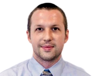
Wim Symens has worked at Luciad for over 10 years and currently manages Luciad's sales operations for Southeast Asia in Singapore. Wim graduated from the University of Leuven with a bachelor's degree in computer science. He started at Luciad as a software engineer in 2004, where he began working on a variety of international projects. He moved to the presales team and also managed the presales team before moving to Singapore in 2015 as the Southeast Asia solutions manager.
Abstract Location intelligence through visual analytics for safer and smarter citiesSensors surge and big data grows. Two billion smart phones and many more GPS sensors are active today, in buildings, in cars, in cities. How to gain knowledge from all that data? How to find the needle in this big digital hay stack? In real-time? Visual analytics, the science of analytical reasoning facilitated by interactive visual interfaces, can be a key enabler to tackle this challenge. In this talk Luciad shares its vision that with the right data architecture, analysis tools and visualization capabilities, any user can be turned into a powerful analyst that can make sense out of all that geo-enabled and temporal data. We will illustrate this vision with concrete use-cases and show how visual analytics can drive location intelligence for safer and smarter cities in the age of the Internet of Everything.
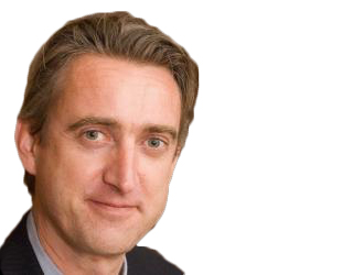
Trevor Taylor, currently responsible for Services for Asia and the Americas, has over twenty-five years of experience in the international Earth Observation community. With a background in Geography (Carleton University, Canada), Mr. Taylor has worked with the Canada Centre for Remote Sensing, Dipix Technologies, Interra (now InterMap) Technologies and, for the last 15 years, PCI Geomatics, where his last position was Director, Business Development with a focus on Central and South America. Mr. Taylor has significant global experience in a wide variety of technical, client services, project, business and strategic planning activities. Mr. Taylor was PCI Geomatics' business contact to OGC for the past decade, representing PCI and OGC interests at the technical, principal, principal plus and strategic levels, particularly in South America, India, China and Western Europe.
Abstract Sensors, Standards, and Situational Awareness; Advancing GeoINT Capabilities in Asia-Pacific
There is an increasing need in Asia-Pacific countries to improve the capability to find, combine and publish actionable information from an increasingly vast array of data sources. Sensors mounted on various platforms such as drones, satellites, ships, vehicles and first responders/soldiers ("wearables", mobile devices) generate extremely large real and near real time data sets. This results in challenges to ensure the right information is rapidly generated from multiple existing and emerging data sources and easily communicated to decision makers and to multiple devices in use by first responders and soldiers. Data interoperability and management continues to be a challenge as much of the required data remains in hard to access silos, both within and beyond a nation's boundaries.
With the pressure to improve a nation's capabilities to respond to both natural and human generated threats to national and regional security, the use of standards to enable better sharing of data and information in the era of big data and a multitude of sensors and devices is critical to improving GeoInt capabilities. This talk will focus on how OGC standards assist in better connecting sensors, such as UAVs and other platforms, to improve situational awareness for land, sea, and air to support, for example, urban resilience, homeland security and cross border collaboration.
The introduction of handheld, SLAM based 3D laser scanners has had a major impact upon the economics of laser scanning projects. The ability to capture centimetre accuracy point clouds indoors, underground or in any GPS denied area while on the move has meant that project costs can be reduced by up to 80%. In addition, the ability to scan complex indoor environments easily and rapidly has enabled Indoor GIS to become a reality.
This presentation will explain how SLAM based scanning differs from traditional static scanning and how the two techniques are highly complementary. Real life case studies will be presented and examples of scanning projects shown. Issues of accuracy and range will be addressed as traditional ways of defining these cannot be applied when the sensor is continuously moving.
It will conclude with a review of how SLAM based scanning is becoming the foundation data source for Indoor GIS, the next major development for the geospatial industry.
Dr. Mazlan is the co-founder and CEO of Favoriot. He is ranked among 50 Most Impactful Smart Cities Leaders by World CSR Congress 2017, ranked Top 10 in IoT Top 100 Influencers by Postscapes 2017, ranked No. 20th Thought Leader in IOT by 2014 Onalytics Report – “The Internet of Things - Top 100 Thought Leaders” and ranked Top 100 in Smart Cities Top Experts by Agilience Authority Index May 2016. He is currently one of Global Vision Board Member. Before Favoriot, he spent 2.5 years as CEO of REDtone IOT and 8 years in MIMOS Berhad as Senior Director Wireless Communications Cluster. He also spent 13 years in CELCOM (mobile operator), handling many senior management positions. Prior to Celcom, he spent 10 years as an Assoc. Professor at Universiti Teknologi Malaysia. He was the Adjunct Professor for UTM from 2008 to 2013 and UTHM (2005-2005, 2013-2016). Dr.Mazlan is a frequent speaker in many major & established IOT, Smart Cities and telco conferences locally and globally. He has served as MOSTI's Innofund, Technofund and Science Fund (ICT Cluster) Technical & Commercial Evaluation Committee and sits in Industry Advisory Panel (IAP) for several local universities. He graduated from Universiti Teknologi Malaysia with a BEE (1984), University of Essex (UK) with MSc. in Telematics (1986) and Universiti Teknologi Malaysia with a PhD in Telecommunications (1993).
Janki Jethi has over 20 years of experience in the Infrastructure sector, including not only technical strength but also excelling in project management and business management. She has managed various aspects of project ranging from a leading a team/engineers, preparation of both technical and financial proposals etc. She has started her professional life in 1998 from Multi Media Consulting Engineers Pvt. Ltd., where she has designed wet utilities of many renowned cities of India. Later on, she joined Jacobs Engineering India Pvt Ltd and SAI Consulting Engineers where, her main focus is on detailed designing and execution of wet utilities including water, sewage and stormwater design, also water and sewage treatment plants. Most of her projects in tenure at these firms is based on cities of UK and USA, like Worcester, Kidderminster, Shropshire, Castlereigh, Craigavon, Seaghan, and Elusbury etc. She has also helped Scottish Water, in creating their effective database of water supply network.
Presently, she is working in Gujarat International Financial Tec-City, Gandhinagar, which she joined in June 2012. The GIFT City is India’s First IFSC and Smart City, where she is heading the Environment Engineering Division as a Vice President. The various infrastructure in her division which she is heading are Water, Sewage and Solid Waste Management. In water infrastructure, she is aiming towards the goal of any tap drinking water while in sewage, zero liquid discharge city. Also, in solid waste management, she has successfully developed and executed the India’s first Automatic Waste Collection System with Plasma Pyrolysis Plant, for waste to energy concept.
AbstractGujarat International Finance Tec-City (GIFT) is envisaged as India’s first major & super tall Central Business District International Finance Service Centre project which would be designed as the focal point of India’s booming financial services market. In terms of scale and sheer physical scope, GIFT is being intended to be at par or above with presently acknowledged globally benchmarked financial centers such as Shinjuku-Tokyo, Lujiazui-Shanghai, La Defense- Paris, London-Dockyards etc. For effective planning and execution of Smart City, GIFT is using ArcGIS for range of applications, few to name them are - land resources, environment, infrastructure planning, logistics, disaster management etc.
Geospatial information, especially imagery, has seen a dramatic increase in temporal and spatial resolution over the last 5-10 years. Large satellites, microsatellites, nanosatellites and UAVs/UASs collect vast amounts of imagery, driving the cost of acquisition and price to the consumer down considerably. Open data policies from leading agencies such as USGS and ESA have resulted in an explosion of earth observation imagery usage. In many peoples’ eyes, this is has resulted in the commoditization of geospatial data from space. However, the challenge in this new era of big geospatial data is to ensure that analytics are based on solid science to ensure the best possible image alignment to support multi-temporal analysis, and atmospheric correction to perform time-based measurements in a scalable and flexible manner.
PCI Geomatics has been at the intersection of remote sensing science, and remote sensing information extraction for over 35 years, and has developed desktop, server and cloud based processing systems that can address these big data challenges. Arnold Hougham will share his 30 plus years of experience and knowledge in the earth observation industry, and will speak on how to go from science to operational information, discussing how software development has evolved and trends observed in our industry
Uke Mohammad Hussein is the Director for Spatial Planning and Land Affairs in the National Development Agency of the Republic of Indonesia since 2016. Before being assigned as a director, he was the Head of Sub Directorate of Data and Information for Regional Development 2009-2011 and the Head of Sub Directorate of Land Affair 2011-2016. Since 2010, he was deeply involved in designing national policies of geospatial information development and national land management which have been accommodated in the National Mid Term Development Planning documents (NMTDP) of 2015-2019. Now, he is working for developing implementing policies for Indonesian Agrarian Reforms.

Dr. Ariel C. Blanco is an Associate Professor at the UP Department of Geodetic Engineering, which he currently leads as Chair. He is also the Director of the UP Training Center for Applied Geodesy of Photogrammetry. He holds a Bachelor’s degree in Geodetic Engineering from the University of the Philippines Diliman, a Master’s degree in Geographic Information Systems from the University of Melbourne and a Doctor of Engineering in Environmental Informatics from the Tokyo Institute of Technology. Dr. Blanco’s research focuses on the environmental applications of Geomatics. He serves as the Program Leader of Phil-LiDAR 2 Program. He is also the Project Director of the BlueCARES Project, a 5-year project on blue carbon ecosystems assessment which is funded by JICA and Program Leader of the counterpart IAMBlueCECAM Program funded by DOST-PCIEERD. He also served as Project Leader of other projects including those on natural resource assessment and agricultural applications.
Abstract Development and Application of Sugarcane Yield Estimation Products of the UP-SRA Yield Estimation System for Sugarcane (YESS) ProjectNational and local total sugar production changes annually due to varying factors such as total area planted, farming practices, crop type, milling schedule and cane variety, among others. Faced with the challenge of increasing demand for sugar, sustainability can be achieved through timely, scientific and farm-specific monitoring and modelling of sugarcane production. The Yield Estimation System for Sugarcane (YESS) Project of the University of the Philippines (UP) and Sugar Regulatory Administration (SRA) aimed to extend and improve the current yield estimation system of SRA through the use of satellite remote sensing due to its regional coverage, revisit capability, non-destructive sampling, increasing availability of free satellite data, among others. Two main estimation models products were generated: (1) the barangay-level (village-level) average LKG per Ton Cane (LKG/TC) and (2) the plot-level average Ton Cane per Hectare (TC/Ha). LKG/ TC stands for 50kgs of sugar per ton cane. The estimation of average LKG/TC employed multiple linear regressions by backward selection method. The average LKG/TC data per barangay were integrated per municipality. Indices such as Fraction of Photosynthetically Active Radiation (fPAR), Leaf Area Index (LAI) and Normalized Difference Vegetation Index (NDVI) per stage of growth were used in the model. The relevance and significance of the variables were analyzed as to which of them will be retained. At least one each of the said indices was selected to become predictor of the Average LKG/TC. For Tarlac Mill District, barangay-specific average LKG/TC estimates were generated for the seven municipalities using seven different estimation models. The R-squares and standard errors were then computed. The result of LKG/TC estimate is strongly dependent on historical Average Gross Production (AGP) data, thus, the model can only be applied to mill district with existing AGP data. The second product is the plot-level TC/Ha which is generated by inputting the Leaf Area Index values extracted from Sentinel-2 MSI data to the linear regression model adapted from Simões et. al (2005). This regression model requires LAI derived from the vegetative stage of sugarcane, which is pre-identified using the ‘yield-forming to mature canes’ product of Landsat. The downloaded Level 1C product was atmospherically corrected to produce the bottom-of-atmosphere image with Sen2Cor, a processor for Sentinel-2 Level 2A product generation. All bands were stacked and resampled to 10m pixel size. After pre-processing, the biophysical parameters such as LAI, fPAR and NDVI were automatically computed using the SNAP software. Zonal statistics were done using the sugarcane validation shapefile from the SRA and the estimation model was finally applied to obtain the average TC/Ha. The computed total TC/Ha showed high accuracy of 85% when compared to the actual yield data for crop year 2016-2017. Plot-level Yield Maps were then created for the test areas.
Addressing mountain development challenges require spatial and temporal data in ranges of regional issues whether - assessing impact of climate change on glaciers, determining water availability scenarios in river basins, devising conservation strategy for landscape, issuing flood early warning, or estimating carbon financing for communities among many others. The Hindu Kush Himalayan (HKH) region posed by typical geographic settings constituting complex and diverse physical and ecological conditions present a formidable challenge to collect and manage data and information. Recent advances in earth observation, near real-time data, in-situ measurements and in combination of information and communication and allied technology have transformed the way we collect, process, and generate information and how we use such information for societal benefits. With the convergence of technologies and the emergence of scientific tools and methods, it provides us with a viable institutional and technological framework for informed decision-making. Such a framework often termed as “Spatial Data Infrastructure” (SDI) is assuming greater significance at the global, regional and national levels. SDI encompasses a framework of technology, policies, standards, and human resources required for acquiring, processing, storing, disseminating, and effectively utilizing geographic information. To this end, ICIMOD as a regional intergovernmental organization is making pioneering efforts to promote and utilize geo-information for sustainable mountain development in the region in close partnerships with regional and international agencies. From ICIMOD point of view, SDI is seen as an important infrastructure to support informed decision-making for sustainable mountain development and continually supporting its member countries especially having less capacity.

Sonny Andalis is a Civil and Structural BIM Specialist for Building and Construction Authority (BCA) under Ministry of National Development (MND). He is registered civil engineer in the Philippines with a professional focus in Transport Engineering and BIM. He is also a registered ACPE and StE Specialist. He has 15 years’ experience in Rail & Airport engineering and has work for Mitsubishi Heavy Industries and CPGairport respectively. He teaches BIM at NUS, NTU, and BCA Academy for both undergrad and post graduate courses. He has written technical papers on BIM interoperability and GIS integration; cloud computing; buildability score and point clouds from 3D LiDAR scanners. He is currently involved in the Virtual Singapore project in cityGML; Underground Master plan and assisted to automated code checking to Eurocodes.
Abstract Virtual Singapore, building blocks of a Smart CityVirtual Singapore aims to be a central repository of maps and information to enable a Smart City a reality. It enables smart planning, data analytics and complex simulations. The programme will support the development of semantically enriched 3D model of Singapore which includes detailed information such as texture, geometry and topology of city objects and terrain attributes. Advanced information and modelling technology will allow dynamic and real-time data to be incorporated on top of static city data powered by BIM and GIS integration. Phase 1 is now online in the government cloud and public version available in 2018.

A graduate of the College of Architecture of the University of Santo Tomas, the Philippine’spremier architectural school, Aldrich comes with more than ten years of experience in the implementation of Building Information Modeling in the design and construction sector. Currently, Aldrich leads the BIM practice group of ESCA Inc. one of the Philippine’s leading engineering companies who is also one of the pioneer in the adoption and implementation of Building Information Modeling in their country. An Autodesk Certified Professional, Aldrich has successfully undertaken assignments in the architectural, structural, and MEPF modellings and execution of various commercial, office, residential and special occupancy structures in both the Philippines and overseas.
Abstract BUILDING INFORMATION MODELING IN BUILDING AND CONSTRUCTIONGlobal adaptation for Building Information Modelling (BIM) is continuously growing as it has been mandated in most of countries. The Malaysian government has also mandated BIM for public projects and continues to promote BIM adoption as a means to modernize the nation's professions and lead to increased productivity. This as Malaysia positions itself as the BIM Centre for ASEAN. The presentation will provide an insight on how the Stake Holders are using BIM in their projects. It will further showcase studies that take concept into real life implementation and execution, also it will exhibit benefits and success stories of the technology adaptors (Owner/Developer and Contractors/Builders) are currently experiencing for the use of BIM.
B. P. Awasthi an IRSE (Indian Railway Service of Engineers) officer is working as Executive Director–Track(P), Railway Board, Ministry of Railways. Apart from Track related works he is looking after policy formulation, planning and implementation of IT related projects in various areas of Engineering Assets management, establishment of GIS Portal of Indian Railways and GIS mapping of Indian Railways assets.
Mr. Awasthi obtained his B.Tech Degree from IIT, Delhi and Master Degree in Systems and Management, also from IIT, Delhi. He has been trained in technical as well as strategic management aspects in India and abroad.
He has worked in various capacities in Northern Railways zone of Indian Railways, Research Design & Standards Organisation (RDSO), Lucknow, Kashmir Railway project and development of web enabled IT-Application Track Management System before joining in present capacity in Ministry of Railways.
Indian Railways (IR), the fourth largest rail network in world, has more than 66,000 route-km and about 1,18,000 track-km. It has more than 7000 stations and about 50,000 land parcels. More than 13,000 passenger trains and 9200 freight trains are operated every day. About 1100 million tonnes freight is carried every year and more than 22 million passengers are carried every day. IR’s passenger-km is 1137 billion, which is the highest in the world. Total revenue is about US $ 25.28 billion. There are 1,41,000 bridges and 28,600 rail-road crossings on IR. Two dedicated freight corridors; ‘Eastern’ of about 1800 km and ‘Western’ of about 1500 km is under construction and 4 more corridors are under consideration. IT enablement of various activities is being done by Online Applications like Passenger Reservation System, National Train Inquiry System and Freight Customer Interface for customer interface. Infrastructure management and internal processes are also being IT/web enabled by various Applications like Land Management System, Track Management System, Coach Management System, Control Office Application, Freight Operation & Information System, Project Sanctioning & Monitoring System, etc. Indian Railways’ Geo-Portal is also under development. This calls for establishment of GIS hardware and software infrastructure, associated application development and GPS survey/mapping of track network, land holding and various assets viz. bridges, level crossings, stations, etc. IR-GeoPortal will provide a backbone for GIS enablement of various IT Applications & services. GIS/GPS survey has been planned by trolley mounted RDPS for on-track assets, other assets by hand held devices and drone based orthophotography/videography. GPS based drones are also being used for monitoring of important projects and creation of 3D interactive model for important assets/locations. It is expected that IR’s Geoportal will help in better asset management and efficient services.
Professor Fredolin Tangang is a Professor of Climatology and Oceanography at the National University of Malaysia. Prof Tangang obatined his PhD from University of British Columbia, Vancouver, Canada in 1997 where he developed a model to forecast El Nino. Prof. Tangang is also an adjunct professor at the Ramkhamhaeng University Center of Regional Climate Change and Renewable Energy (RU-CORE), Bangkok, Thailand. He is also a fellow of the Acadamey of Sciences Malaysia. Prof Tangang also serves as a member of the Scientific Expert Panel of the Malaysian National Disaster Management Agency (NADMA). Prof Tangang was a former IPCC Working Group I Vice-Chair. Prof Tangang has conducted extensive research in climate variability and change and oceanography. He has published extensively in high-impact factors international journals.
Abstract Addressing future climate change information gaps and data needs in the Southeast Asia region through the Southeast Asia Regional Climate Downscaling (SEACLID)/CORDEX Southeast Asia ProjectThe Southeast Asia (SEA) is one of the most vulnerable region to climatic changes especially extreme weather events and sea level rise. However, gaps remain in understanding how climate change affects the region due to lack of robust regional climate change information. Under the framework of WCRP Coordinated Regional Climate Downscaling Experiment (CORDEX, http://www.cordex.org/), Southeast Asia Regional Climate Downscaling (SEACLID)/CORDEX SEA has been established (2013-2017) and funded by the Asia-Pacific Network for Global Research (APN) to provide multi-model regional climate information (http://www.ukm.edu.my/seaclid-cordex). More than ten CMIP5 Global Climate Models (GCMs) have been successfully downscaled to 25 km resolution over the CORDEX SEA domain based on the collaboration of 20 institutions from 14 countries (Malaysia, Thailand, Vietnam, Indonesia, Philippines, Cambodia, Lao PDR, Australia, South Korea, UK, Sweden, Germany, Hong Kong, and Japan). Three Regional Climate Models have been used including RegCM4, RCA4 and also WRF. This paper summarizes key findings of model performances and projected future changes of mean temperature, precipitation and extremes over SEA based on these simulations. Depending on the scenarios, surface air temperature over the region by end of 21st century is projected to increase by 3-4oC. For boreal winter, wetter condition is generally projected over mainland Southeast Asia. During boreal summer, drier condition is projected over the Maritime Continent especially Indonesian region. For precipitation extremes, rainfall intensity, frequency of intense rainfall as well as frequency and duration of droughts are projected to increase throughout the region. The generated high-resolution climate change scenarios serve user data needs and requirement in assessing the potential impacts of future climate changes on various sectors.
Non-Revenue Water or NRW reflects the operational efficiency of a water supply operator. Throughout the world water operators strived towards a low, optimal or economically achievable NRW level. Based on studies, for developing countries 25 % seems the NRW level that can be achieved. Malaysia, a developing country, also strives towards achieving 25% NRW level and the past 5-year Malaysian Plans, investment amounting to few RM billions had been provided by the Federal Government but success so far had eluded us. Malaysia's NRW level is currently looming above 30% with some states having NRW as high as 60%. Figure 1 shows the National NRW Level from 1990 to the present and Table 1 shows the 2015 NRW levels for all states. In view of these non-achievements, the Federal Government through the Economic Planning Unit & the Ministry of Energy, Green Technology & Water (KeTTHA) put-up a new approach of planning & implementing National NRW Control Program. In the past loans of zero interest were given to the states and they carry out their own planning, procurement & program implementation.
In the new approach, states will be grouped into states having NRW level above 40 % and below 40%. A two-tiered National NRW program will be introduced. The first tier will be for states that have NRW level above 40 %. Their high NRW level is characterized by having inaccurate measurement of base-line NRW level, high physical & non-physical losses, inaccurate/unavailable pipeline mapping & poor infrastructure with regard to NRW Control. For such states, hand holding from the Federal Government will be provided in the form of technical assistance & financial grants. The 2nd-tier group will be those states having low NRW (< 40%) and they have to invest and implement their own NRW Control Program. The proposed program, investment & targets need to be approved by SPAN (National Water Services Regulator). If targets are met, their investment will be partially reimbursed by the Government. The Water Supply Dept. of KeTTHA has been entrusted to carry-out the planning, procurement & implementation of the basic NRW program for the 1st-tier group of states by engaging with all relevant parties & stakeholders. Figure 2 shows the communication plan with relevant parties & stakeholders. Altogether about 10-12 contracts will be awarded to successful NRW Contractors before the end of 2017.
Eve Kleiman is currently the Director for Spatial & Graph technologies for Oracle Corporation across the Asia/Pacific region. She has over 30 years experience in the information systems industry, of which 22 years is with Oracle Corporation. Her expertise has been with Spatial, Graph and Multimedia technologies across the Asia/Pacific region. Eve works with Spatial and Graph solutions across the Database, Big Data and Cloud technologies. Eve holds a degree in Statistics and Psychology and a Masters in Econometrics and Operations Research from Monash University.

Mr. Vikas Singhal graduated in Electronics & Communication engineering and did his post graduation in Metro Rail Transport: Technology & Management from IIT Delhi. He has decade of experience in Metro rail projects working in both projects and operations & maintenance. Currently he is working as Deputy General Manager in Maharashtra Metro Rail Corporation. He is the lead for the Implementation of the milestone project of Five Dimensional Building Information Modelling at Maha Metro. This digital platform brings end to digitalization of project processes & data. With his years of experience in Metro railways, he brings a unique perspective on the use of innovative technologies, Methods & Processes which brings value and improvement in the whole project ecosystem.
AbstractEach transportation Infrastructure project element brings its own dynamism & characteristics. It starts from the planning and ends with operation and maintenance. Geo Spatial information has helped Nagpur Metro Project in the effective planning, 3 D space design coordination & more efficient Asset information Management system. The whole Metro rail alignment was first captured with the drone survey which was then converted into 3D reality mash. As the pioneer platform of 5D BIM being adopted at Nagpur Metro project to ensure Digital project delivery, effective use of geospatial technology becomes key for the project.
Geomatics is responsible for the integrity of geospatial data in all PETRONAS/PCSB operational data and databases. One of the challenging is managing CRS within the complexity of E&P dataset throughout different phases of the E & P (Exploration and Production) business cycle. Failing in managing CRS will lead to loss of opportunity, increase in cost, delays in project delivery and loss of company reputation. As a custodian of geospatial data integrity, geomatics has conducted initiatives to educate user on the importance of CRS, increase project efficiencies, improve the current practices in handling geospatial data and subsequently avoid any potential risk. The presentation will describe about the geomatics initiatives in ensuring the geospatial data integrity along the E&P business cycle and the approach to sustain the geospatial integrity.
Chris Fowler is the National Security lead for Asia Pacific, supporting and advising best practises in GIS and helping to establish geospatial platforms to support key operational requirements in Defence, Intelligence, Emergency Management and Public Safety. As a GIS professional for over 15 years he began his career at the UK Hydrographic Office, providing foundation data for the Royal Navy and Commercial Shipping across multiple maritime jurisdictions and requirements. He has been part of the key roll out of a geospatial platform for the Hydrographic Office, modernising its use of GIS, evolving with WebGIS and extending this further into operational activities.

Kate Levy is a Solution Engineer for the National Security sector in Esri's Asia Pacific region. She works with clients, business partners and distributors to introduce and implement Enterprise GIS. Kate has worked in the National Security domain for over 10 years, including as an imagery and geospatial analyst in the Australian Department of Defence, and in the civil maritime domain for Australia's Border Protection Command. With this experience, she has provided technical advice and vision for National Security agencies in Australia and throughout the region. Kate plays an important role in facilitating technical exchanges and workshops, resolving technical issues, and guiding local counterparts to deliver best-practice Enterprise GIS solutions.
Dr. John Rogers is a director of the Malaysian chapter of buildingSMART and Roamef, companies advancing the business and societal benefits of Building Information Modelling (BIM). John previously led corporate change programmes in the UK telecoms and banking sectors that were enabled by digitalisation. He now works to propagate the digitalising of the built environment, as BIM, to achieve built asset, whole-life-cycle value optimisation culminating in facilities and operations management. John is an Assistant Professor at Heriot-Watt University and leads development of AI and VR systems.
Dinesh Sathyamoorthy is currently a senior research officer in the Science & Technology Research Institute of Defence (STRIDE), Ministry of Defence. He serves as Chief Editor for the Defence S&T Technical Bulletin, and editorial board member for the Malaysian Journal of Remote Sensing & GIS and The Journal of Defence and Security, as well as reviewer for several international journals and conferences. He is the Secretary of the Institution of Geospatial & Remote Sensing Malaysia (IGRSM), and a senior member of the Institute of Electrical and Electronics Engineers (IEEE), serving as committee member of the IEEE Geoscience & Remote Sensing Society (GRSS) Malaysia Chapter.
Abstract Evaluating Global Positioning System (GPS) Adjacent-Band Compatibility via GPS SimulationAdjacent-band interference signals at frequencies close to the GPS signal bandwidth can also disrupt the performance of GPS receivers, in particular those that incorporate poor filtering design to achieve a low-cost product. Every radio signal, even though it operates in a specific portion of the spectrum, introduces interference into adjacent portions of the spectrum. The amount of interference that is permissible to seep over into adjacent spectrums is controlled in many countries by their respective communications commissions, but it is not possible to eliminate it completely. The higher the transmission power used, the higher the interferences will be in adjacent portions of the spectrum. The number of systems that make use of the radio frequency spectrum has significantly increased in recent years and the number of users increases daily. This development has crowded the radio frequency spectrum significantly, resulting in increased occurrences of adjacent-band interference for GPS receivers. This study is aimed at evaluating the adjacent radio frequency band power levels that can be tolerated by GPS receivers and to advance understanding of the extent to which such power levels impact GPS performance. The study is conducted using GPS simulation, which allows for the tests to be held with various repeatable conditions, as defined by the authors.
Mr Zainal Azman is Deputy Director General (Operation Sector), National Disaster Management Authority, Malaysia. Prior to his current position, he has been Deputy General Secretary, Ministry of Agriculture and Agro-based Industries, and Director, Ministry of Domestic Trade, Co-operation and Consumerism
Masanobu Tsuji is the director of Bangkok office, Japan Aerospace Exploration Agency (JAXA). He joined to NASDA, former organization of JAXA in 1985 after getting a master degree in electronics and computer science. Since then, he has worked for satellite development, ground system development and earth observation research. Also, he has worked for capacity building of young engineers and researchers in Asia. He was executive secretary of Asia-Pacific Regional Space Agency Forum (APRSAF) in 2013-2015. His recent interest is to implement space technology to societal needs of emerging countries.
Abstract Disaster & Climate Change monitoring from SpaceIn this presentation I will introduce how satellites technology is used for disaster risk reduction and climate change monitoring . As for disaster, I will explain about Sentinel Asia. It is a voluntary basis initiative led by the APRSAF (Asia-Pacific Regional Space Agency Forum) to support disaster management activity in Asia-Pacific by applying the WEB-GIS and satellite data. Currently, 106 organization in 28 countries are joining to Sentinel Asia. As for climate change, I will explain about JAXA's activity for GHG monitoring and global rain precipitation measurement from space. A recent analysis of JAXA's satellite, IBUKI (GOSAT) observational data shows that the global atmospheric monthly mean CO2 concentration exceeds 400ppm and increasing year by year. As a result of global change, floods and droughts occur more frequently than before. JAXA's Global Satellite Measurement of Precipitation (GSMaP) project provides hourly rainfall maps in near real time. It is useful for early warning of flood and drought.

Peter Hawkins serves as the Regional Director APAC for HERE Technologies the Open Location Platform leading the Data and Content Team responsible for the Spatial Index. Peter brings over 20 years of experience spanning Product, Business Development, Strategy and Operations across Telecoms, Consumer Solutions, and the Spatial Industry. Located in Singapore but originally from London, UK, Peter has extensive working experience within the technology and spatial science sectors across Europe, Asia and the US.
Peter has led development of consumer and enterprise grade telematics and business connectivity solutions, along with being an early innovator for location enabled wearable devices. Moving into the telemetry and data space, Peter worked within established Multi-National Corporations and in the Start Up environment.
Currently, the team at HERE has developed data solutions that powers consumer location platforms, autonomous driving capabilities with a HD Map, and a full suite of Enterprise grade Location Platform API's to empower business solutions.
By 2050, we will have close to ten billion people on this planet. Close to 2000 megacities. "Virtual roads" are needed so that drones can glide through the system. We will have to face with questions on how to best sustain our resources. We faced with "aging population". Machines will have to teach machines. Robotics will rise. What technology to make sense of the enormous amounts of data that we collect every day? One thing is certain: Location is the glue that links these factors together. One of the big tech revolutions right now is Internet of Things. Building intelligent sensors into objects for objects to give us feedback. Our world has become intelligent and responsive with many possibilities of a connected and adaptive world. We have seen automakers harnessing real-time data generated by the on-board sensors of connected vehicles to create a live depiction of the road environment. As connectivity and vehicle sensor technologies become more pervasive across the industry, HERE also plans for other automakers to be able to contribute their vehicle data.

Hajah Norizam Binti Che Noh is currently the Director of Malaysian Centre for Geospatial Data Infrastructure (MaCGDI), Ministry of Natural Resources and Environment (NRE), Malaysia. She holds a Bachelor Degree from the University of Malaya and has been serving the government of Malaysia for almost 35 for years now. Prior to this she has worked in various Ministry such as Ministry of Finance, Ministry of Agriculture and Ministry of Human Resources. Her vast experience in managing people, systems and developing applications is indeed an advantage to lead the role of managing the implementation of Malaysian Geospatial Data Infrastructure (MyGDI) where, among her significant tasks includes facilitating geospatial information sharing activities among all agencies at all levels including the private sector in Malaysia. She plays a vital role to lead MaCGDI in embarking towards developing the Malaysia Geospatial Master Plan to empower the Malaysian Geospatial Data Infrastructure (MyGDI).
AbstractGeospatial information plays an important role in delivering sustainable social and economic development in the country. As economic development and modernization efforts continue to increase in Malaysia, the demand for better transportation, telecommunications, land management, food, water conservation, energy and environmental protection are on the rise. In line with the ‘Transformasi Nasional 2050’ or TN50 the vision of becoming a developed nation, we should strive to be amongst the top countries in the world in economic development, citizen well-being and innovation. Thus, the needs for geospatial information and technologies are playing a significant role in helping to shape these development efforts. Geospatial information has application in many fields including transportation, humanitarian, security, natural resources, environmental hazards, natural disasters, pandemics, social and economic crises. The vital role of high-quality geospatial information and technologies continues to drive national transformation and giving a positive impact to the growth of the socio-economy. However, the full potential of these technologies in this country is unlikely to be realized until governments maximize access to geospatial information through Malaysia Geospatial Data Infrastructure, MyGDI. The need to create MyGDI has been intensified by current geospatial technologies such as GPS, satellite navigation systems, mobile phone services, GIS, ICT and field sensors that help in capturing/processing /disseminating information tied to a location. The most important economic benefit of MyGDI is making nationwide geospatial information available and accessible. Policy intervention is needed to strengthen the direction and strategy for joint action to ensure the sharing of geospatial content which is systematic through an effective and efficient management and governance. This paper addresses how policy intervention will impact the sosio-economic value of geospatial information and technologies that could promote the growing recognition amongst all agencies that an understanding of location based information is important for effective decision-making.
Hussein Harahsheh is an environmental Remote Sensing Scientist, currently working for "IDOM Consulting Engineering Architecture SAU" as Business Development Advisor. Graduated from France as Civil-Engineer, and hold from Japan a PhD on Environmental Remote Sensing. He started his carrier, in 1986, as instructor, research scientist and projects manager in the field of Remote Sensing and GIS at the Royal Jordanian Geographic Center(RJGC) for about 9 years. In 1996 was appointed a position of visiting researcher in Japan, at Chiba University/Center for Environmental Remote Sensing for one year. In 2001 he was appointed as assistant Professor at United Arab Emirates University, and then in 2003 and for 13 years, he shifted to industrial sector and become general manager of Global Scan Technologies. In 2016, he was appointed as Lecturer of Environmental Remote Sensing at Balqa'a Applied University in Jordan, as well working as freelance expert and consultant for many international companies. He is Author of many publications and speaker in 70 plus international events.
Abstract Port Asset Management with 3D VisualizationAlgeciras Bay Port Authority needs to manage the assets that provide services to the ports and their customers like the electricity, water supply or storm networks. Idom is helping the Authority to manage its assets in a more efficient and effective way by building an asset management system with 3d visualization, location capabilities and closely integrated with the other systems used by the authority like Video Surveillance System, Access Control System, and Port Management System. It is a GIS based system consisting of several components: Geodatabase with topology rules and location information for all the assets, GIS Server for mapping, visualization and spatial analysis web services, 3D Client interface for visualization and security tasks, Web Client for visualization and simple asset management web interface, and Desktop Client application for asset management.
Bhupinder Singh joined Bentley in 1994 and is the Senior Vice President of Bentley Software. His team is responsible for the strategic direction, development and delivery of Bentley?s industry leading software solutions for sustaining infrastructure. His prior roles at the company include managing director of sales for Bentley South Asia and senior vice president of the Platform Products Group. Prior to joining Bentley, Singh held various software engineering positions at Montgomery Watson Hazra, Bell Labs and Intergraph Corporation. Singh holds master?s degrees in Computer Science from Rutgers University, Structural Engineering from Vanderbilt University, and a bachelor?s degree in civil engineering from IIT Delhi. He also has a certificate in Management from the Wharton School of Business at the University of Pennsylvania.
Ryan is a FARO BIM/CIM Sales Engineer handling the 3D Documentation product line which includes the terrestrial and handheld laser scanners ensuring creation of complete solutions and awareness for their diverse applications. He holds a Bachelor’s Degree in Geodetic Engineering from the University of the Philippines and has ten years of extensive experience handling different spatial technologies in the fields of GNSS, GIS and Surveying.
Bandwork GPS Solutions Sdn Bhd has been serving the geospatial industry with leading-edge technologies and solutions across diverse field of applications, including land surveying, mapping, construction, agriculture & etc. They also provide consultation, support, trainings and seminars to government officials and private sector employees on a regular basis. Bandwork GPS Solutions Sdn Bhd has been appointed by FARO as the Malaysia Distributor for 3D Documentation products..
Mr Jackson Cham holds a Bachelor of Engineering (Hons) Degree from The University of Adelaide, Australia. He is a certified trainer for FARO Laser Scanning Products with FARO Asia Pacific. He has been leading implementation of innovative laser scanning solutions for geospatial applications and projects in Malaysia.
Beow Kwan Chew is the Product Marketing Associate Manager for Asia Pacific at FARO. He is handling the 3D Documentation and Product Design Group product lines. He obtained his Bachelor of Engineering (Hons) in Electrical and Electronics from the University of Glasgow.
The business of Utilities will change more in the next 5 years than in the past 100 years. The need for deeper customer engagement has dramatically increased due to the emergence of retail market, which is enabled by the technologies like smart grid, smart meters etc. “Prosumer” is the new category of consumers, who also provide energy to the grid. Utilities have to build stronger analytical systems to manage the supply and demand more efficiently. GIS can help utilities consume the data in their ‘Systems of Records’ and other inputs that come from sources like Satellite Imagery, Drones, LiDAR, Ortho etc. and build ‘Systems of Insight’ and ‘System of Engagement’ to support their business better and to effectively engage with their customers.
Rajathurai, has been working with Bentley systems since last 16 years and he has managed several key project implementations in areas of Mapping, Water Utility, Municipal, Defense in the region. He has been actively involved in the geospatial industry with varying projects. He has over 7 papers published in various international conferences in the areas of Geospatial and utilities.
Abstract Advancing Construction Projects through reality 3D modeling and collaborationToday's advances in technology continue to propel the construction industry into new areas that result in the construction of infrastructure assets with more accuracy and efficiency than ever before. The construction projects in general are very large and complex with project teams in multi-locations. The challenges in front of the construction firms are many from Better Planning, Protecting Margins, safety, Environmental challenges and achieving highest quality of work. This topic envisages on a set of innovative solutions from that will help win these challenges through multi-discipline design and analysis, construction modeling, project collaboration work packaging, construction management etc. It is also to ensure that the project critical information available at the right time to right people for informed and intelligent decisions.
John Ahlrichs leads business development activities for Planet, a satellite imaging and solutions company. Previously, he has held numerous technology, marketing and sales leadership positions, primarily for start-up companies. John has a Master of Science in Crop Remote Sensing from Purdue University in the United States, a Ph.D. from Texas A&M University and a MBA from University of St. Thomas in Minnesota.
Abstract Daily optical imaging to monitor activity over land and seaThe earth observation industry is rapidly changing from a supply constrained business where orders are placed for individual datasets to subscription models where all data collected by multiple sensors are available for one fixed fee. Planet, with over 150 satellites in a polar orbit, is now able to offer single fee subscription access to near daily coverage of the world at 3.1 m resolution. Other than when clouds interfere, the Planet access model allows for daily, reliable and cost-effective monitoring of shoreline, ports and even open water. All data are processed and stored online to be automatically downloaded for processing and integration into application software through an API. This capability not only allows automated observation of remote ports and near shore activity, it also allows monitoring and identification of restricted areas where open water vessels may not have AIS systems to indicate their location. This presentation will discuss advances that facilitate monitoring of open water areas, opportunities for machine learning to improve the decision-making and several interesting applications of this technology that are currently being used or considered.
Shattri Mansor is currently the Director of Geospatial Information Research Centre, Universiti Putra Malaysia. He maintains a diverse research interest including image processing, remote sensing and GIS. His major research effort includes feature extraction from satellite imagery, spatial decision support system, UAV-based remote imaging, disaster management and early warning system. As a result, hundreds of his works has been recognized and published extensively in renowned journals and conference proceedings. In tandem with his expertise, Prof. Shattri has also supervised and co-supervised a total of 40 MS students, 40 PhD students and 8 post doctorates. Prof. Shattri holds membership to various organizations and institutions. He has served as a councilor for the Institution of Surveyors Malaysia (ISM), an Editor of the Journal of the Malaysian Surveyor and an executive committee for ISO TC211. He is currently the Editorial Board member of Disaster Advances Journal and International Journal of Geoinformatics. As a leader he manages and leads his group and organization towards commendable achievements. He has received several awards at the international and national level including Gold Medals and Best Article Award.
Abstract Object Detection in Unmanned Aerial System (UAS) Videos for Homeland Security: Current and Future DirectionsHomeland security and surveillance have been mentioned to be one of the largest markets for unmanned autonomous vehicles, sensors, and systems (UAS) technology, particularly when space borne technology, manned airborne and in situ methods are not as efficient for various reasons. The reasons include the spatial and temporal resolutions, accessibility, speed, cost efficiency, and operational safety. This has in turn highlighted a growing need for the development of data acquisition and data processing techniques, rather than just the vehicle, across many domains. Robust methodologies and reliable results are very critical for successful applications of UAS. Object detection is a key ability required by remote imaging and surveillance. The latest research on this area has been making great progress in many directions. In this presentation, we give an overview of past research on object detection, outline the current main research directions, propose our algorithm, and discuss open problems and possible future directions.
Lt Col Muhamad Zamri bin Husran is currently the Director of Geospatial Operation Section at Defense Geospatial Division of the Department of Survey and Mapping Malaysia. The main responsibility of his division is to obtain and provide geospatial information and services to the Malaysian Armed Forces (MAF). He has a lot of experiences through direct involvement in the development and operation of unmanned aerial vehicle (UAV) capability for MAF, NRE and MKN. He has also been involved in the Implementation Force (IFOR) in Bosnia Herzegovina in 1996 and Op Daulat Sabah in 2013. He obtained his basic diploma in Land Surveying from University Technology of Malaysia in 1989 and also diploma in Strategic and Defense Studies from University of Malaya in 2005. He then furthered his basic degree in Surveying Science and Geomatics from University Technology of MARA in 2009 and graduated in 2012.
Abstract IMPLEMENTATION OF UAV'S - LEGISLATION, OPERATION, TRAINING AND PLANNING
Department Survey and Mapping Malaysia (DSMM) especially through Defense Geospatial Division (DGD) workforce in the process of implementation of aerial photography with some unit acceptance of fixed wing UAV aircraft and rotor wing capable of carrying out aerial photography mapping and monitoring. This development is in line with the current needs of the government and private agencies.
The use of these UAVs are subject to the legal aspects. Legal issues need to be clear about the limits of the use of UAVs as it could tarnish the country's security. Existing laws such as those used by the Official Secrets Act, DCA, DSMM and MCMC should be taken into account.
UAV capability has been generating a lot of orthophoto images and video monitoring for the purpose of updating the maps, confirmation position and disaster/crisis. The area affected by the intrusion of soil, bauxite, an el Nino effect and so on. It is very effective in producing images below 300m in height with high precision. Training are key factors to produce individuals capable of operating these UAVs.
In line with the growing UAV capability, BGSP found that there is a need to use remote sensing sensors such as LIDAR, Thermal, Infra-Red, Multi Spectral and Hyperspectral under UAV platform. Development costs are getting cheaper sensor has given the assumption that the practitioner will move to Remote Sensing UAV platform.
Dr. Ken Tsutsui is an expert in remote sensing technology, working mainly in developing system related with satellite imageries and GIS for NTT DATA Corporation. He is one of the developer of AW3D service, which provide global high-resolution 3D map.
Abstract Overview on the Usage of AW3D Global High-Resolution 3D Map in Disaster ManagementUsing remote sensing technology such as Digital Elevation Model (DEM) has many advantage in disaster management field compared to ground survey or any traditional method. For instance, while ground survey would be a tough task to do in disaster condition due to poor access, DEM will provide actual condition of disaster site without any necessity to go to the scene. AW3D became the world''s first five-meter-resolution DEM covering all global land spaces in April 2016, derived from ALOS satellites. It also offers a higher-resolution 3D map at half-meter resolution using commercial high-resolution satellite imagery. In the aftermath of April 2015 Nepal earthquake, AW3D was utilized by ICIMOD to identify high risk area of land-slide and creating hazard map. It also being utilized by Nanyang Technological University to simulate tsunami in Macau, which is achieved a good result in identifying where to evacuate in the case of tsunami. In volcanic country such as Indonesia, it has been utilized to predict the pyroclastic flow in the case of volcanic eruption, so any disaster prevention measures can be taken by surrounding municipals. In this paper, we explain on how AW3D has a big socio-economy benefits in disaster management field.
Noor Atika is an Environmental Scientist currently working with an environmental consultancy. She has been involved in numerous projects mapping marine habitats for the use in Environmental Impact Assessments. A graduate of Universiti Malaysia Sabah, Atika has a strong background of marine biology with four years of experience.
Abstract Utilization of GIS, Side Scan Sonar and Video in Creating Marine Habitat Map of Kuala Linggi, Melaka, Malaysia
Side scan sonar with video verification has been intensively used to map the seabed around the globe, alongside with other seabed mapping technologies includes multi-beam sonar and RoxAnn. However, the used of these technologies in Malaysia for marine habitat mapping is still low and poorly documented.
In this study, the side scan sonar was used to map a segment of the sea floor in the bay of Kuala Linggi, Melaka (cover approximately 68km2) and the results mosaicked using 100 Khz to 325 Khz data. Data from the sonar mapping, a towed camera, bathymetry data, sedimentary samples and borehole data were merged in a Geographical Information System (GIS) to generate a description of the bottom type and biological habitat. ArcGISTM software was used for the interpretation and visualisation during data processing and HYPACK software were used for navigation and data acquisition. Habitat and presence of certain species were also presented in point features, but strictly limited to area where video ground-truthing occurred.
An area (approximately 31.57 km2) of scattered hard substrate associated with octocorallia (soft coral and sea fan) were discovered and dominant octocorallia were identified up to genus level wherever possible. The remaining surveyed areas were categorized as soft sediment.

Recently, the number of natural disaster occurrence is increasing because of abnormal changes of weather in Korea. In Korea the storm and flood insurance system is in effect to prevent these natural disasters. The national storm and flood insurance Premium rate is very low and the risk of adverse selection resides because of choosing by who lives in high risk area. To solve these problems, the storm and flood insurance rate map are required. In this study, the prototype of storm and flood insurance premium rate map of the Ulsan, Korea was made and the method of GIS analysis for the insurance premium rate calculating and the procedure of the Ulsan storm and flood insurance rate map were researched.
The business intelligence and analytics platforms are shifting from IT-led reporting to modern business-led analytics. A new term visual analytics (VA) is now used to emphasize the shift from domain specific experts to non-technical users who want to integrate analytics into their daily decisions and actions.
In the next 5 years, the number of citizen data scientists will grow five times faster than the number of data scientists. This presentation will cover some of the new trends in the BI/VA technology and discuss how location intelligence plays a significant part in the next generation BI tools.