Symposium Partner |
 |
GEOAGRI – GEO Smart Technologies for Innovations in Agriculture
Agriculture is a key strategic sector for many Asian countries like Indonesia, Malaysia and Philippines, involving a high proportion of the poor. Understanding the fact that the agriculture resources are among the most important, renewable, dynamic natural resources, it is very much necessary for the implementation of the effective management decisions. The development of spatial technologies in recent years has made available new tools and capabilities to be used for agriculture. In particular, the digital technology has evolved in the last ten years starting from the use of GPS (Global positioning systems) for operations like levelling, seeding, cultivating, planting, harvesting to irrigation of crops. The integration of GNSS technology with geographic information systems (GIS) and remote sensing (RS) technologies has enabled the collection and analysis of spatial and non- spatial data in more accurate and timely manner. The availability of high resolution satellite images such as IKONOS, Quick Bird, GeoEye-1 and World View has improved the identification, analysis and monitoring of the agriculture activities.
|
Agriculture - Snapshot
Source - Asian Development Bank |
TECHNICAL AGENDA
Asian countries has been adopting the technological changes required for expanding the crop production area and producing better yields to anticipate the increasing need for food, year-on-year during the last 50 years. Geospatial technologies play a boosting role for the major priority areas like achieving self-sufficiency in key commodities, managing the effects of climate change, natural hazards and land use. Understanding the importance and advantages of the technology in the region, a dedicated session – GeoAGRI - GEO Smart Technologies for Innovations in Agriculture is Organized as part of the Geo Smart Asia – 2015.
MAJOR THEMES
Innovators for sustainability
The session aims to bring at front the advantages of using the latest geospatial technologies and tools for strengthening various agricultural activities. It focuses upon the use of technologies for the sustainable intensification of the agriculture sector. With this session we aim to bring at front the geospatial solutions for combating the challenges like increased globalization, increasing environmental pressures, increased price volatility and food security issues. The programme emphasizes on the application of precision technologies which has highly mechanized the agriculture sector of the region.
Climate Smart Agriculture
The geospatial technologies are widely used for smart agriculture which helps in steering the solutions to build a comprehensive solution that help farmers produce higher productivity, better margins and lower waste. The session aims to highlight and address the challenges, opportunities and smart solutions for the climate change.
Innovations, Applicability and opportunities of Precision Farming in Asia
The session aims to highlight the role of precision farming for agriculture in Asia. Emphasis to be laid on the most commonly used precision agriculture technologies like grid soil sampling, yield monitors, precision harvesting and more. The session aims to lay focus on the benefits and scope of precision farming techniques in small scale farming and plantation agriculture in Asian countries.
Panel Discussion - Synergies between agriculture policies, program and activities
The panel discussion tries to bring at front the decision-makers, regulators and stakeholders to have deeper understanding of the agricultural machinery industry. It will try to bring the research organizations, industry people and the policy makers at the same platform to understand and provide smart solutions to help farmers worldwide to grow food affordably and sustainably.
Objectives
- To understand current geospatial domain’s path and bring awareness to the agricultural stakeholders on global platform.
- To exchange of ideas and sharing of knowledge and skills pertaining to the domain and provide an explicit platform for networking opportunities.
- To strengthen and connect geospatial communities all over the world with the strategies taken to cater global challenges.
- Exchange of skills and knowledge on new forms of applications and technology by sharing latest success stories and challenges.
- Bring together decision makers to discuss and deliberate the sustainable contribution of geospatial intelligence.
Target Audience
- Ministries & Department of Agriculture from different countries.
- Agricultural Research Agencies
- Multilateral Agencies
- Industry Players
- Agricultural Associations & Unions
- Agricultural Universities & Colleges
Speakers
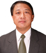
Khoo Hock Aun
Director, The GROW Centre & Managing Director, Cosmo Bio fuels Group, Kuala Lumpur, Malaysia Vice-Chair-The Roundtable on Sustainable Biomaterials, Switzerland
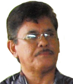
Dr. Zainol Abidin
Managing Director, Agrostevia Worldwide (M) Sdn. Bhd
Kuala Lumpur
Malaysia

Sutha Veloo
Assistant Director
Planning & ICT Division, Department of Agriculture
Ministry of Agriculture and Agro-Based Industry
Malaysia

Dr. Siva Balasundram
Country Representative/Associate Professor
The international Society of Precision Agriculture
Malaysia

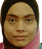
Siti Hajar Md Nor Azam
Senior Scientist, Precision Agriculture Unit, Sime Darby Research, Malaysia
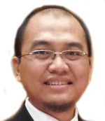
Fatwa Ramdani
Director of Geoinformatics, Research Center, Faculty of Computer Science, University of Brawijaya
Indonesia


Doria Tai Yun Tyng
Principal Assistant Director
Lands and Surveys Department Sabah
Malaysia

Mark Yong
CEO
Garuda Robotics
Singapore
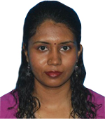
Dr Jeyanny Vijayanathan
Research Officer
Soil Management Branch
Forest Plantation Programme
Forest Research Institute Malaysia (FRIM),Malaysia

Jigg L. Pelayo
Senior Science Research Specialist
Central Mindanao University
The Philippines
