Speakers
Department of Survey & Mapping
Malaysia
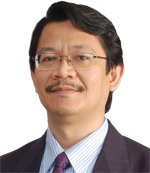
Datuk Ahmad Fauzi Nordin is currently the Director-General of the Department of Survey and Mapping Malaysia (JUPEM). He is a qualified land surveyor who additionally serves as the Chairman of the Licensed Land Surveyors Board of Peninsular Malaysia. He is also a Past President and Fellow of the Royal Institution of Surveyors Malaysia (RISM), as well as a member of the Executive Board of the United Nations Global Geospatial Information Management for Asia and the Pacific (UNGGIM-AP).
About presentation
“Towards Next Leap: What’s next for Data Creation and Management”
The use of geospatial information is growing rapidly and many recognize that an understanding of location and place is very important for effective decision making. At the same time, there has been immense growth in data capture methods as well as in the amount of data collected and generated. It would consequently be beneficial to identify the major trends expected to impact on those involved in geospatial information management in the coming years. The presentation will therefore deliberate on the future of among others - data creation, managing massive data, cloud computing, open source, standards and positioning in relation to the geospatial world.
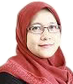
Dr Suhazimah Dzazali was appointed to the role of Deputy Director General (ICT) in MAMPU, Prime Minister’s Department in August 2014. Not new to MAMPU, she was previously the Public Sector ICT Consultant (Information Security Management). A post she holds since 17 November 2008. Her current portfolio covers the role of Government Chief Information Officer as well as leading the Public Sector ICT planning and development. In relation to her contributions in the field of cyber security she was awarded the Information Security Professional of the Year 2013 by the CSM-ACE. Dr. Suhazimah has also served in various Government agencies mainly INTAN, Immigration Department of Malaysia, and Road Transport Department. Her 28 years as civil servant has provided her with wealth of knowledge and experience in system development, information security as well as direct involvement in several transformative projects such as the computerization and modernization of Malaysian Immigration Department (1995 -2000), setting up of Government Emergency Response Team (2001), and the development of Malaysian Public Sector Risk Assessment Methodology (2003-2004). Dr. Suhazimah obtained her PhD (Information Security Management) from University of Malaya in 2007 and has Master of Science and Bachelor of Science degrees in Computer Science from Northrop University, California (USA). Always striving to improve herself professionally, she is a Certified Information Security Manager (CISM) from ISACA, Certified Tester Foundation Level (CTFL) from Malaysian IT Software Quality Board and Certified Disaster Recovery Professional (CDRP) from EC Council.
About Presentation
Geospatial Data Management : A Collaborative Approach
The Government Transformation Plan (GTP) targets for an innovative citizen-centric public delivery service by 2020. Thus, the public sector is geared towards delivery of quality public services based on the needs of the citizen and businesses. One of the strategic enablers identified is the establishment of an enabler in the form of data sharing platform and supporting governance structure or processes that entails the need for data sharing and creation of a collaborative environment.
Geospatial information is widely used in the industries cutting across the public and private sectors and has direct contribution to the economy. It also forms as part of the national knowledge infrastructure that enables innovation and better decision-making. Removing key barriers to connecting this information could increase further in productivity benefits and generation of revenue.
The Public Sector has identified the need for a collaborative approach in geospatial data management to reduce redundancies, increase productivity and efficiencies, as well as reducing cost. The importance of geospatial infrastructure and infostructure cannot be denied in lights of the rapid development and adoption of Big Data Analytics and Internet of Things.
A national strategy that encompasses the policies, organizational responsibilities, data, information, technologies, standards, services, and financial and human resources is necessary to achieve this vision.

Dr. Yuming Fu holds Dean’s Chair Professorship at the Department of Real Estate, School of Design and Environment, National University of Singapore. His teaching and research focus on urban economics, economic development and geography, real estate markets and housing policies. His research has been published in leading academic journals such as American Economic Review, Journal of Urban Economics, Regional Science and Urban Economics, Real Estate Economics, and Journal of Real Estate Finance and Economics. Dr. Fu currently serves as the vice dean of research at his school. He also served on the board of the American Real Estate and Urban Economics Association (AREUEA) and Asia Real Estate Society (AsRES) and is an editorial board member of these societies’ journals, Real Estate Economics and International Real Estate Review, respectively. He is a Fellow of Weimer School of Advanced Studies in Real Estate and Land Economics, Homer Hoyt Institute (USA). He obtained a PhD in Urban Land Economics from the University of British Columbia, Canada.
Malaysia
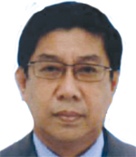
Dato’ Dr. Nadzri bin Yahaya served as the Director General at the Department of Solid Waste Management, Ministry of Urban Wellbeing, Housing and Local Authority from 2007 until August 2014. Since 2002 he has been serving as the Chairman of the National Industrial Standards Committee on Environment Management. He has been a Member of the Solid Waste and Public Cleansing Management Corporation. He has also been involved in the formulation of National Environment Policy, National Biodiversity Policy, National Climate Change Policy, the setting up of the National Committee on Clean Development Mechanism (CDM), the preparation of the Initial National Communication on Climate Change, the enactment of the Solid Waste Management and Public Cleansing Management Act 2007 and as well as the privatization of solid waste and public cleansing.
About PresentationGeospatial industry has evolved beyond its traditional domain of providing visibility of spatial data to a significant tool to aid businesses and governments in driving operational excellence. GIS applications and technologies offered means, for operation efficiencies in many sectors such as properties, city management, constructions, and utilities. It is apparent that the way forward is the convergence of geospatial technologies with other technologies to open up new opportunities and business. Significant changes of business processes driven by the introduction of geospatial and geoinformatical technologies will improve productivity and cost efficiency in the long run. GIS solutions will continue to play an important role in Utility industries to enhance its asset management, operation, business and delight customers.

Eric Broussouloux, Asia Regional Manager at IMAO, has a vast two and a half decade experience in project development and management in Asia, Middle-East and Africa in the fields of mapping, GIS, satellite images and aerial surveys. Currently, he is in charge of the creation and management of IMAO's new office in South Asia.
About PresentationUltralight, an alternative to the helicopter in Powerlines Sector
Powerlines Sector needs georeferenced data with high density at a reasonable price, for various purposes such as monitoring, maintenance, planning etc. IMAO has developed a solution for aerial data acquisition that uses “Ultralight” instead of a helicopter. IMAO believes that Ultralight is appropriate for linear projects that require low speed. The presentation at GEOGRID session will focus on the following aspects:
• How this solution meets the specific needs of the Powerlines Sector?
• What are the advantages of this solution?
• How is the data acquisition optimized through a customized methodology?

Ng Siau Yong is the Director of GeoSpatial Division at the Singapore Land Authority (SLA). He is responsible for driving and establishing a collaborative geospatial environment in Singapore. He oversees the formulation, design and management of the policy and programme for geospatial information governance, infrastructure and technology development, capacity building, and the use of geospatial systems in data analytics. Under his stewardship, various important geospatial initiatives have been implemented. Among them, OneMap (www.onemap.sg), the Singapore Government’s geospatial information and services portal, has won many international accolades. GeoSpace, an online geospatial community, has been set up as an essential platform to cater to the geospatial data needs and operations within the government system. The annual Singapore GeoSpatial Challenge has now become a critical geospatial learning and competition event for students. Siau Yong initiated the setting up of the Singapore GeoSpatial Scholarship to strengthen the building of geospatial manpower. He is currently driving the set-up of Virtual Singapore, the multi-agency-based 3D geospatial data, operating, analytic and research platform, together with the National Research Foundation and the Infocomm Development Authority, under the Singapore’s Smart Nation Programme. Trained as an urban planner, Siau Yong started his career with the Singapore Urban Redevelopment Authority. He later served the Ministry of National Development as Deputy Director, Strategic Planning and the Ministry of Law as Deputy Director, Land Policy. Upon joining SLA, he first assumed the position of Director, Strategic Planning and Policy and later Director, Land Asset Management Services, prior to taking on the current portfolio. Apart from his professional work, Siau Yong has been actively involved in tertiary education for more than 17 years. Until recently, he taught Urban Development, Urban Planning and Urban Policy in undergraduate and postgraduate programmes as Adjunct Associate Professor with the Department of Real Estate of the School of Design & Environment, National University of Singapore (NUS).
Dr. Zainol Abidin is the Managing Director of Agrostevia Worldwide (M) Sdn. Bhd., an Agricultural Biotechnology company, located in Kuala Lumpur, Malaysia. He received his Medical Degree from Bachelor of Homeopathic Medical Science (BHMS), from Hahnemann University Hospital, Broad and Vine, Philadelphia, PA 19102, USA. He also received his Masters in Business Administration from The Open University Business School MBA. He served in Pantai Holdings Berhad (Pantai Hospital), Kuala Lumpur for more than eight years. He carried out research on stevia rebaudiana that can stabilize blood pressure, diabetes, prevent/reduce obesity and its anti-cavity qualities. Then he formulated “MySweet” stevia sweetener as an alternative to sugar. Dr. Zainol Abidin attended several agricultural courses and has written 22 articles covering precision agriculture, usage of agricultural robots and GPS technology in plantations, applying Solar power for plantation’s electricity needs, contract farming to enhance farmers’ income and eradicate rural poverty, and how governments can attract agricultural graduates to be Agropreneurs.
About Presentation
21st Century Agricultural Revolution – Smart Farming of the future.
The agricultural sector is going to face enormous challenges in order to feed the 9.6 billion people that the FAO predicts are going to inhabit the planet by 2050: food production must increase by 70% by 2050. The call for 21st Century Agricultural Revolution and Smart Farming address these issues and increase the quality and quantity of agricultural production by putting together smart software, robotic machinery, mechatronics, electricity from solar panels, internet, GPS mapping, inspection drones, data collection and using sensing technology to make farms more “intelligent” and more connected thorough the so-called “precision agriculture” also known as ‘smart farming’. The need to use less fertilizer, use less and clean energy, use less human labour, but cultivate larger areas of land using less than 5% of the fertilizer levels used in Asia presently. Increase yields mean increase farmers’ income which will eradicate rural poverty, reduce population migration, make agriculture an attractive choice for the younger generation and governments can attract agricultural graduates to be Agropreneurs. Contract farming projects organized by the government with the cooperation of the private sector, will further increase participants in smart farming and the production of food from the agricultural sector throughout the World. This is the only way to ensure enough food for the future World population.
Dr. Nurwadjedi, Deputy of Geospatial Thematic Information in Agency of Geospatial Information (BIG), has been coordinator of National Thematic Geospatial Information Working Group for Implementation of One Masp Policy. He has also been the Head of Center for Land Resource Mapping, BIG; head of Center for Marine Resource Mapping, BIG (2010-2011); head of Land Resource Data Base Division, BIG. He is an expert in aplication of remote Sensing and geographic informaton system for land resource survey and mapping.

Dr. Nurwadjedi, Deputy of Geospatial Thematic Information in Agency of Geospatial Information (BIG), has been coordinator of National Thematic Geospatial Information Working Group for Implementation of One Masp Policy. He has also been the Head of Center for Land Resource Mapping, BIG; head of Center for Marine Resource Mapping, BIG (2010-2011); head of Land Resource Data Base Division, BIG. He is an expert in aplication of remote Sensing and geographic informaton system for land resource survey and mapping.
About Presentation
One Map Policy to Support National Development in Indonesia
The availability of geospatial data is an important aspect to support national development. The role of geospatial data covers development in many sectors. To implement the use of geospatial data for the national development, the Indonesian Government legalized the Geospatial Information (GI) Act on April 21, 2011. The main goal of GI Act is formulated in the One Map Policy directed to guarantee the availability of accurate, accessible and accountable geospatial information. One Map Policy is defined as a policy direction to produce geospatial information approved by the stakeholders and used nationally, based on the criteria of one single georefence, one standard, one geospatial database, and one geoportal. The strategic approach to implement One Map Policy is by establishing the Working Group of Thematic Geospatial Information (Pokja IGT) which has members from the government, university, and non governmental organization. The role of Pokja IGT is a media for coordination and synergy among stakeholders in establishing thematic geospatial information. In the Working Group, the role of Geospatial Imformation Agency (BIG) is as a base map provider and coordinator/integrator which has functions to facilitate the related ministries/agencies in developing national standard of thematic mapping methodologies and establishing one thematic map. Since 2012, Pokja IGT has continued to develop the standard of thematic geospatial information issues including climate change, hazard mitigation, spatial land use planning, national food security, renewable energy development, marine resource development, and rural development.
India
Prof. Dr. Muralikrishna V Iyyanki, PhD from the Premier Institute -Indian Institute of Science (IISc), Bangalore, is presently Dr Raja Ramanna Distinguished Fellow at the Defense Research and Development Organization (DRDO), India, and the National Coordinator for Geospatial Public Health, which is National Networking Government of India Project. He is Professor and Founder Head of the Centre for Spatial Information Technology (CSIT) at Jawaharlal Nehru Technological University (1990-2005), and Director of Research and Development Centre (2005-2008). He has served as a guest scientist at German Space Research Institute (DLR) and GKSS Research Centre. His present research focuses are on hyperspectral remote sensing image classification and geospatial public health management and geospatial technology applications
Bentley Systems
Australia
John Taylor joined Bentley Systems in 2011 and is the Senior Director for Government for the Asia Pacific region. John has over 30 years of experience in the Federal, State and Local Government, Defence & Emergency Services, Utilities, Transportation, Real Estate Development and Geospatial market, holding various senior management and consulting positions. His role focuses on the positioning, development and delivery of Bentley’s Government and Geospatial solutions across Asia and the Pacific region. He is an experienced technical programme leader, with over 20 years Service in the British Army, mostly within the UK Defence Geospatial and Imagery Intelligence Agency and subsequently 8 years in management consultancy, where he focussed on integrating geospatial solutions into Public and Private sectors organizations. A qualified Chartered Surveyor and specialist in the production and exploitation of geospatial information, John has extensive experience of the international Geographic community, as well as the broader application of GeoInt for Government and Civil use. He has led geodetic survey, map production and GIS data management teams in Africa, the Middle East, North America and Europe and was the Senior Instructor for GIS and Terrain Analysis at the UK’s Royal School of Military Survey. His previous role prior to joining Bentley was the senior technical advisor and Transition Director for Bayanat LLC in Abu Dhabi, where he was responsible for leading the transition of the UAE Armed Forces Military Survey Department into a commercial geospatial data services company. Educated at the Royal Military Academy Sandhurst and the University of Edinburgh, John has an MSc in GIS and a Diploma in Defence Geospatial Information Management. John works out of Bentley’s Brisbane, Queensland office in Australia.
About PresentationGeoInt requirements for Security and Disaster Management are varied and are often representative of the operational tempo. Preplanned security and disaster management operations typically have time to look at a range of data source options and enjoy the benefits of time in terms of preparing data and information for options analysis and communication of the plans. However many security operations and disaster management responses are often as a result of rapidly changing circumstances (terrorist attack or natural disaster), where rapid data capture and flexibility in how data is sourced and used are essential to ensuring the best possible information is made quickly available to both decision makers and military field staff. This session will highlight Bentley’s capabilities to generate detailed 3d models to support situational analysis, as well as technologies for field data exploitation and multi-source geospatial data analysis.
Naveen brings in 20 years of extensive domain as well as consulting expertise, having worked in South East Asia and India. With a substantive experience in architecture, construction, project management, and BIM, he has helped various customers over the past 9 years to implement BIM within their organization. Being involved in the forefront of BIM technology - as it evolved, and his solution centric approach has earned him the confidence and trust of the customers he’s engaged with. He’s worked with the Building and Construction Authority of Singapore to pilot, and implement the BIM Submission guidelines for Building Construction Approvals. He has been actively involved in planning and implementing BIM at several multidisciplinary firms like CPG, Surbana, Arup, DP Architects, Zuhair Fayaz, Hyder Consulting and Land Transport Authority Singapore - to name a few. He has also been a prominent speaker, evangelising BIM, at events organised by Singapore Institute of Architects, Association of Consulting Engineers Singapore, Singapore Contractors Association Limited, Pertubuhan Arkitek Malaysia, and National University of Singapore. Naveen has a master’s degree in Construction Management and a bachelor’s degree in Architectural Engineering.
Science & Technology Research Institute for Defence
Malaysia

Dinesh Sathyamoorthy received the B.Eng. and M.Eng.Sc. degrees in computer engineering from Multimedia University in 2003 and 2006 respectively, and the PhD degree in electrical and electronics engineering from Universiti Teknologi Petronas in 2013. He is currently a senior research officer in the Science & Technology Research Institute of Defence (STRIDE), Ministry of Defence. He serves as Chief Editor for the Defence S&T Technical Bulletin, and editorial board member for the Malaysian Journal of Remote Sensing & GIS and The Journal of Defence and Security, as well as reviewer for several international journals and conferences. He is the Secretary of the Institution of Geospatial & Remote Sensing Malaysia (IGRSM), and a senior member of the Institute of Electrical and Electronics Engineers (IEEE), serving as committee member of the IEEE Geoscience & Remote Sensing Society (GRSS) Malaysia Chapter. His research interests include geospatial technologies and digital signal & image processing.
About PresentationGlobal Positioning System (GPS) Receiver Evaluation Using GPS Simulation
Many designers are working on improving characteristics of Global Navigation Satellite System (GNSS) receivers, such as lower power consumption, the tracking of weak satellite signals, faster acquisition times and more accurate position fixes. At present, many developers and users still struggle to identify suitable standard tests to objectively verify and evaluate the functionality and performance of GNSS receivers. There are two types of methods for conducting GNSS evaluations; field evaluations and GNSS simulation. Field GNSS evaluations, which employ live GNSS signals, are subject to various error parameters which are uncontrollable by users. The ideal GNSS receiver evaluation methodology would be using a GNSS simulator which can be used to generate multi-satellite GNSS configurations, transmit GNSS signals which simulate real world scenarios, and adjust the various error parameters. This would allow for the evaluations of GNSS receiver performance under various repeatable conditions, as defined by users. As the evaluations are conducted in controlled laboratory environments, they will be inhibited by unwanted signal interferences and obstructions. This presentation will provide a review of research activities that have been conducted in the Science & Technology Research Institute for Defence (STRIDE) in regards to the evaluation of the effect of various vulnerabilities on Global Positioning System (GPS) signals using GPS simulation, with the focus thus far being on radio frequency interference (RFI), simplistic spoofing, static multipath, satellite clock error and power consumption. The future research direction in regards to the evaluation of a larger group of vulnerabilities, in particular intermediate spoofing, dynamic multipath, and ionospheric and tropospheric delays, for GPS and other GNSS systems, including GLONASS, Galileo and BeiDou, will also be assessed.
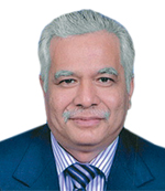
Dr Ahamad Zakaria graduated from University of Newcastle-Upon-Tyne, England in 1982. He went for further study in University of New South Wales, Sydney, Australia. From that University, he obtained Master of Science (M.Sc) in GIS/LIS. Now he is Director of Survey & Mapping, Department of Survey & Mapping Selangor Darul Ehsan. Before he was posted here 4 years ago, he was Director of Survey & Mapping, Department of Survey & Mapping, Pahang.
About Presentation Digital Cadastral Database (NDCB) In Selangor – The Way ForwardThis paper describes how NDCDB in Selangor state is created from various sources. These sources are of varying accuracy, hence the data in the database will have different accuracy but all are within the accepted tolerance. If those data are outside the accepted tolerance, they were rejected by the computer system. However, the database is seamless and is very important and form part of NDCB for the whole of Malaysia. In Selangor, since the sources are of varying accuracy, so in areas where the sources are of higher accuracy, the data is more accurate compared to other areas. At the present time, the Department of Survey & Mapping Selangor is undertaking various processes to make the database more accurate with a better tolerance. This can be done by putting in more controls during adjustments of the points in the database. This paper will try to describe how this can be done and the rigorous process that the adjustment has to go through before a point is accepted in the database. By putting in more control points, the boundary mark in the database will get better and better. On further adjustment, however, a point which is accurate enough at one instant, may become worst as further adjustment is made because sometimes the new control points in the adjustment is of less accuracy. However, this can be avoided by excluding points, those that are accurate enough, from going further adjustment. The process how this can be done will also be touched in this paper.
Malaysia
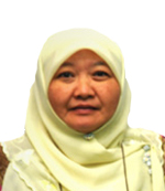
Sr. Khuzaimah Abdullah started her career as Valuation Officer with the Department of Valuation and Property Services (JPPH), Ministry of Finance in June 1982. She assumed the present position as Director of National Property Information Centre (NAPIC) in April 2013. Prior to this appointment, she was the Deputy Director (Research & Development) in National Institute of Valuation (INSPEN). Graduated with Bachelor of Survey (Property Management) from Universiti Teknologi Malaysia and obtained Master of Science (Property Asset Management) from Sheffield Hallam University, UK. She is a Registered Valuer with the Board of Valuers, Appraisers and Estate Agents Malaysia and a member of the Royal Institution of Surveyors Malaysia (RISM).
About Presentation Property Market Performance Indicators : Making Sense Of Napic’s DataThe existence of National Property Information Centre (NAPIC) is to collect, collate and disseminate real estate data to the industry palayers. Having established more than a decade, its presence has shed lights to the real estate industry. Every year, not less than 50 reports are produced covering data and information pertaining to real estate. Each report has its own distinctiveness and provides multiple indicators in guiding the decision makers in making informed decisions. Excessive information or data overload however, may caused confusion and misinterpretation. Thus, this presentation is to provide a brief insight of the various reports and their contents and how they could be benefitted by the readers and users.
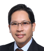
Alan Yong offers a unique combination of understanding government business processes and management in technological change strategies. In his current role, he is responsible for overseeing Asia Pacific markets promoting land management technology solutions, supporting customers and partner agencies, leveraging on Thomson Reuters extensive platforms to raise the importance of land management and information systems. Mr. Yong has spent close to ten years managing and working with various government agencies as well as donor funders to develop efforts in the Asia Pacific rim, assisting clients and prospects to develop various strategies within the vertical government agencies, creating the need on revenue growth, increased transparency and better processes. He is also fluent in various languages such as English, Mandarin, Bahasa Melayu, Bahasa Indonesia and fair in Russian.
Ministry of Lands and Mineral Resources
Fiji Islands
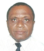
Samuela holds a Post Graduate Diploma in Governance and Masters Degree in Governance from University of the South Pacific and a Diploma in Geoinformatics from ITC, The Netherlands. Prior to his current role as the Director Land Use/Land Reform at Ministry of Lands and Mineral Resources in Fiji Islands, Samuela was the Assistant Director of Lands- Geospatial Information responsible for the overall management and development of of the Mapping and Land Information Division (now the Geospatial Information Division) of the Ministry. In his current role, Samuela coordinates and manages the Fiji Government initiative on Land Reform program.
About Presentation
GeoLand Asia - Geospatial Technology Supporting Land Administration
The Fiji Island Scenario
Fiji has a unique land system with 3 major tenure systems – land being traditionally owned by the indigenous (iTaukei Land), land owned by government (State Land) and land being held in fee simple (Freehold Land) by individuals, families or cooperative entities where titles to such lands are registered to them.
Bringing together land under these typical systems, labour and capital for sustainable growth of our economy requires planning, prioritization of policy interventions, consultations and the use of appropriate technology. Geospatial information provides the impetus for sustainable development by allowing for accessibility to required data, sharing of data and manipulation of such land data not only for socio economic purposes but also more importantly to allow for island nations like us sustain resources from threats of environment degradations and climate changes.
Khoo Hock Aun currently leads the Cosmo Biofuels Group since 2005 which has been actively engaged in establishing proprietary algae production systems, integrated rubber & jatropha curcas plantations, oil palm biodiesel/biomaterial downstream processing and trading activities in the Asia Pacific region; promoting use of oil palm biomass for second generation biofuel and biofertiliser, including biogas capture for electricity generation. He has developed projects in establishing plantations for biofuel feedstock and processing plants for deployment in South East Asia and since developed a worldwide network of expertise for biofuel technology, production, project execution and marketing through his role as Vice-Chair of the Roundtable on Sustainable Biomaterials. This network is essential for establishing state-of-the-art and cost-effective sustainable platforms for biofuel/biomaterial production integrated with upstream sectors and market demand. He is also Director of the GROW Centre (Green Renewable Organic World Centre Sdn Bhd) which focuses on sustainability innovation and development. He is also active in developing algae projects through Applied Licencing for Production and Harvesting Algae (ALPHA) and other agricultural projects including agroforestry plantations in South East Asia. He also provides consultancy and project development advisory in sustainable tourism, conducting green technology sustainability related projects and studies in the field of conservation and tourism. Mr Khoo Hock Aun graduated with a Bachelor of Science (Agribusiness) from Universiti Putra Malaysia and was a Nuffield Foundation Study Fellow in the area of financing biotechnology projects with the Science Policy Research Unit, University of Sussex, United Kingdom. He has managed a number of trade associations in both Malaysia and South East Asia for 20 years and began his carreer as a staff writer for Malaysian Business magazine.
About Presentation
Geo Smart Technology Applications in Sustainability Management
In Agriculture & the Environment
Sustainability is now an important aspect of agriculture and forestry management from the perspective of economic, environmental and social dimensions. Advances in spatial technologies has made available new affordable tools and capabilities for applications in agriculture, forestry conservation and land use planning.
These applications have considerable impact on the sustainability of agricultural systems especially when viewed in the expected expansion of land area affecting biodiversity and the environment. They serve as a useful tool for monitoring activities that have impact on climate change and green house gas emissions in particular.
Digital technology has evolved from the use of GPS (Global positioning systems) for operations like leveling, seeding, cultivating, planting, harvesting to irrigation of crops and coupled with Unmanned Aerial Vehicles, they serve as the new frontier for farmers and agribusiness managers to develop more efficient approaches to agriculture and forestry systems and enhance their sustainability even further.
Geographic information systems (GIS) and remote sensing (RS) technologies has enabled real time collection and analysis of spatial and non- spatial data which can be applied to enable remote management decisions over large areas and distances. This has relevance to the important need to establish traceability of agricultural and forest commodities in global supply chains.
Doan Minh Chung is a senior researcher (Assoc.Prof, PhD) and Director of the Space Technology Institute (STI) under Vietnam Academy of Science and Technology (VAST), Hanoi, Vietnam. He has graduated at the Physics faculty, Hanoi University of Technology in 1978, then work as engineer in Institute of Physics, VAST until 1990. From 1986-1987 he worked as specialist in the National Institute of Nuclear Physics in Debrecen, Hungary. From 1990-1997 he studied as doctoral on Microwave remote sensing technology in the Institute of Electronics, Bulgarian Academy of Sciences, Bulgaria. From 1997-2006 he work as senior researcher (PhD) at Institute of Physics, VAST. From 2006 until now he work at STI, VAST. From 6/2010-now he is Director of STI, VAST. He is member of the Vietnam National Program on Space Science and Technology from 2008-now, member of the Project Manager Unit (PMU) of the Vietnam Earth Observation Satellite Project from 2010-now, member of the Vietnam Space Committee (VSC) from 2009-now and the national focal point of Vietnam at APRSAF, UNESCAP.
Building Smart Cities with Smart CitizensIn developing Smart Cities, we must not allow technology to overcome the whole deployment. We cannot ignore the most important dimension of cities i.e. the people, who live, work and create within them. We must also take into account the voice of the citizens and let them become active in the process of city design. One of the ways to get citizens to participate in conversation with their government is through their most close-to-heart device i.e. smartphones. Crowdsensing has also become a new business model which allows this large number of smartphones to be used not only for exchanging information between their users, but also for activities that may have a huge societal impact. Crowdsensing applications are particularly attractive to cities authorities because they can provide the relevant parties with valuable data without the need to make significant investments. It has reignited citizen engagement with their government authorities, opening new perspectives for cost-effective ways of making local communities and cities more sustainable, livable and safe. With the ability to acquire local knowledge through sensor-enhanced mobile devices - e.g., location, personal and surrounding context, noise level, traffic conditions, noise pollution, it opens up to many possibilities to share this knowledge within the social sphere, practitioners, health care providers, urban planners and utility providers such as local councils. It's about time for us to empower the citizens to help build smarter cities.
About Presentation Building Smart Cities with Smart CitizensIn developing Smart Cities, we must not allow technology to overcome the whole deployment. We cannot ignore the most important dimension of cities i.e. the people, who live, work and create within them. We must also take into account the voice of the citizens and let them become active in the process of city design. One of the ways to get citizens to participate in conversation with their government is through their most close-to-heart device i.e. smartphones. Crowdsensing has also become a new business model which allows this large number of smartphones to be used not only for exchanging information between their users, but also for activities that may have a huge societal impact. Crowdsensing applications are particularly attractive to cities authorities because they can provide the relevant parties with valuable data without the need to make significant investments. It has reignited citizen engagement with their government authorities, opening new perspectives for cost-effective ways of making local communities and cities more sustainable, livable and safe. With the ability to acquire local knowledge through sensor-enhanced mobile devices - e.g., location, personal and surrounding context, noise level, traffic conditions, noise pollution, it opens up to many possibilities to share this knowledge within the social sphere, practitioners, health care providers, urban planners and utility providers such as local councils. It's about time for us to empower the citizens to help build smarter cities.

John Whitehead is the Director of Sales and Distribution, APAC, for Trimble's Geospatial Division. He works with Trimble's customers and distribution partners throughout the region delivering geospatial solutions utilizing surveying, mapping, and spatial imaging technologies. Prior to Trimble, John worked for the Lincoln Institute of Land Policy throughout Asia as a consultant in the field of land policy, public finance, and property rights. He holds a Master of International Business from the Fletcher School of Law & Diplomacy at Tufts University.
About Presentation Transforming the way you work: what's new from TrimbleAs Trimble continues to expand on core technology solutions, developing new market opportunities for our geospatial clients remains equally important. This presentation will cover a range of new technologies Trimble has recently released, as well as examine the areas where investment will continue….and why
Lieutenant Colonel Abdul Rahman Alavi (Rtd) was graduated from the Royal Military College, Kuala Lumpur, Malaysia in 1977 and commissioned into the Royal Rangers Regiment. As an Infantry soldier, he had several jungle/insurgency operation experience against the Communist Terrorist in several parts of Malaysian jungle including East Malaysia. He He was seconded to United Nations HQ in New York serving with Department of Peacekeeping Operations (DPKO) from 2009-2012. He retired from the Service on compulsory retirement in July 2014. Some of the significant courses abroad were Instructor Training Course in Fort McClellan, Alabama, USA and Infantry Officer Advance Course in Fort Benning, Georgia, USA in 1987. He was also a trainer and had served as instructor in Territorial Army Training Centre from 1981-1983, instructor and Adjutant in Young Officers’ Combat School from 1985-1988 and as Cadet Company Commander and Head of Military Studies Department in Royal Military College from 1992-1994. On peacekeeping experience, he had served in UN mission in Mozambique (ONUMOZ) from 1994-95 as the Chief Operation Officer of Central Region. He was also made as the Chief of Staff cum Operation Officer with International Monitoring Team (IMT), Mindanao, Philippines in 2004-05, and this is an on-going regional arrangement of ceasefire monitoring and peace initiative (under Chapter VII of UN Charter) facilitated by Malaysia between the Moro Islamic Liberation Front (MILF) and Government of the Republic of the Philippines. Lieutenant Colonel Abdul Rahman was to Military Planning Service, Office of Military Affairs, Department of Peacekeeping Operations, UNHQ, New York from 2009-2012. He was first assigned as the desk officer for MINUSTAH (UN Stabilisation Mission in Haiti) and deployed to Haiti during the January 2010 devastating earthquake in Haiti to assist the Military Component in revising and drafting of military strategic CONOPS aftermath of the earthquake with new priorities, restructure Component’s OPORD and advising on military matters to the Force Commander. He was also the desk officer for UNIFIL (Lebanon), UNMIL (Liberia), UNOCI (Cote d’Ivoire), Somalia and Libya. He was appointed as the Team Leader for UN missions in Europe, Latin America and Somalia (ELAS) before returning home in September 2012. Lt Col Abdul Rahman is a graduate of Malaysian Armed Forces Staff College in 1991 and Defence College in 2002 and holds a master degree in Strategic and Defence Studies from Malaysia National University (UKM). He is enrupted with reading and writing and had since then written several articles and the most significant was the article on The Changing Focus of Security: From National Security to Human Security, which won the second prize in the 2004 Army Essay Writing Competition and the essay was then published in the Malaysian Army Journal June 2005 issue and won the best article. He also won the first prize in 2013 Army Essay Writing Competition titled Army Training: Is the Current Concept Still Relevant? He is now a contracted lecurer in National Defence University of Malaysia since September 2015.
About Presentation Relevance Of Geospatial Intelligence For Coastal SecurityGeospatial Intelligence is defined as intelligence discipline which includes imagery and mapping data collected by satellite, aircraft or UAV. Maps, databases, census information, GPS waypoints, utility schematics, or any discrete data that have locations on earth are also categorized as geospatial intelligence. The requirement for geospatial intelligence for coastal security in Eastern Sabah Security Command (ESSCOM) area is much higher in need than any other maritime security area in the Malaysian waters. ESSCOM is a special security area over east coast of Sabah which covers 1,734 km waters. ESSCOM was established after the late Feb 2013 bloody incident in Kg Tanduo, FELDA Sahabat, Tawau. Four main security agencies made of the MAF, RMP, the Immigration Department and MMEA were mobilized to operate as an integrated element under ESSCOM to safeguard and protect 1.4 million people living along the coastline. However, academic observation assumes that respective Service interest and sentiment take precedence of the common value and the weakness in security control and defence of East Sabah become the core problem due to refusal to share information and intelligence among the agencies. Currently ESSCOM is depending on Coastal Surveillance System (CSS) radar as its source of geospatial intelligence source, which is not compatible with the naval assets deployed in the operation. Spanish ‘SIVE’ radar system – “Integrated System for External Vigilance” could be a better option for ESSCOM. SIVE is merely a detection mechanism but it integrated with Spain’s ‘Guardia Civil’ for rapid reaction.
Datuk Sr Dr. Abdul Kadir started his career with Department Survey and Mapping Malaysia (JUPEM) on 1st April 1978 and retired on 10th. April 2014. He has served JUPEM for more than 36 years in various sections and divisions including the State of Johor. He also served as the Deputy Director General of Survey and Mapping (2004 – 2009) before becoming Director General of Survey and Mapping (2009 – 2014). Accordingly, he also became the Deputy Chairman and later as Chairman of the Land Surveyor Board Malaysia. Other positions held was the Director of Military Mapping Malaysia with a rank of Honorary Colonel and as well as an Advisor to the Military Mapping Council (2009 – 2014). Joint Chairman of Technical Committee for International Boundary Survey between Malaysia and Neighboring Countries (Indonesia, Thailand, Singapore and Brunei) (2009 – 2014). He has been very active in the development of surveying education and profession at national and international levels from 2004 until April 2014. He served as an Adjunct Professor with University of Technology Malaysia (2006 – 2014) and University of Technology Mara (2010 – 2012). Other positions held including Chairman National Mapping and Spatial Data Committee, Chairman National Committee on Technical Standard (TC2) Geomatics and Geographical Information, Chairman National Committee on Geographical Names, Chairman United Nation Group of Experts on Geographical Names (UNGEGN) for Asia South East and Pacific South West Division, President the Royal Institution of Surveyors Malaysia and Chairman Steering Committee for International Symposium on Geo-information and Exhibition (ISG). For his many contributions to the surveying profession and the country, he was conferred the title Dato’ (Dato’ Setia Diraja Kedah) by Sultan of Kedah (2007) and Datuk (Panglima Jasa Negara) by His Majesty, The King of Malaysia (2011). He was also awarded the Malaysian Surveyor of the Year Award by the Royal Institution of Surveyors Malaysia (2011). Currently, he is a Professional Licensed Land Surveyor registered with the Land Surveyors Board Malaysia and Sabah Surveyors Board. He is currently practising under Platinum Survey Consultant since 10th. April 2014 as Chief Executive Officer.. Datuk Sr Dr. Abdul Kadir holds a PhD in Geomatic Engineering from University of New South Wales, Australia (1994), a Master of Science in Photogrammetry from ITC, The Netherlands (1985) and a Bachelor of Surveying (Land) from University of Technology Malaysia (1978).
Rodney Chaffee is responsible for the sales of all FARO products throughout the Asia Pacific Region, including FARO’s direct and indirect sales channels. Mr. Chaffee has 20 years of experience selling technical products and leading sales teams in a business-to-business sales environment. He has enjoyed increasingly challenging roles at FARO Technologies over the past 15 years. These experiences include directly selling FARO products to customers in the US, leading regional sales teams in the US and China, and leading FARO’s China sales. Prior to joining FARO, Mr. Chaffee was a Sales Engineer and District Manager for Therm-O-Disc, Inc., a division of Emerson Electric.
About PresentationThe advancement of 3D Terrestrial Laser Scanning technology, data storage and integrated software architecture has expanded the usage of GIS technology to more applications which empowers enterprises, governments, and users. This presentation will share an example on how government leveraged GIS solutions to its strategic land transport planning, resulting in better outcome and improved overall efficiency and accuracy. The adoption of GIS technology has further empowered users to make better decisions with more accurate data. In addition, the presentation will also cover some of the challenges faced by Enterprises and Government and how GIS technology can help to overcome those challenges in various common applications such as historical sites preservation, infrastructure building and monitoring, and Building Information Modelling.

John Whitehead is the Director of Sales and Distribution, APAC, for Trimble's Geospatial Division. He works with Trimble's customers and distribution partners throughout the region delivering geospatial solutions utilizing surveying, mapping, and spatial imaging technologies. Prior to Trimble, John worked for the Lincoln Institute of Land Policy throughout Asia as a consultant in the field of land policy, public finance, and property rights. He holds a Master of International Business from the Fletcher School of Law & Diplomacy at Tufts University.
About PresentationThe haze engulfing Indonesia, Singapore and Malaysia over the past month is a reminder of the immediate need to introduce better technology into the agriculture space in this region, especially in the management of plantations. This session will focus on new geospatial solutions Trimble has developed that will focus on the oil palm industry and other plantation-based agriculture.

Scot Craig is a Regional Sales Manager at Trimble's Agriculture Division covering Japan and South the East Asian Region. He is based out of Perth Australia, his role is focused on sales operation and in developing and growing Trimble Agricultures’ distribution channel. Prior his current role he was a Field Application Engineer. Mr. Craig has been with Trimble since 2011; before joining Trimble he was with CNH OEM and was responsible for the sales support and product marketing.
Jeyanny Vijayanathan is currently attached to Forest Research Institute Malaysia under the Soil Management Branch since year 2005. She has completed her M.Sc in Soil Fertility & Management (2007) and PhD in Soil Science (2015), both awarded from Universiti Putra Malaysia. Her research interest and specialization for the past 12 years includes Soil fertility, survey and plant nutrient management; Carbon stocks and fluxes in the natural and plantation ecosystems; Environmental soil science, Crop science & Precision agriculture (geospatial statistics). She has co-authored up to 6 books, 14 academic journals, and more than 35 proceeding papers. She is active commiittee member of the Malaysian Society of Soil Science.

Weihan, Ooi was received the bachelor degree in Geomatics Engineering at University Technology of Malaysia in 2004 and Master degree in GIS and Geomatics Engineering at University Putra Malaysia in 2006. In the same year, he joined National Space Agency of Malaysia (ANGKASA), an agency under the Malaysian Ministry of Science, Technology and Innovation, works as a Research Officer until now. He works under space application and technology development division with specific responsibilities on R&D programs and activities related to spatial satellite technology and application.
About Presentation Should gnss become a national critical infrastructure?Global Navigation Satellite System (GNSS) are nowadays become an essential component and widely applied in many civilian sectors and military. The GNSS application and product are capable to provide worldwide and near real-time services through its precise positioning and timing information technologies. In Malaysia, there are already several initiatives and GNSS ground infrastructures established for various applications. However, the technology could possibility be interrupted in the operation causing signal failure, interference or jamming. This paper mainly discussed the GNSS vulnerability issues as well as the overall impact of the GNSS to the economy and society. The National Space Agency (ANGKASA) is looking into the possibility of making GNSS as a Critical National Infrastructure in the country.
Dr Hoang Ngoc Lam, Deputy Director General Department of Survey and Mapping, Ministry of Natural Resources & Environment Vietnam Graduated with a Master of sciences in applied geodesy from Moscow State University of Geodesy and Cartography in 1995 and also took a Doctor of Philosophy in Technical Sciences there, Dr Lam was Director of Northern Center of Remote Sensing Technology Application, National Remote Sensing Center, Ministry of Natural Resources and Environment. He then has been appointed to Deputy Director General, Department of Survey and Mapping, Ministry of Natural Resources & Environment since 2011. He is currently responsible for Science and International Relations in Department of Survey and Mapping. His past projects include "Establishing geo-database of basic hydro - topographic information system for regional flood control and socio - economic development in Mekong delta" (2005- 2009). This is a government high priority project applying advanced technologies in surveying, mapping, hydrological information system, GIS and data management.
Masanobu Tsuji is the director of Bangkok office, Japan Aerospace Exploration Agency (JAXA). He is also the executive secretary of Asia-Pacific Region Space Agency Forum (APRSAF) and spending busy days to prepare the 22nd session of APRSAF, which will be held on December 1-4, 2015 at Bali, Indonesia. He joined to NASDA, former organization of JAXA in 1985 after getting a master degree in electronics and computer science. Since then, he has worked for satellite and ground system development, earth observation research and capacity building for young engineers in Asia. His recent interest is to implement space technology for societal needs of emerging countries.
About Presentation JAXA has organized the Asia-Pacific Space Agency Forum (APRSAF) with Ministry of Education, Culture, Sports, Science & Technology in Japan (MEXT) and local host organizations in Asia-Pacific since 1993, One of the initiatives born in APRSAF is “Sentinel Asia”. It aims to monitor disasters using Earth observation satellite data.. This is voluntary based activity and 98 organizations, such as space agency, disaster management organization, meteorological department and universities in 25 countries and region are joining. This year, Sentinel Asia has provided satellite radar (SAR) images for great earthquake in Nepal, flood in Myanmar and so on. Especially, satellite images are useful for the area where there are not enough maps. As the first step, Sentinel Asia has started 10 years ago to provide satellite images to suffered area of disaster. As the second step, It has enhanced function to transfer images more quickly by using communication satellite. As the third step, it expanded the scope not only for monitoring but also mitigation and relief from disasters Sentinel Asia will be an integrated system which includes satellite Earth observation, satellite communication, GNSS, CORS and ground observation network in future.

Kaushik Chakraborty has more than 25 years of experience in international sales management and business development across the Asia Pacific and EMEA regions. Prior to joining Bentley, he was vice president of the Hexagon Group and served in leadership roles at Intergraph and Leica Geosystems. Chakraborty has lived and worked in Singapore, Germany, the United States, and the United Kingdom and now works out of Bentley’s Singapore office. He holds a master’s degree in engineering and has earned certificates in management and leadership.
Bui, Quang Thanh is a GIS lecturer who is in Center for Applied Research in Remote sensing and GIS, Faculty of Geography, VNU University of Science. Bui has an extensive background in GIS applications in natural resources management, urban studies, land administration and spatial statistics. Bui’s responsibilities include training staff in GIS applications, keeping abreast of latest software and hardware developments, research and evaluate IT products and to develop procedures to use new technologies for data collection and analysis. He is an active member of steering committee of Viet Nam Association of Geodesy, Cartography and Remote Sensing.
Kuok-Choy Lam is a Senior Lecturer of Geography at the Universiti Kebangsaan Malaysia (UKM), where he teaches undergraduate courses on Remote Sensing and GIS, Tropical Geomorphology and postgraduate level courses on Research Methodology. In addition he serves as Research Fellow at the Earth Observation Centre of the Institute of Climate Change, UKM. Dr. Lam also oversees management and research activities of the Geospatial Unit at the School of Social, Development and Environmental Studies, of the Faculty of Social Sciences and Humanities, UKM. He holds a PhD. in Geography from University of Sheffield, UK (2013), and MPhil and M.A. degree in Geography from the Universiti Kebangsaan Malaysia. His main areas of interest include the vegetation phenology study, land use and land cover change study, and impact of climate change and adaptation
A registered Civil Engineer and has a Masters Degree in Engineering Management with specialization in Systems Management. He is currently the Chief of the Information Services Division, Philippine Department of Energy (DOE). He has more than 20 years of experience in digital mapping and geographic information system (GIS) design and implementation and as well as its application for energy exploration, development, utilization and distribution.
About Presentation
Energy Contract Area/ Site Validation and Mapping Using Geospatial Technologies
The Philippine Department of Energy (PDOE) had previously conducted international roadshows and series of Philippine Energy Contracting Rounds (PECRs) for petroleum and coal resources. In addition, PDOE also conducted the Open and Competitive Selection Process (OCSP) in awarding renewable energy contracts. As a result, the DOE had received several hundreds of energy contract applications. It was a positive indicator that investors are coming in. However, considering the scarce manpower of DOE, timely processing and approving of the energy developer’s/ contractor’s applications became a big challenge. Since several hundred applications were received by the Department, it became a big challenge to the Information Services Division (ISD) of the PDOE that is mandated to verify the proposed areas of energy developers. Using conventional way of area/ site validation and mapping shall take at least a week to accomplish. However, ISD Geodetic Engineers used the GIS technology and performed geospatial overlays of the digital Philippine topographic map, existing energy contract areas and the National Integrated Protected Area System (NIPAS) data layers. It was found out that some energy contract application areas overlapped the environmentally protected areas while others fall within existing energy contract areas which could not coexist in terms of energy exploration and development.
The use of GIS as a tool for checking the energy contract area applied by the energy Developers/ Contractors was very useful in the processing and approval of energy contract applications without necessarily conducting actual fieldworks. As a result, two proposed energy sites have been validated and reported each day to the concerned DOE Bureaus/ Offices. Hence, we realized that the use of geospatial technologies such as GIS and GPS equipment are very much beneficial for energy exploration and development towards a sustainable, secure and affordable electricity supply in the country.
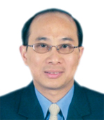
Dr. Ong is a Professor and Deputy Dean of Research and Postgraduate Studies at College of Engineering, Universiti Tenaga Nasional (National Energy University), Kajang. He is the Uniten’s project leader for TNBR-UNITEN Smart Grid Test-Bed initiative and also heading the Center for Smart grid Technology in Uniten. He received his Bachelor of Science degree in Electrical Engineering and Master of Science degree in Physics from University of North Dakota, USA, in 1986 and 1989, respectively. Later, he was educated and trained in University of Minnesota where he received his Ph. D in Biomedical Engineering and Medical Physics. Currently, he is actively working on ICT in power utility especially in the area of smart grid. His previous job experience includes title like scientific and database programmer, network administrator and designer, biomedical engineer, and instrumental specialist. His research interests include Utility communication, Smart Grid informatics and Analytics system, and data network design.
About Presentation
GIS in Smart Grid
In essence, power utility is a business of coordinates and manage energy flow network from sources to consumers in a distributed and diverged geographical areas. Smart grid is all about adding a digital layer of computing and communication on top of this energy network with back-end support of data warehouse and analytics. Every physical component in an energy network can be assigned a two-point coordinate in a map and hence Geographic Information System (GIS) fitted naturally as a tool for planning, operation and project implementation of power utility. GIS is generally considered as a visual analytics tool that provides additional dimension of images for exploring hidden possibilities. In terms of operation, asset and outage management has long been associated with GIS. Multiple layers profile maps capabilities of GIS has pushed certain task such as planning beyond the traditional capacity enhancement. Previously unrelated parameters such as Volt/VAR and kWh are now used to plan the implementation of demand response scheme. GIS is also a natural crossing point for data integration. However, to battle the uphill challenges of GIS implementation, data availability, data integrity and consistency of data model need to be sorted out beforehand. Furthermore, popular acceptance requires intuitive GUI that is tailored to respective end-user training and mode of operation. In short, GIS is a knowledge generation tool yet to be fully explored in power utility.
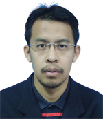
Mohd Azahar Ab Aziz started working with Tenaga Nasional Berhad since April 2005. His current post in TNB is Manager in Utilities Solution Unit, ICT Division. He has been involved with GIS project in TNB since 2005. Start with Distribution Network Management (DNIM) Project from 2005 to 2008 as System Analyst. After that he was assigned to Corporate Geospatial Information System (CGIS) from 2009 – 2014. During this project he was involved with System Infra and Architecture Design and also Map Solution. Currently he is project Manager for TNB SmartView project and Distribution Operation Management Project (DOMS). DOMS project was part of Outage Management Solution in TNB and this project used by TNB Regional Control Centre (RCC) along with SCADA system.
About PresentationTenaga Nasional Berhad (TNB) is the largest electricity utility in Malaysia and a leading utility company in Asia. Listed on the Main Board of Bursa Malaysia with almost RM87 billion in assets, and serving an estimated 8.3 million customers in Peninsular Malaysia, Sabah and Labuan. In 2005, TNB is embarking on a 20-Year Strategic Plan with the ultimate objective of transforming into a world-class player by the year 2025 to transform the utility company into a more focused, efficient and capable organization, able to deliver more value to its customers and shareholders. TNB is adopting new and better ways to do the electricity business and one of the TNB shared value is customer focus. As part of its drive to deliver high quality products and services at par with premier international corporate bodies and provide best possible services to customers, one of TNB’s initiatives is developing a TNB Smartview. This GIS web based application is design to visualize TNB assets location and information as well as address searching map location on a web and mobile platform using Google Maps solution. TNB Smartview application is also able to display real time tripping and breakdown information on the map through integration with SCADA and MFFA system. For this first stage of development, TNB SmartView is purposely develop for TNB CareLine users as they will be able easily to locate the outage or TNB fault finder crews and can directly inform to the customers through phone called.

Josh manages enterprise sales and partnerships at Planet Labs. Planet designs, builds and operates the world’s largest constellation of Earth-imaging satellites. In this capacity Josh has led the company's foundational commercial deals and its market entry strategy. Josh has over a decade of sales and business development experience across technology and clean energy sectors. He was previously the VP of Sales at SCIenergy and the Director of Environmental Markets at World Energy. Josh holds an MA in International Economics from Johns Hopkins University School of Advanced International Studies (SAIS) and a BA from Washington University in
About PresentationWhat if monitoring daily change on our planet was as simple and instant as logging into a website? Planet Labs uses an agile, software-like model to design, build, and launch small earth-imaging satellites into space - essentially, Planet Labs has strapped aerospace to Moore’s Law. They have launched 87 satellites to date -- the largest fleet of Earth-imaging satellites in history. The result is a radical new dataset that reflects daily change at global scale. Josh Alban of Planet Labs, will detail advancing technology that is reshaping our view of Earth, and discuss Planet Labs’ self-service data platform that enables people to
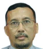
Associate Professor Dr Wan has more than 25 years experience as a lecture in Surveying Science and Geomatics. He has served as a lecturer at Universiti Teknologi MARA (UiTM) since 1988. From 2007-2010 he was the Dean of the Faculty of Architecture, Planning and Surveying, UiTM Shah Alam. His research interest is in the field of Geographical Information Science, UAV Photogrammetry and Remote Sensing. His current research projects are i) DEMs Height Accuracy Assessments for Flood Inundation Mapping, ii) Development of Flood Vulnerability Index, iii) Landslide Hazard Zonation Mapping using GIS-based Multicriteria Decision Mapping and iv) The Effects of Built and Natural Environments on the Urban Microclimate.
About Presentation
Disaster Management using Airborne LiDAR Technologies
Light Detection and Ranging (LiDAR) technology can be considered as one of the most important three dimensional (3D) geospatial data collection techniques. Today, professionals from various industries require 3D detailed, up-to-date and accurate information for 3D visualization, modeling and analysis. BUMITOUCH PLMC Sdn. Bhd. is registered Malaysia based private limited company specializing in airborne mapping using LiDAR technology for various applications such as topographic mapping, agriculture, infrastructure management, utility, geology and soil science, mining and disaster management. This paper highlights some of the Airborne LiDAR mapping projects carried out and applications developed by the company especially related to disaster management (flood modeling and landslide hazard risk mapping).

Dr. Ariel C. Blanco earned his doctoral degree in Environmental Informatics from the Tokyo Institute of Technology and his Master’s degree in Geographic Information Systems from the University of Melbourne. He finished his BS Geodetic Engineering at the University of the Philippines Diliman. Currently, he is an Associate Professor at the UP Diliman College of Engineering. He also serves as the Chairman of the Department of Geodetic Engineering and Director of the UP Training Center for Applied Geodesy and Photogrammetry. He is also the Program Leader of Phil-LiDAR 2 Program which aims to produce detailed resource maps using Light Detection and Ranging (LiDAR) for various applications such as production of high value crops, irrigation assessment, aquaculture production, forest protection, and discovery of renewable energy resources. He is also the Project Leader of the Resilience and Preparedness for Inclusive Development (RAPID) Program - Natural Resource Assessment Project, funded by UNDP through the Climate Change Commission of the Philippines. His recent researches include salinity intrusion, urban water quality, geospatial analysis of poverty incidence, agricultural land use mapping, mangrove and seagrass mapping, damage potential mapping and development of decision support systems for coastal environment.
About Presentation
Geospatial Technologies in Natural Resource Assessment, Environment and Climate Change Related Studies
This paper discusses the roles of geospatial science and technologies for environmental applications. Three programs/projects exemplify these roles in various settings and scales. One of these programs/projects is the recently concluded Coastal Ecosystem Conservation and Adaptive Management (CECAM) Project under the JICA SATREPS Program. The CECAM Project mapped land and benthic covers as well as the historical changes in extent and the factors affecting such spatio-temporal distribution. Integrated Decision Support Systems (IDSS) were developed to address specific issues in the project areas. These include erosion and sedimentation, declines in coral and seagrass cover, fish kills, and beach erosion. The IDSS, which evaluates scenarios for supporting decision-making, integrates geospatial technologies such as Remote Sensing and GIS with hydrologic, hydrodynamic, and water quality models.
The Philippines embarked on a nationwide detailed mapping using LiDAR through the Disaster Risk and Exposure Assessment for Mitigation (DREAM) Program. This Program generates high-accuracy digital surface model, digital elevation models, and calibrated and validated flood models for river basins in the Philippines. These models are used for early warning systems. With the availability of LiDAR data and orthoimages, natural resource inventory is being undertaken by 15 universities to map forest, agriculture, coastal, water, and renewable energy resources under the Phil-LiDAR 2 Program. This is Program is also assessing the vulnerability of agriculture (various crops) and coastal marine resources (e.g., corals, mangroves, and seagrass).
A more detailed assessment is being conducted in coastal towns in Leyte and Samar provinces under the UNDP-Climate Change Commission’s RAPID Program. This UP-CCC Natural Resource Assessment Project provides current and historical assessments of forest, agricultural, inland water, coastal and marine resources. NRA is seen as critical for a more effective Climate Change Adaptation (CCA) and Climate Change Vulnerability Assessments (CCVA) and Disaster Risk Reduction and Management (DRRM). Geospatial technologies (including satellite RS and UAV mapping) and intensive field surveys are combined to achieve detailed assessments. The Project also includes an environmental valuation and municipal accounts components. This ties the biophysical changes with socio-economic systems, activities, and impact.

Landslide Hazard Analysis at Jelapang and Gua Tempurung of North-South Expressway in Malaysia using High-Resolution Airborne LiDAR Data
PLUS Berhad holds the concession for a total of 987 km of toll expressways in Malaysia, the longest of which is the North-South Expressway or NSE. Acting as the 'backbone' of the west coast of the peninsula, the NSE stretches from the Malaysian-Thai border in the north to the border with neighbouring Singapore in the south, linking several major cities and towns along the way. North-South Expressway in Malaysia contributes to the country economic development through trade, social and tourism sector. Presently, the highway is good in terms of its condition however some locations need more attention. Stability of slopes at these locations is of most concern as any instability can cause danger to the motorist. Mapping landslide-prone regions are crucial in natural hazard management and urban development activities in hilly and tropical regions. This research aimed to delineate a spatial prediction of landslide hazard areas along the Jelapang and Gua tempurung Corridor of the North-South Expressway in Malaysia by using two statistical models, namely, logistic regression (LR) and evidential belief function (EBF). Landslides result in high economic and social loses in Malaysia, particularly to highway concessionaries such as PLUS Berhad. LR and EBF determine the correlation between conditioning factors and landslide occurrence. EBF can also be applied in bivariate statistical analysis. Thus, EBF can be used to assess the effect of each class of conditioning factors on landslide occurrence. A landslide inventory data were recorded using field measurements for Jelapang and Gua Tempurung corridor. Subsequently, the landslide inventory were randomly divided into two data sets. Findings reveal that LR technique can be utilized in landslide hazard studies for land use management and planning.

Benoit Frédéricque joined Bentley Systems in January 2008. He is Senior Product Manager and responsible for Bentley’s Geospatial and Reality Modeling product lines. Benoit Frédéricque got his Ph.D. in Geomatic Sciences from the Laval University, Québec and his Master degree at Ecole Nationale des Sciences Géographique (IGN's school of Geomatics), France
About Presentation
3D Cadastre: Bentley Systems' perspective on today's motivations and opportunities
Cadastre mission, registering legal status and property rights associated to land, has been essential to the development of our society. Cadastre systems continue to evolve and we are at a new significant paradigm: 3D cadastre.
During the last decade the trend towards 3D cadastre has materialized as explained by Van Oosterom et Al. in their analysis of the Second FIG 3D cadastre Questionnaire: "there has been significant progress during the last 4 years: more and more countries have legal provision for the registration of 3D parcels, jurisdictions such as Australia/Queensland, Australia/Victoria, China, Germany, Malaysia, Sweden, Trinidad and Tobago have 3D information on their cadastral/ survey plans ... ".
This on-going trend is the result of several factors. First, population growth happens in cities, leading to an increase in complexity of our land usage that needs to be reflected in the way we document this usage. 2D representations are simply not adapted to a complex context where above and below ground infrastructure and ownership have to co-exist. Secondly, BIM technology has matured and promoted as part of its methodology to design and support infrastructure delivery processes in 3D. This also means that land management aspects must be considered in 3D. Thirdly, land management technology and GIS technology are now mature enough to support fully 3D cadastre as well as hybrid modes combining 2D and 3D.
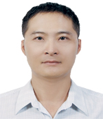
Tsai,Wen-Yu is specialist in Survey Information section of NLSC in Taiwan. He graduated from the Surveying Engineering Department of National Cheng Kung University. Among 20 years of service in the NLSC, he has been engaged in 15 years in field measurement for Cadastral Resurving, He is also involved in control point maintenance, and dedicated to Information Security and maps management over the last 2 years.
About Presentation
The Current Development and Future Perspectives of Mapping and Circulation National Land Map Data in Taiwan
The National Land Surveying and Mapping Center (NLSC), Ministry of the Interior (MOI) is responsible for surveying and mapping affairs including the execution and maintenance of nationwide surveying and mapping jobs and its results as well as the planning, production, management and circulation of national land surveying and mapping database. In order to fulfill our duties, the NLSC has been produced and updated the cadastral map, land section data, basic topographic map, base chart of marine area, littoral zone topographic map, digital terrain model (DTM), land use investigation data, common version electronic maps and country village boundary map, which are deemed as core or basic data in the ten-year development project of Nation geographic information system (NGIS), periodically. Furthermore, to facilitate the public, the NLSC has set up survey information supply mechanism according to Land Surveying and Mapping Act, built up online land surveying and mapping data circulation web system and continuously applied latest surveying, mapping, information and communication technology (ICT) to introduce multiple update and supply mechanism so as to optimize the map service efficiency. The above national core or basic data’s establishment and circulation status and future perspective of will be presented in this paper.

Jason has worked in the GIS industry for over 20 years in a wide range of roles with AUSLIG, BAE Systems, Amcor and more recently with Thiess as Corporate GIS Manager, Leighton as Manager – GIS & Survey Solutions and now as the Director of Spatiali. Jason holds a Bachelor of Applied Science (Land Information) and a Master of Science in the area of Remote Sensing. Spatiali have been developing GeoSpatial applications for large infrastructure projects. This technology is used extensively in the construction, mining, services, transport and environment sectors primarily for the management and communication of GeoSpatial data.
About Presentation Geospatial Engineering - Appetite for ConstructionLarge Engineering companies have realized that virtually every aspect of their work is related to geography. They are developing Geospatial Systems that support their core activities in the Building, Civil, Mining, Process, Environmental services, Utilities services, and Facilities Operations and Maintenance sectors. This paper will discuss the Geospatial implementation rationale, deployment and development issues, and the benefits that a Geospatial System bring to a company. In addition, we will present and discuss the benefits to business processes that may occur as a result of deploying and investing in such Geospatial Systems. Spatiali provides Geospatial Systems to Australia’s most recognised and successful infrastructure companies.

Dr Zaffar Sadiq Mohamed-Ghouse is Manager-Business, Research & International Relations for Australia New Zealand, Cooperative Research Centre for Spatial Information (CRCSI) and Board Director for the Surveying Spatial Sciences Institute, Australia’s peak professional body in spatial. Zaffar has 17 years of experience in consulting studies, design, development and management of spatial databases, review data framework policies, and technology including GIS applications development. Zaffar holds a pivotal role as an advisor to various National and International spatial organisations. Zaffar has published 40 research papers. He represents Australia on the ISO Technical Committee. He is a member of several boards and technical committees at National and International level. Zaffar is a recipient of the “Young Professional Award” by the Surveying Spatial Sciences Institute, Australia. He holds an Honorary Senior Fellow appointment at the Department of Infrastructure Engineering, The University of Melbourne, Australia; University Associate, appointment at the Curtin University, Western Australia; and Visiting Expert 3D research lab at University of Technology Malaysia. He has been appointed to the council of the International Society of Digital Earth (ISDE).
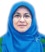
Geospatial technology is being widely used in various fields and disciplines. The rapid and dynamic development of technology has generated humongous applications of the geospatial technologies in almost all fields. This paper attempts to share Jabatan Penilaian dan Perkhidmatan Harta (JPPH) experiences in embarking on geospatial technologies in realising the organizations’ objectives by transforming work processes which combines or marry, valuation attributes and geospatial data, within one environment. The project enilaian, developed inhouse and a joint venture project between JPPH, Ministry of Finance (MOF) and Agensi Remote Sensing Malaysia, Ministry of Science and Technology (MOSTI) is anticipated to transform the present work processes of JPPH to one that uses Geographical Information System (GIS), valuation works parameters and satellite images. This system would subsequently give an increased positive impact on the reliability of the services given as it would be able to save time, save costs, increase monitoring efficiency as well as strengthen integrity.
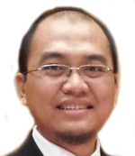
Fatwa Ramdani is currently the Director of Geoinformatics Research Center at Faculty of Computer Science, University of Brawijaya (UB). He obtained his bachelor degree from Department of Geography, University of Indonesia on 2007. He received his master (2011) and doctoral degree (2014) from Earth Science Department, Graduate School of Science, Tohoku University, Japan. His expertise is in geoinformatics science which combines geography, environmental science, and informatics to solve complex problems that is faced by the society today. His research focused on spatial phenomenon that observes changes in the human-physical environment (e.g. geospatial data acquisition and geospatial data fusion for development of environmental assessment databases, geocomputation and geovisualization for geospatial data analysis). His work addresses fundamental challenges in physical, environmental and social problems through information infrastructure technology. Currently, his research is focus on development and application of unmanned aerial system (UAS) for environmental monitoring.
About Presentation
Modified Vegetation Indices derived from UAS for Replanting Management within Coal Mine Site
Unmanned Aircraft System (UAS)-based aerial photogrammetry offers great possibilities to acquire in a efficient and low-cost way field data for precision of replanting management in coal mine site applications. This field of study is rapidly expanding because of the advantages and favorable circumstances for plantation assets management, especially for concentrating on yield health. This study used compact camera of digital color-infrared photographs to acquired near-infrared (NIR), green and blue images (NGB). The resolution is 16-megapixel, with a red-light-blocking filter in front of the lens. We tested the UAV-camera system over adult oil palm trees plantation and replanting location within coal mine site. The NGB images then processed with a photogrammetric software to produce orthomosaic image that already have georeferenced. Those orthoimages were employed to extract some Vegetation Indices (VI) such as the Normalized Difference Vegetation Index (NDVI), the Green Normalized Difference Vegetation Index (GNDVI), and the modified GNDVI. The study demonstrates the great potential of high-resolution UAS data and photogrammetric techniques applied in the mining site to collect multispectral images and evaluate different VI, suggesting that the modified GNDVI-based on data derived from UAS, represent a a quick, solid, and financially savvy asset in product appraisal for exactness cultivating for replanting management of coal mine site applications.
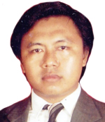
Geographers Role In Lifting Underground River Water To Overcome Drought In The Karst Region
Drought becomes a major problem faced by most of the people who live in karst areas, especially at the upper area, not to mention the Pucung village, Eromoko, Wonogiri, Central Java. Pucung village inhabited by 4,139 people which half of them experiencing severe water shortages in the dry season. In fact, their average income is only Rp 600,000 per month in which nearly half of that income spent to buy water.
This paper describes the role of geographer in lifting the underground river water to overcome the drought in Pucung village. The role consist four phases of activities, namely: (1) exploration and research that includes cave mouth detection using infrared aerial photographs scale of 1: 10,000, speleological surveys, and 3 sustainable research; (2) Pre-lifting activities that include socialization of the existence of an underground river, vertical job training and raising donor to the cost of lifting of water; (3) Water lifting activities that include underground river damming, electrical installation, plumbing, pump and reservoir manufacture; and (4) Post-lifting activity that includes the establishment of water distribution management organization, organizational training, improvement of reservoirs and water pipelines down to houses.
The method used in this activity is survey research method and cave exploration. It is also used method of aerial photo interpretation and analysis of secondary data.
The water lifting was successfully carried out on the result of the synergy between student nature lovers activities, research program, and community service performed by the Faculty of Geography UMS. Since the year 2012 this effort was successful to provide clean water to overcome the drought, and economically provide residents expenditure savings to buy water with very significantly by 1,300 percent (from IDR 50,000/m3 to IDR 3,500/m3). Besides being able to solve the problem of drought in the dry season, this activity also simultaneously trigger productive activities such as farm and fisheries.
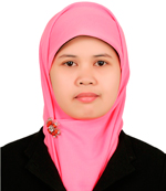
Dwi Wahyuni Nurwihastuti holds a Bachelor’s degree in Physical Geography, M.Sc. in Remote Sensing, PhD in Geography Science from Faculty of Geography, Gadjah Mada University. She is lecturer at Geography Department, Faculty of Social Science, State University of Medan from 2003. Her research areas include geomorphology, disaster management, natural resources management, application of remote Sensing and GIS.
About Presentation
Landslide Hazard Zonation using Geographic Information System (GIS) in Karo Highland, North Sumatra Province, Indonesia
The research is conducted in Karo District, North Sumatra Province, Indonesia. Landslides often occur in the research area. The research objective is to analyze landslide hazard zonation using Geographic Information System (GIS). The zonation of landslide hazard was analyze based on the factors causing landslide. The techniques of Geographic Information System (GIS) were applied on the analysis of factors causing landslide and distribution of landslide hazard zone.
The results showed that the landslide hazard zonation in the research area can be divided to 5 zones, i.e. very low, low, moderate, high, and very high. The 19.49 % of research area is safe from landslide hazard. On the other hand, 80.51% of research area is potential to occur landslides. Furthermore, the very low of landslide hazard zone is 266 Ha (0.12%). The low of landslide hazard zone is 42,079 Ha (19.37%). The moderate of landslide hazard zone is 80,681 Ha (37.15%). The high of landslide hazard zone is 75,636 Ha (34.82%). The very high of landslide hazard zone is 18,536 Ha (8.53%).

Fatwa Ramdani is currently the Director of Geoinformatics Research Center at Faculty of Computer Science, University of Brawijaya (UB). He obtained his bachelor degree from Department of Geography, University of Indonesia on 2007. He received his master (2011) and doctoral degree (2014) from Earth Science Department, Graduate School of Science, Tohoku University, Japan. His expertise is in geoinformatics science which combines geography, environmental science, and informatics to solve complex problems that is faced by the society today. His research focused on spatial phenomenon that observes changes in the human-physical environment (e.g. geospatial data acquisition and geospatial data fusion for development of environmental assessment databases, geocomputation and geovisualization for geospatial data analysis). His work addresses fundamental challenges in physical, environmental and social problems through information infrastructure technology. Currently, his research is focus on development and application of unmanned aerial system (UAS) for environmental monitoring.
Peter Godwin is Senior Manager, Mineral Rights Information with SNL Metals & Mining and in this role he liaises with government departments and other organisations to ensure that key information such as that related to mining cadastre, is available to be integrated into the SNL database for access in context for informed decision making. Peter worked in mineral exploration for over ten years implementing geophysical ground surveys and GPS control surveys, processing data, integrating information into mapping systems and conducting training. Peter currently resides in Australia and regularly travels to various parts of the world.

Richard Sugandha is a surveyor with over 10 years’ experience in Australia & South East Asia as a technical expert in Mobile Laser Scanning and Terrestrial Laser Scanning for construction, engineering, and design applications. Richard also has an in-depth understanding of 3D modelling, feature extraction, data formats, data migration and interpretation of 3D mobile/ terrestrial scan data tailored to meet the specific needs of individual key clients across multiple engineering disciplines.”
About Presentation“Undertake 3D Laser Scanning on modules to replace the need for trial assembly and to capture an accurate record of each module constructed in the Fabrication Yard. Benefits included, module validations and engineering As-built reports for early detection of problems, virtual assembly, module interface analysis between modules and site structures prior to installation and the alignment of points clouds to design datum for clash detections and punch listing.”

Verification On-Site Survey Through Gis And Remote Sensing Application At Selected Rubber Area Of Peninsular Malaysia
Malaysian Rubber Board (MRB) already conducted an extensive on-site survey to get rubber information. It was published in the year 2012 and covered for the whole Malaysia. The targeted respondents were independent rubber smallholding. The objective of this survey was to know how well smallholders accept and use technology recommended by the MRB. Yet, the integration with spatial information is needed to confirm the area, current status and monitoring program. Thus, this study was conducted to verify on-site survey using GIS and Remote Sensing application. It also tests on how well the on-site survey data, integrate with spatial information. The selected study area was at Jelebu, Negeri Sembilan. The important information to locate the area is registered lot number referred to a Cadastral Map produced by Department of Survey and Mapping Malaysia. The registered lot number must follow Unique Parcel Identifier (UPI) format established by Malaysian Centre Geospatial Data Infrastructure to get an exact location based on this Cadastral Map. Then, using ArcGIS tools, the information was joined together to produce Independent Rubber Smallholding Area Map. After that, the map was overlaid with the Land Use Map produced by Department of Agriculture. It was to confirm the land area registered as rubber. We used Google Earth Pro software to know and monitor the current status of the independent rubber smallholding area. The result shows that only 75% of on-site survey successfully joined with spatial information. It is because not all lots have fully registered with Department of Survey and Mapping Malaysia. Further information from Land District Office is needed to complete the independent rubber smallholding area map. The produced map later successfully integrates with Google Earth Pro to monitor the current status.

PASCO’s Social Contributions through Geospatial Business Development Activities
In the present days the demand of geospatial information has skyrocketed and it is recognized as an important social infrastructure, as it serves as fundamental information for the national land and for corporate management. Geospatial information is indispensable to local government operations. PASCO Group has put the best efforts into enhancing its technological capabilities as a geospatial information business that has a significant role to play in the establishment of a social system industry. I will be talking about PASCO’s activities, especially highlighting MMS, 3D, PALS, Oblique, ALB and ALOS2. We are engaged in the nationwide deployment of dedicated fleets of vehicles, Mobile Mapping System (MMS), by capturing high-precision, 3D and panoramic images of the road and its surroundings and enhancing efficiency in the collection of geospatial information. The Heliborne Portable Aerialphotography and Locator System (PALS), developed by PASCO, can grasp the damage situation earlier using this system in the event of a natural disaster. We capture Oblique aerial photographs and automatically generate 3D models for the utilization of archiving the Greater Tokyo Metropolitan Area. Such 3D data is highly useful as a geospatial information platform for advancing urban functions and realizing the vision of the Smart City, and also for urban planning and landscape design, view simulation and disaster prevention simulation etc. Recently PASCO has incorporated Airborne LiDAR Bathymetry (ALB) for highly accurate hydrographic surveys and monitoring. We are also involved in satellites business activities. PASCO is a prime distributor of ALOS-2, ALOS data and imagery selected by JAXA. We provide products and services that underpin secure and comfortable lives for the people around the world.
John Trinder is a graduate of the University of NSW and ITC in the Netherlands. He was employed at UNSW from 1965-1999, progressing to Professor and Head of the School. He currently holds the position of Visiting Emeritus Professor in the School of Civil and Environmental Engineering. He was elected Honorary Fellow of UNSW in 2013. John has undertaken teaching and research at UNSW for nearly 50 years, specialising in Photogrammetry and Remote Sensing. He was Secretary General (1996-2000) and President (2000-2004) in the International Society for Photogrammetry and Remote Sensing (ISPRS) and is currently an Honorary Member. John is currently SSSI President in Australia.
About Presentation
Contributions of the Geospatial fields to monitoring sustainability of the urban environments
While the concept of sustainability of developments has been presented
as an essential goal for the future, the issue is clouded by multiple suggestions of how to assess sustainability.
Sustainability Indicators have been presented as a means of judging sustainability,
but the question is what indicators should be used and how would they be measured?
Many hundreds of indicators have been proposed that cover the three pillars of sustainability: social,
economic and environmental.
The geospatial fields can make important contributions to defining sustainability in terms of some of these
indicators, where the outputs from remote sensing and GIS technologies are related to the indicators.
The applications of these technologies also vary for different sections of the environment, such as agriculture,
transport, forestry, and urban areas and many more.
The presentation will concentrate on aspects of urban areas that can be monitored by the geospatial fields because of the rapid growth of urban areas across the globe. The sustainability of urban environments requires urgent assessment if the ideals of sustainability are to be ensured for future generations. A greater contribution should be made from the geospatial fields to monitoring the future sustainability of urban areas.

GIS For Rice Field Management: An Overview Of Geospatial Solution For Agriculture Development
Being one of the Asian countries where rice has been the major staple food, Malaysia is also bound to the necessity of producing high yield to achieve the market requirements. Hence, increasing rice production has been part of major agriculture development strategies in Malaysia. Currently, Malaysia is focusing more on increasing the rice production sufficient to the local consumption, which also aims to reduce the necessity for importing rice. At present, Malaysia has achieved the level of self-sufficiency in rice production at about 71.7 % (2013) of the local consumption.
The challenges observed for producing and maintaining high yield is when the changes occurred in rice at field and could not be detected precisely, causing the actual acreage of rice producing area is less accurate. Apart from that, it is also challenging to obtain the timely status of the rice major activities (land preparation, planting, irrigation, and harvesting) on field by executing on-site verification. Under these circumstances, any irregularities during the growth are hardly foreseen, and the effects visible merely on yield production results.
Understanding the constraints and target to be achieved, Department of Agriculture has taken an initiative to establish an innovative rice mapping solution with the collaboration of Malaysia Remote Sensing Agency, where GIS and satellite imageries were used to establish rice mapping & monitoring system.
Dato’ Sr. Dr. Mohd Zaid Bin Abdullah holds a Ph.D from Universiti Teknologi Malaysia (UTM) in Land Administration & Development. He currently holds the position of President of Association of Authorized Land Surveyors Malaysia (PEJUTA) since April, 2015. Dato Abdulllah also holds an ISO 9001: 2008 certification from Benchmark Certification Pty. Ltd for SMART SURVEY CONSULTANT and was conferred the “ Darjah Dato’ Paduka Mahkota Terengganu”, D.P.M.T., award which carries the title DATO’ by His Royal Highness, Sultan of Terengganu on 26 April, 2015.
About Presentation
Geospatial Practices Supporting Land Administration In Malaysia - Licensed Land Surveyor's Perspective
As the population of Malaysia grows, development is at its highest since Independence and the natural resources become less, there has never been a more important emphasis placed on effective land administration procedures. The proper planning and decision making and implementation process depends largely on a reliable data set of geophysical information. This article highlights the importance of such data and how the Licensed Surveyors of Malaysia are contributing towards this purpose.
Trudy Ranjini Ganendra graduated from University of Cambridge in 1997 with a Masters of Engineering. Then, she joined Ganendra, Ahmad & Associates, a consulting engineering firm as an Engineer. Her responsibilities encompassed contract management (financial and technical) and liaison with client and contractors for Civil Works of a Large Mixed Development (Pulau Indah, Malaysia), as well as design and supervision. In 1999, she obtained a Masters of Science from Imperial College in Environmental Engineering. In 2001, she was appointed as the Director of Ground Data Solutions R&D Sdn Bhd (GDS), a Malaysian-owned high-tech LiDAR survey and mapping service provider. She is responsible for the daily operations of GDS in both business and operational capacities. Her business responsibilities encompass corporate policies, financial analysis and strategic relations. The operational aspects involve bidding, planning and execution as well as reporting and client liaison. Till date, she has successfully executed more than 80 projects both local and overseas.
About PresentationAirborne LiDAR technology for utility mapping The evolution of airborne laser scanning systems and the development of automated 3D point cloud processing tools have resulted in generating valuable source of information for utility mapping. The presentation will highlight how LiDAR data is being used across Malaysia in a variety of applications focusing on utility mapping based on the experience of Ground Data Solutions R&D Sdn Bhd (GDS) in Railway, Hydropower, Transmission line, Road and Water industries. As part of the presentation, GDS will also discuss about its newest system, the full waveform Riegl laser scanner Q-780 and Phase one 80 MP metric camera, which can provide the highest resolution LiDAR and aerial photography data available in Malaysia. Solutions for online LiDAR data management and their benefits to utilities will also be discussed.
Prof. Dr. Aruna Gopinath is attached to the Centre of Defence and International Security Studies (CDISS) at the National Defence University of Malaysia since 2009. She served 37 years at the University of Malaya before joining NDUM. She was sent to the University of the Philippines, Diliman to work on the Moros of S. Philippines and earned a PH.D in 1984. Upon her return to Malaysia she set up Philippine Studies as a subject at the History Department, University of Malaya. Till now, she is the only specialist who has worked on the Moros and terrorism in Southeast Asia. She has travelled extensively as a Visiting Scholar to several prestigious universities like Cornell University; George Washington University; American University under the ACLS award of the Fulbright Foundation in 1990. As a Chevenning Scholar, she served as a Visiting Professor to the Universities of Cambridge; Oxford; Hull; London School of Economics; School of Oriental and African Studies, University of London in 1997. In 2003 as a recipient of the Southeast Asian Regional Visiting Scholar Award, she was attached to the University of Hanoi. In the same year, she was a Visiting Professor at the University of Madras and the Jawaharlal Nehru University, New Delhi. In 2007, she served at the University of Cairo as a guest Professor on Southeast Asia. She has written 6 books and over 250 articles in local and international journals and the media. Her areas of expertise include terrorism; counter terrorism, conflict resolution and gender studies. She is also involved in social work and works in many NGO’s dealing with education. Currently, she is the president of an NGO-Saluting Her Endeavour (SHE) dealing with battered women and children of prisoners. She is also a trained classical dancer in Barathanatyam and Mohini Attam and in classical music
About Presentation
The Katibah Nusantara And The Growing Threat Of The Islamic State In Sea
The presence of Southeast Asian fighters in the IS is well known. However, the IS strategy of waging a global jihad with grandiose plans for its Malay Archipelago fighters is evident in the establishment of its combat unit-the Katibah Nusantara (KN) in Poso, Indonesia since September 2014 which poses serious consequences for Southeast Asia’s security.
The KN has been successful in its recruitment drive for fighters and supports through videos and printed press in the Malay language. The KN will gain importance in IS strategic goals of establishing a worldwide Caliphate. The combat returnees for IS could be mobilised to undertake attacks in Southeast Asia. The region could soon be confronted with a far stronger force in terms of numbers, ideology and military training and combat experience. With more than 30,000 foreign fighters fighting in Iraq and Syria, it is not alarming to realise that there are 700 fighters in the KN in Indonesia. About 30 groups in Southeast Asia have pledged their allegiance to the IS.
Headed by an Amir, most of the leaders are Indonesians even though many Malaysians are part of it. The unit is sub-divided into various departments, including those handling combat fighters, snipers, heavy weapons, tactics and strategy and military management. The primary objective of the combat unit is to assist IS to achieve its jihad goal of establishing an Islamic state in Iraq and Syria and Southeast Asia as part of the wider Caliphate. Ideology is a major factor binding these fighters. The KN assists families in Indonesia and Malaysia whose husbands or children are in Iraq and Syria, including those who have perished in combat. The unit motivates the fighters to continue their struggle through religious classes and prevent disillusionment or retreat from the combat zone of recruiting new fighters by providing a more conducive environment of fellowship and serves as a pull factor for those intent on supporting IS.
The paper will discuss the operating structures, working dynamics and security implications to Southeast Asia. The unit is now seeking to build its operational capacity and looking for skilled individuals eg. Snipers; explosive experts; heavy weapons experts; tactics and strategy experts and experts in military leadership. The paper will also discuss the technology that has been used thus far, largely the Facebook for recruitment initiatives and social networking tools; the use of Bitcoin to transfer assets around the globe in seconds and anonymity and access to several conventional arms eg. Tanks; armoured vehicles; howitzers along with other towed artillery. There is a move towards changing the signals intelligence and attempts to obtain chemical and biological agents are ongoing though difficult.
Lt Col Ajaya Kumar (Rtd) was commissioned into the Malaysian Royal Signals Regiment on 15 June 1978. He had held numerous appointments including that of being an instructor in various training institute in the Army. He served with the United Nations under UNAMET and subsequently UNTAET in East Timor from July 1999 to June 2000. He was seconded as a Senior Lecturer with the Faculty of Defence Studies and Management, at the National Defence University Malaysia in May 2009. During the secondment he authored a book entitled “East Timor: Beyond the call of duty” based on his experience during his tenure in East Timor. He retired in February 2013 and is currently on contract with the university as an Associate Professor.
About Presentation
Use of Technology by the IS
The IS uses technology to increase their reach and to some extent stay below the radar of law enforcement. They use social media on the cyberspace to carryout dissemination of information regarding their activities as well as to recruit fighters and supporter globally. The potential of financial transactions carried out cannot be dismissed.
She graduated in B.Sc. in Remote Sensing from UTM in 2008; she then joined Sime Darby Research, a subsidiary of Sime Darby Plantation. With the focus on oil palm research, she had introduced and implemented the use of geospatial technology to various departments in the company. Those were oil palm yield forecasting, nutrient mapping, water management, feasibility studies, HCV assessment, hotspot monitoring, ganoderma study and many more. She is currently active in conducting survey and mapping for the oil palm plantation covering more than 20 estates across Peninsular Malaysia.
Carsten Rönsdorf is Practice Lead for Future Cities, standards and 3D for Ordnance Survey International, a subsidiary of Britain’s National Mapping Agency. He manages the Dubai office and provides geospatial and strategic advice to government agencies across the Middle East and South East Asia, specialising in in open standards, data sharing, 3D and future cities. A geodesist by training, Carsten has been at Ordnance Survey for 13 years and he has been leading the standardisation of the Open Geospatial Consortium’s CityGML standard since 2007.

He works for Aetos Holdings Pte Ltd, which is one of the leading provider of Unmanned Aerial System (UAS) services in Singapore. Although such services are still relative new in Asia, both government and commercial organizations have been using UAS services for surveys, inspections and also for safety and security applications. He is a founding member of the Singapore chapter of the Association For Unmanned Vehicle System International (AUVSI).

John Trinder is a graduate of the University of NSW and ITC in the Netherlands. He was employed at UNSW from 1965-1999, progressing to Professor and Head of the School. He currently holds the position of Visiting Emeritus Professor in the School of Civil and Environmental Engineering. He was elected Honorary Fellow of UNSW in 2013. John has undertaken teaching and research at UNSW for nearly 50 years, specialising in Photogrammetry and Remote Sensing. He was Secretary General (1996-2000) and President (2000-2004) in the International Society for Photogrammetry and Remote Sensing (ISPRS) and is currently an Honorary Member. John is currently SSSI President in Australia.
About Presentation
Strategic Collaboration between Australia and Asia in the Spatial Sciences
SSSI is the national body in Australia for surveying and spatial sciences with more than 2000 members, comprising 8 Regions and 5 Commissions and managed by a Board. It offers local events that contribute to the requirements of Continual Profession Development (CPD), as well as high level certifications for professionals who wish to demonstrate to the community that they have reached a high level of competence in their field. Inherent within these programs is coverage of the following topics, details of which should be interest to the GeoSmart audience. The presentation will cover some of the important new developments in Australia in the spatial industries, including the G20 Globe, an indigenous technology used in G20 meeting in Brisbane by the Queensland Government that could be of benefit to the whole world; the world leading lidar QA/QC Tools and Standards that have been developed in the Cooperative Research Centre for Spatial Information (CRC-SI); Foundation Spatial Data Framework that will represent the fundamental spatial data for the nation; the dynamic datum for the continent of Australia which sits on the fastest moving tectonic plate on Earth; developments in survey practice, including Cadastre 2034 and a national cadastre; Australia’s National Positioning Infrastructure that is fundamental to precise location in Australia in the future; the application of big data management procedures for earth observation which has led to the development of the ‘data cube’; adaptation of UAVs in the Australian market; and professional ethics.
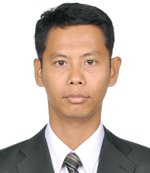
Akbar Cita holds a bachelor’s degree from Geological Engineering, Gadjah Mada University and Master of Science at Kiel University, Germany. He has written several papers in the journal, book and map related to the topic of Geomorphology and Quaternary Geology. Currently, he serves as the Sub-Division Head of Information System; Information Department. His work involves managing data and network operation in Center for Geological Survey.
About Presentation
The development of web-based geological data catalog in The Centre for Geological Survey, Geological Agency of Indonesia
Center for Geological Survey (CGS), geological agency of Indonesia has the task of doing research and service in the field of geology. Center for Geological Survey store many geological document and publication results from various parts of Indonesia. The Act Number 14 year 2008 on public disclosure require Public Agency to establish and develop information systems for managing public information efficiently so that it can be accessed easily. To achieve this objective, CGS develops web-based catalog of geological data. The catalog will contain the maps and publications produced by CGS such as geological maps, quaternary geological maps, geomorphologic maps, seismotectonic maps and journals of geology and mineral resources. The catalog uses a scale of 1: 50,000 topographic maps. The available spatial data in the database (Geodatabase) subsequently published via WebGIS server. It is use OpenGeo consisting of GeoServer, PostgreSQL with PostGIS extensions and GeoExplorer.
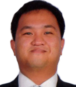
Sonny Andalis is a BIM Specialist for BCA Centre for Construction IT (CCIT). He is a civil engineer by profession with a focus in Structural and Transport Engineering. He has 13 years’ experience in Telecom Infrastructure, Facility Renovation, Rail & Airport Engineering under Alcatel, CPG Consultants & Mitsubishi Heavy Industries prior to joining BCA. In BCA, he is responsible for Civil and Structural BIM eSubmission implementation & handholding of BIM adopters. He teaches BIM at NUS, NTU, Singapore Polytechnic, Ngee Ann Polytechnic and BCA Academy. He has written technical papers on BIM interoperability; BIM physical & structural analytical model integration; BIM cloud computing and renovation using laser scanners to create point clouds.
About PresentationInfrastructure projects are essential is the development and running of a country. A strong correlation exist between good infrastructure and quality of life. Unlike buildings that has a lifespan of 50 years, infrastructure easily double at 100 years and must constantly be upgraded to be relevant to changing demands and technology. Infrastructure must also be resilient to withstand natural forces like floods, earthquakes and tsunamis. For a city state like Singapore, keeping the city cope with increasing population requires constant innovation due to constraints of space and balance with sustainability and environmental impact. This paper will discuss the implementation of Building Information Modelling (BIM) to major infrastructure projects and its integration with Geographical Information Systems (GIS). The creation of Project Information Model (PIM) for regulatory submissions and Asset Information Model (AIM) for facility operation and management to enable the creation of a Smart City a reality. The author will also share best practices from the ongoing UK Crossrail, and soon to finish Sweden Hallandsas Tunnel.

With nearly 30 years’ experience in Geospatial industries, Kenneth Smillie is managing mobile solutions from Leica Geosystems including UAS and mobile mapping systems. He joined Leica Geosystems in 1998 in the Middle East, as a Consulting Engineer and has held various sales and marketing positions in the Middle East, Switzerland and Asia. Prior to joining Leica Geosystems, Mr Smillie has worked as a land surveyor, project manager and part-time aerial survey pilot. He holds a geomatics degree from the University of Glasgow and an MBA from the University of Strathclyde (U.K.)
About Presentation
UAS Rotory Revolution: Inspection to Inventory, Mapping to Movies
The advent of professional rotory small UAS has not only had an impact on the surveying and mapping community, but also in the way that many other industries approach their day to day work tasks. This includes the large and growing Industrial Inspection sector. Sensor independent rotory UAS platforms bring a wealth of new sensors and techniques to traditional and new industrial segments which open up new opportunities to those service providers who have or will move to UAS operations.
The new opportunities are created in several ways, a number of which will be detailed. Access to new and more varied sensor payloads open new segments and applications where UAS can extend the core advantages of speed, safety and economic operations whilst being able to satisfy individual industries’ specific requirements, whether in the broadly Mapping or Inspection areas.
Allied to a greater variety of sensor payloads, improvements in UAV absolute coordinate positioning helps to drive the adoption of UAS in these new areas. Techniques to improve the accuracy of acquired data both in the open with GNSS, or in GNSS denied areas, such as within buildings, gives certain applications improved results and allows some to be undertaken by UAS for the first time.
A short overview where mainstream commercial use of small UAS is concentrated will be given and an indication of which new and altered segments and applications can and will benefit from the advances in the dual areas of payload variety and range, and of higher accuracy positioning. Examples of some new application specific opportunities will be shown together with improvements which can be achieved in existing applications by using the new sensors and accuracies attainable.
College of Engineering and Information Technology
Caraga State University
Philippines

Meriam is an Associate Professor in the College of Engineering and Information Technology of the Caraga State University (CSU) in Butuan City, Philippines. In 2010, she obtained her Master of Science in Remote Sensing degree from the University of the Philippines in Diliman, Quezon City. She also has a Bachelor of Science degree in Geodetic Engineering that she earned in 2003 from the former Northern Mindanao State Institute of Science of Technology (now CSU). Meriam heads the CSU Phil-LiDAR 1.B.14 project, one of the component projects of the “Phil-LiDAR 1 – Hazard Mapping of the Philippines using LiDAR” program funded by the Philippines’ Department of Science and Technology, which aims to generate flood hazard maps of river basins in Caraga Region, Mindanao, Philippines.
About Presentation
Flood Hazard Exposure Assessment of Buildings through Combined Use of LiDAR Data and Flood Simulation Models
Determining the types and locations of buildings that are exposed to various flood hazards is important in flood disaster preparedness, risk assessment, and mitigation. In most cases, the availability of a 3D building database where each building is attributed in terms of name, type (e.g., residential, commercial, government, educational, etc.), and height (among many other attributes) makes the required analysis fast, efficient and informative. In this work, we conducted flood hazard exposure assessment of buildings in Cabadbaran River Basin, Mindanao, Philippines through combined use of LiDAR data and flood simulation models. First, we generated a 3D GIS database of buildings through analysis of various datasets that include 1-m resolution LiDAR Digital Surface Models (DSM) and Digital Terrain Model (DTM), high resolution images in Google Earth, and free online web maps such as Wikimapia. Building footprints were manually digitized from LiDAR DSMs and saved as GIS Shapefiles. The average of the base elevations and top elevations for each footprint were then extracted from the DTM and DSM, respectively, and used to compute for the building heights. Information on the name and type of the buildings was obtained by using Google Earth, Google Map, and Wikimapia as references. The generated 3D building database was used later on in the flood hazard exposure assessment through GIS overlay analysis. Prior to this assessment, we first developed a flood model of the river basin using a combination of HEC HMS hydrological model and HEC RAS hydraulic model. The flood model was used generate flood hazard maps that are representative of maximum flooding due to rainfall events of varying return periods (2-, 5-, 10-, 25-, 50-, and 100-year return periods). With these inputs (3D building database and flood hazard maps), we conducted overlay analysis to identify which buildings are exposed to various levels of flood hazards (e.g., low, medium, high). In addition to this, we also characterized the degree of flood exposure of buildings by comparing their heights with the simulated flood depths. The results of this study consist of a series of maps showing buildings exposed to various flood depth and hazard levels that can be utilized by Local Government Units in their flood disaster risk reduction and management strategies.

Dr. Azhari bin Mohamed is currently the Director of Survey (Geodetic Survey Division) at the Department of Survey and Mapping Malaysia (JUPEM) in Kuala Lumpur. He graduated with an Honours B.Sc. in Surveying and Mapping Sciences from the University of East London (1984), an M.Phil in GPS Geodesy from the University of Newcastle upon Tyne (1995) and a PhD in Geomatic Engineering from the Universiti Teknologi Malaysia (2003). He is also the Chairman of the National GNSS Working Group, past Joint Chairman of the Malaysia-Indonesia Common Border Datum Reference Frame (CBDRF) Project, a member of the Malaysia Inter-Agency Committee on Earthquake and Tsunami Risk Management, the Secretary of the National Eclipse Trackers (ET) Team, a member of the National Islamic Calendar Technical Committee and also a committee member of Islamic Astronomy Society of Malaysia.
About Presentation
GPS-derived Displacements Before and After the 5 June 2015 Ranau, Sabah M 6.0 Earthquake
Natural disasters such as earthquakes, tsunamis, and volcanic eruptions endanger the lives of many people in tectonically active areas. Within the south east asia region, the convergence and collision of the Indo-Australian, Philippines and Eurasian plates are moving at rates of up to 10cm/year. Although Malaysia is considered as a country with relatively low seismicity, for the state of Sabah, earthquakes of local origin are known to occur from time to time. Between 1923 and 2007, it has been reported that a total of 65 earthquakes with magnitudes ranging from 3.3 to 6.5 on Richter scale had occurred. In an effort to better understand the geodynamic process in Sabah, the Department of Survey and Mapping Malaysia (JUPEM) and the Department of Minerals and Geoscience (JMG) cooperated in the establishment of a GPS network in Ranau. The Ranau GPS Campaign 2010 was conducted in three epochs for the purpose of studying the tectonic behaviour of the area by determining the magnitudes and directions of the movement of active faults. The network comprises 19 new stations and five Malaysian continuously operating reference stations.
On 5 June 2015, an earthquake with a magnitude of 6.0 on the Richter scale occurred at 7:15 am local time in Ranau. The event epicentre was located at a depth of approximately 10 km below Mount Kinabalu which is approximately 15 km north of Ranau. JUPEM had dispatched a total of 10 survey teams to resurvey the Ranau GPS network using GPS and to date, two (2) GPS campaigns had been carried out.
This paper describes the 2010 and 2015 GPS campaigns that had been carried out by the Geodetic Survey Division of JUPEM. Preliminary analysis of the results obtained suggests that horizontal displacements of between 4.2cm and 51.1cm had occurred in stations located in the Mendasan and Lobou-Lobou fault zones. This paper concludes that more GPS observations involving additional stations as well as more permanent GPS stations are needed in order to verify station motions and obtain a better understanding of the tectonic behaviour, thus paving the way in mitigating seismic hazards in Ranau.
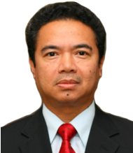
Dr. Yunus started his survey career in 1985 with his appointment as the Assistant Director of Survey at the Department of Survey and Mapping Malaysia, soon after his graduation from University of Newcastle upon Tyne in 1984, United Kingdom. He was admitted to the Master of Philosophy, at the same university in 1996 and a Doctor of Philosophy (PhD) atthe University of Nottingham, United Kingdom in 2008. Dr. Yunus is currently the Division Director of Survey at the Utility Mapping Division. He is also affiliated to the Royal Institution of Surveyors Malaysia as a Fellow.
About Presentation
Underground Utility Mapping in Malaysia; Moving beyond 2020
Malaysia established a Utility Mapping Division at JUPEM in 2006 in line with the mandate given by the Malaysia Cabinet in 1994. JUPEM is directed to compile and manage underground utility data obtained from utility providers and act as a repository body for underground utility information for the whole of the country.Securing underground utility data have been a bane to development project owners where accurate data is not easily and readily available. Most of the time, utility detection needs to be executed for new development project.This is true for most cases, especially for road expansion projects where there is insufficient accurate data available for references. This inevitably increases the cost of a project where utility detection work constitutes part of the initial planning.In the 9th Malaysia Plan, JUPEM has developed a National Underground Utility Database (PADU). JUPEM has populated the database with data from major utility providers for the whole of the Klang Valley. With the cooperation given by all the stakeholder, obtaining data is not a major issues. The main issue is in term of accuracy of data. Verifications made by JUPEM suggested that accuracy of data obtained from the providers are accurate to several metres. This situation would reduce PADU to just being a medium of storage for such data without fulfilling the greatercourse of being an accurate and reliable reference for the industry. With the existing capacity available, there is a limit in which JUPEM could achieve in doing verification jobs. This, however does not guarantee the data would remain up-to-date. The effort by JUPEM will be of no avail if there is no mechanism available to update the information. Thus, there is a need to look at the bigger picture, deal with the situation holistically andlook far into the future beyond 2020 and to design the system, standards and policy. NBOS is one of the approaches taken by the JUPEM to address such matter, where policy is set cross-boundaries not only between departments within a ministry but also between ministries. The presentation discusses such approach, the system available at JUPEM and the short and long term plan in fulfilling its objectives.

Muhammad Jafni bin Jusof holds BMm. (Hons.) Film & Animation from Multimedia University (MMU), and currently pursuing his Master Degree in UiTM has a lot accomplishment throughout his working experience. Currently he is Digital Content Designer for Centre for Creative Content and Digital Innovation, a lot of projects joined under it such as Malaysia Post Independence Architecture Atlas, Malaysia Traditional Boat Builder & Sultan Suleiman Royal Mosque Scanning Preservation Project. He also has experience as Graphic Designer at Origin Technology Sdn Bhd for 2 years and Video Editor at Creative Advances Technology Sdn Bhd also for 2 years. Some of his contributions to be highlighted are the Tempurung Cave gigapixels HDR spherical panoramic virtual reality recording for APT Consortium Sdn Bhd, Kota Kuala Kedah animated illustration panoramic virtual reality, project with En. Erwin Abd. Jabbar, University of Malaya Art Gallery (UMAG) online virtual gallery website and Cheong Fatt Tze Mansion photographic and gigapixels panoramic virtual reality recording.
About Presentation
Representation of The Past: Digital Preservation of Malaysian Heritage Through Spatial Laser Scanning
It is clear that constant physical development of infrastructure and technology may affect our environment particularly our colonial styles building and monuments. Despite the destruction or damage to the structure of these old building due to war, weather and vandalism, building with high historical value are being rebuilt, conserved, restored and preserved to as it was before and now repurpose as offices, hotels or restaurants where it is also act as a tourist attraction spots and source of income for some locals.
Notwithstanding of all this, physical preservation does not guaranteed the survival of the structures due to considering threats from excessive land development and natural disasters. Digital technology with the help of special laser scanning is in need to digitally record the state of the buildings which rich of architectural preferences. Laser scans provide detail measurements of these structures that might not have its original building plan. While the spaces will probably not accessible in the future due to many reasons, a a digital copy could save it for later maintenance purposes, preservation and conservation work, rebuilding or even just for references. Combined with high-resolution photographic imaging, the digital copy of these old heritage buildings is necessary to have for such developing nation.
CSU Phil-LiDAR 1 Project
Caraga State University
The Philippines
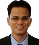
Engr. Jojene R. Santillan is the Chief Science Research Specialist of the CSU Phil-LiDAR 1 Project of the College of Engineering and Information Technology, Caraga State University (CSU) in Butuan City, Agusan del Norte, Mindanao, Philippines since April 2014. He obtained his Master of Science in Remote Sensing degree as well as a Bachelor’s degree in Geodetic Engineering from the University of the Philippines in Diliman, Quezon City in 2008 and 2004, respectively. Before transferring to Caraga State University, Engr. Santillan worked as a researcher at the Research Laboratory for Applied Geodesy and Space Technology of the Department of Geodetic Engineering & Training Center for Applied Geodesy and Photogrammetry, University of the Philippines-Diliman from 2005 to 2014. His research interests include remote sensing (RS) and GIS-based environmental monitoring and modeling, natural resources mapping using RS technology, and numerical modeling and simulation with RS and GIS.
About Presentation
Near-real Time Flood Event Visualization and Damage Estimations for Geospatially-informed Decision Making in Times of Flooding
The Web-based Near-real Time Flood Event Visualization and Damage Estimations (Flood EViDEns) is an online geo-visualization application developed through the Phil-LiDAR 1 project of Caraga State University. The application is targeted to be utilized by the Local Government Units (LGUs) and communities in the Caraga Region, Mindanao, Philippines to assist them in geospatially informed decision making in times of flood disasters. The application is an amalgamation of web mapping technology, various geospatial datasets including LiDAR-derived elevation and information products, hydro-meteorological data, and flood simulation models to visualize in near-real time the current and possible future extent of flooding and its associated damages to infrastructures. The Flood EViDEns application facilitates the release and utilization of this near-real time flood-related information through a user-friendly front end interface consisting of web map, tables and charts. The application's back-end consists of computers running flood simulation models and geospatial analysis to dynamically produce (in an automated manner) water level forecasts, current and future flood extents, and tabulated information on the structures affected by flooding including hazard types. These outputs are forwarded into a PostgreSQL/PostGIS spatial database where it is accessed by the front end interface for web visualization. The information provided by Flood EViDEns is very important especially to the LGUs and the community as it can increase awareness and responsiveness of the public to the impending flood disaster. Providing this kind of information during a heavy rainfall event is useful as it could assist in preparation for evacuation, in easily identifying areas that need immediate action, in identifying areas that should be avoided, and in estimating the severity of damage to people and infrastructure as flooding progresses.

Ryan joined FARO as a Sales Engineer handling the 3D Documentation product line which includes the terrestrial and handheld laser scanners tasked to ensure creation of complete solutions and awareness for their diverse applications for FARO’s dealers and end users. He holds a Bachelor’s Degree in Geodetic Engineering from the University of the Philippines and has more than seven years of extensive experience handling different spatial technologies like GPS and GNSS equipment in the Surveying industry.

Graduate in Architecture and specialized in Restoration at the Polytechnic School of Milan, Giorgia has a long professional experience in the 3D Surveying Industry. She has managed the roles in the capacity of service, technical support and training, supporting the distribution network in Europe, South America and, especially, in the Asia Pacific Countries. Thanks to the engagement in the research and assistant professor activities, she managed specific projects, such as the structural cultural heritage verification, in occasion of the last Italian earthquakes: Salò, L'Aquila and Emilia ones.

GBandwork GPS Solutions Sdn Bhd has been serving the geospatial industry with leading-edge technologies and solutions across diverse field of applications, including land surveying, mapping, construction, agriculture & etc. They also provide consultation, support, trainings and seminars to government officials and private sector employees on a regular basis. Bandwork GPS Solutions Sdn Bhd has been appointed by FARO as the Malaysia Distributor for 3D Documentation products. Mr Jackson Cham holds a Bachelor of Engineering (Hons) Degree from The University of Adelaide, Australia. He is a certified trainer for FARO Laser Scanning Products with FARO Asia Pacific. He has been leading implementation of innovative laser scanning solutions for geospatial applications and projects in Malaysia
Md Afif holds a Bachelor Degree of Science in Remote Sensing from UTM and currently taking a Master Degree in Remote Sensing. Focus of his research is in utilizing terrestrial laser scanning and airborne laser scanning in managing remote sensing applications. One of his professional experiences in laser scanning is in UTM Razak School of Engineering and Advance Technology to define the needs of airborne laser scanning technology in landslide and land deformation. He participated in a UTM Scientific Expedition at Royal Belum, Perak as a terrestrial laser scanning operator and handles raw data processing in forestry related applications. He has also successfully done cooperation with FRIM in terrestrial laser scanning data collection for forest biomass mapping. He was trained technically in the use of FARO laser scanners and software like AutoDesk Revit, Autocad and kubit pointsense. He is currently a Technical Engineer for Atama Tech managing FARO laser scanner sales for special applications.
Professor Dr Roslan Zainal Abidin is the President and Vice-Chancellor of IUKL. Previously, he was director of the International Research Centre on Disaster Prevention (RCDIP), Universiti Teknologi MARA (UiTM) Malaysia; lecturer at the Faculty of Civil Engineering, UiTM Shah Alam; and civil engineer with the Department of Irrigation and Drainage (DID) Malaysia. He studied civil engineering at at Institut Teknologi MARA (ITM) and in 1986, was awarded a scholarship to pursue a master’s degree at Miyazaki University, Japan. In 1989, he continued his studies at the doctorate level at Kagoshima University, where he majored in soil erosion. From a civil engineer to an academician, a researcher, and finally an inventor, Prof Roslan has become an accomplished individual who is willing to cross beyond the impediments and complexity in his field of interest. Among his many inventions are the ROM SCALE, used to forecast erosion-induced landslide risk, the world’s first such scale created for landslide; the ROSJAN Number which is used to predict flood type; the RIM Classification for sinkhole prediction; ROSE Index for predicting landslide risk; Slope Monitoring and Early Warning System Using Intelligent Geosynthetics (Geodetect); and the National Soil Erodibility Inventory for highland resorts in peninsula Malaysia. Prof Roslan has 9 gold, 5 silver, and 8 bronze medals; and 8 special awards under his belt for his inventions in various national and international competitions.
About PresentationForecasting Erosion Induced Landside
Soil erosion is globally recognised as a serious threat to the human well being. The basic definition of the word ‘Soil Erosion’ basically means the destruction of soil by the dual action of water and wind. It is essentially a smoothing process with soil particles being carried, rolled or washed down by the gravitational force. Erosion induced landslide is fundamentally a continuous process caused by two prominent means of disturbance either geologically or accelerated that affects the geotechnical strata and the surface of the earth. The severity or impact on the soil strata depends significantly on the rainfall intensity, energy and magnitude of the rainfall erosiveness which scour away and breakdown the soil particles and carry them away besides the degree of soil erodibility itself. A combination of these two main factors namely rainfall erosivity and soil erodibility can be used as a predictive tool in forecasting erosion induced landslide.
Globally, erosion induced landslide poses enormous threats and over the past years as well as in the present scenario have caused severe damages. Apart from claiming lives of the humanity, it destroys residential and commercial properties, arrests development in urban and rural areas and impairs water quality of rivers and streams. The problem of erosion induced landslide is not unique as it occurs in most countries throughtout the world.
From the engineering perspective, soil erosion includes the process of detachment of soil particles from the soil mass as a function of rainfall erosivity. When raindrops fall on the bare surface of a slope, it would results in the slope to be eroded and exhibiting erosion features of sheet, rill or gully. With increasing external stimulus of intense rainfall, this would gradually cause slope failure or landslide as commonly being kown. Slope failure due to soil erosion phenomenon that leads to landslide occurrences had entirely been referred under the standard classification system of shallow translational type of movement of debris slides and flows.
Thus identification of potential erosion locations is substantially crucial as it would lead to the determination of landslide prone areas. At present, there are about 46 number of major landslides event in Malaysia since 1993 that have been identified as erosion induced landslide areas claiming more than 150 lives. Malaysia faces the problem of lanslide mainly due to its geographical location in the area of destruction which recorded an average annual rainfall of 2500mm. The need to take appropriate mitigating measures against erosion is essential in planning new development projects. As erosion induced landslide constitute a major socio-economic problem, information on erosion risk locations would supplement a reliable landslide hazard map in the country. This in many ways would reduce the number and impact of landslide occurrance, thus mitigating economic and social losses. By knowing the level of rainfall erosivity and soil erodibility impact of an area, the potential risk of erosion induced landslide can be determined.

Felizarta holds the position of Staff Engineer in Network Asset Planning - Substation Asset Planning Department of MERALCO. He is in-charge of the assessment of present and future substation power transformer loading conditions of the MERALCO electric system as well as the formulation of load forecasts and substation development plans for short, medium and long term planning horizon. He has a Bachelor of Science Degree in Electrical Engineering from the University of Santo Tomas, the Philippines. He is a Registered Electrical Engineer and has an overall experience of more than 12 years in engineering, power distribution, training etc.
About Presentation
Landuse Modeling Using Satellite Photomaps
Landuse modeling is used in the load forecasting process of MERALCO which starts with modeling in the spatial load forecasting software the geographic locations of substations and its coverage, landuse (customers), major roads and highways, waterways and identification of vacant-usable lands with possibility of being load bearing in the future, as well as those vacant-restricted which are either publicly owned or non-developable lands, using satellite photomaps of the Meralco franchise area. The software uses a geographically exact computer model of Meralco’s substations and customer locations which are digitized by the user using a layer of satellite image to perform land use simulation and pattern recognition to determine where new customers will develop. Then, it converts the digitized map or vector data to raster or grid maps of the new land use as well as other data such as customer load curve data, and expectations in increased customer demands for electricity to create future load maps.
Thus, landuse modeling is very critical to come up with the best long range plan for the distribution system substation and ultimately a superior short-range substation planning.
Using satellite photomaps as a background map, substation planning engineers can update various parameters such as land use, highways, substation area coverage, substation location, water ways, zoning, urban poles or spot loads as well as other government infrastructure projects. Land-use modeling or simulation permits the planner to evaluate multiple scenarios, since land-use simulation considers the growth across an entire region and the interaction of the various load growth drivers in that region. Most importantly, landuse simulation identifies areas of the system where capacity deficiencies will occur in the future.
Visualizing the Smart City –3D Spatial Infrastructure
The rapid and ongoing growth of cities in the Asia Pacific region has created an increasing requirement for smart spatial infrastructure to assist with planning in the urban environment. The use of smart 3D City Models is an important tool to help plan, visualise, analyse and better manage spatial infrastructure in these areas. This presentation will discuss the various processes of data acquisition including LiDAR, aerial imagery, satellite imagery, oblique imagery and terrestrial methods for smart 3D City Models. It will highlight the visualisation tools available to undertake analysis of planned developments and clearly communicate these results to project stakeholders and the wider public. Recent Case Studies will show how these smart 3D City Models can effectively bring government and society together, by spatially enabling the planning and approval process.

Asst. Prof. Ornprapa Pummakarnchana Robert (PhD) is presently working as a lecturer and researcher in GIS and remote sensing at Silpakorn University, Thailand. Her research is focused on GIS and remote sensing applications in monitoring environmental pollution. She also received a few honor awards; Annual 10 Best Articles Award given by International Frequency Sensor Association in 2008, Scholarship to attend NATO Advanced Study Institute on Functionalized Nanoscale Materials, and Systems in 2005 and 2007, and Best Speaker Award from Asian Conference on Remote Sensing in 2004. Recently, she has been working on Geo-database for national defense together with Royal Thai Army
About Presentation
Discussion topics on Data Collection – Why Do We Need Technologies and Tools?
include 1) current method adopted for collecting geo-specific attributes for GIS layers, 2) manually plotting of inventory data and profile for forested areas, 3) tools developed and purchased for use in the project, and 4) needed tolls and technologies for future GIS data collection.
Lt. Col. Ampun Janpengpen (Ph.D.) is currently a researcher at Defense Technology Institute (Public Organization) of the Kingdom of Thailand. He received Master and Doctoral degree from University of Maryland in Civil and Environmental Engineering. His major research interests focus on Project Management and Environmental Management. He has particular interests in applying UAS in construction projects, utilizing MiniUAV in water resources management and mitigating odors in wastewater industries.
About Presentation
Discussion topics on Current Technologies and Tools for the Project?
include 1) army officers for data collection workforce, 2) MiniUAV: the current potential tool for the next project, 3) maneuvering and flexible capabilities suitable for the application, and 4) UAV opportunities for geo-database for defense.
Wg Cdr Worakong Meekhla received MSc in Weapons and Vehicle Systems from Defence College of Management and Technology, Cranfield University, UK. He is now a test and evaluation engineer of Defence Technology Institute (Public Organization). He has performed a defence research coordinator among the Army, Air Force and DTI.
About Presentation
Discussion topics on Current Technologies and Tools for the Project?
include 1) small-arms simulators in the world, Asia and ASEAN, 2) technologies and tools to enhance the effectiveness and realism of the simulation, 3) the revenue small-arms simulators could bring to the industry, and 4) Thailand’s small-arms simulator market: facts and figures, key players and potential benefits.
Gp. Capt. Chamnan Kumsap (PhD) is a former Air Force officer now working as a researcher in Defence Technology Institute (Public Organization) of the Kingdom of Thailand. He received a doctoral degree from Asian Institute of Technology in Remote Sensing and Geographic Information Systems. His fields of interest include Landscape Visualization, Remote Sensing, Geographic Information Systems, Military Simulation and Training and Serious Game Technology.
About PresentationDiscussion topics on background of GIS Modeling for Military Simulation and Training
include 1) the geo-database as a basic component of DTI’s military simulation and training technology, 2) a strategic plan to put forward geo-database to defense industry under a multilateral collaboration, 3) lessons learned from the project on geo-database for training scenarios, and 4) future aspect of the project and the need for international collaboration.

Madam Ir Rozinah Anas has vast experience in the ICT industry. She is the Project Director for MERS 999, Telekom Malaysia. Rozinah began her career as fresh engineer in the Government Telecoms Department which was privatized and known as Telekom Malaysia (TM) today. Her 25 years stint in TM encompasses experience in Network Operations, Planning and Implementation, Product Development and Sales. She has successfully managed and deployed mega projects with TM. She has presented in various conferences and seminars locally and abroad. Her latest challenging task is the improvement of the emergency and disaster management services for the government of Malaysia. Her current program is in setting up a new system throughout the country for all the emergency service providers, conducting training program, awareness and publicity campaign to the public for emergency services. Her aspirations are to see Malaysia becoming the hub of Public Safety within the region. She graduated from Clemson University, USA in Electrical Engineering. Her professional qualifications include certification with M.I.E.M. as a professional engineer and Certified International Project Manager (CIPM) from AAPM, USA. She loves travelling and reading. Amongst her favorite author are Robert Kiyosaki and Steven Covey.
About Presentation
APPLICATIONS OF UNMANNED AERIAL VEHICHLE (UAV) IN PUBLIC SAFETY : TM AERIAL SERVICES
Telekom Malaysia proudly would like to introduce a new TM Aerial Services with an integrated solution for live transmission in high definition, data centre and geospatial analysis using unmanned aerial vehicle (UAV). Some of the TM Aerial Services will cover solution for public safety especially forest fire monitoring, hazardous material management and flood monitoring. Some case studies of real incidents covering earthquake, flood and landslide will be share to the forum participants
Capt. Martin A. Sebastian, Royal Malaysian Navy, joined MIMA in Nov 2011 as Fellow and Centre Head of the Centre for Maritime Security and Diplomacy. Prior to joining MIMA, Capt. Martin completed three years of Secondment with the Department of Peacekeeping Operations (DPKO), United Nations Headquarters, New York. He served in the Office of Military Affairs (OMA) as a Strategic Planner in the Military Planning Service (MPS). In OMA, he was appointed as Team Leader for Africa Planning Team II covering West African peacekeeping missions. He pioneered the setting up of a maritime planning section in MPS and was appointed as the OMA Team Leader for the Maritime Working Group, which monitored planning requirements for the UNIFIL Multinational Maritime Operations in Lebanon and riverine operations in peacekeeping missions. Capt. Martin is credited for leading a team in the drafting of a UN Policy for Maritime and Riverine Operations in Peacekeeping. He is country representative in the Council for Security Cooperation in the Asia Pacific (CSCAP) and Indian Ocean Rim Association (IORA) Maritime Security Study Group. He has presented in the ASEAN Regional Forum Inter- Sessional Meeting on Maritime Security (ARF – ISM MS), ASEAN Defence Ministers Plus Expert Working Group (ADMM Plus EWG), ASEAN Maritime Forum (AMF) and the annual Workshop on Managing Potential Conflicts in the South China Sea. His field of expertise on Maritime Security is in Diplomatic engagements, Conventional Operations, Law Enforcement, Maritime Industry and Maritime Search and Rescue; and Humanitarian Disaster Relief from the Sea.

Associate Professor Dr Anuar Ahmad has more than 33 years experience as a lecture in Surveying Science and Geomatics. He has served as a lecturer at Universiti Teknologi Malaysia (UTM) since 1983. Currently he is the undergraduate manager at the Faculty of Geoinformation and Real Estate, UTM Johor Bahru. His research interest is in the field of Aerial Photogrammetry, Close Range Photogrammetry, UAV Photogrammetry, Geomatic Engineering, Geographical Information Science and Remote Sensing. His current research focuses on the use of UAV for research and diversified applications such as large scale mapping, river mapping, coastal erosion mapping and etc. Currently he involves in a research for development of fixed-wing UAV, multi-rotor UAV and UAV lidar for Tenaga Nasional Berhad (TNB) Research Sdn Bhd for the purpose of research and mapping transmission line. Apart from teaching and research he also has published over many articles in nasional and international conference proceedings and journal. In tandem with his expertise, also he has supervised many MSc students by research and PhD students.
About PresentationGeospatial Technology for Utility Mapping using Unmanned Aerial Vehicle
In Malaysia, Tenaga Nasional Berhad (TNB) is a utility company that supply electricity for the nation. It is the largest electricity utility in Malaysia and a leading utility company in Asia. TNB comprises of several departments that include TNB Research Sdn Bhd, TNB Transmission and others. TNB is working hard to transform the utility company into a more efficient organization which is able to deliver more value and quality services to its customers and shareholders. Nowadays, TNB Transmission is utilizing the Geographical Information Technologies (GIT) such as Remote Sensing, Global Positioning System and GIS for planning new transmission line route. The used of GIT really does help in planning works for selecting new route for transmission line and searching for new substation site. The TNB Research Sdn Bhd also is utilising GIT for their research activities. These two entities have used digital data, however, the use of digital data is very expensive. Hence other alternative shall be seriously considered to save cost and time for data acquisition and processing. TNB Research Sdn Bhd, and TNB Transmission are considering current technology of UAV system for acquisition of geospatial data. They engaged Universiti Teknologi Malaysia (UTM) to develop UAVs for the purpose of research and utility mapping (i.e transmission line). Fixed-wing, multi-rotor UAVs and a special UAV lidar will be developed. UAV technology is known for their easy movement, great flexibility and low costs, is promised to be a great aerial sensor for capturing remote sensing data. UAVs can be launched and deployed within minutes, and send data back in real time. They can provide bird’s eye view over an intersection or a large area, and provide continuous information. Data such as elevation (DSM, DEM), digital aerial image and video can be obtained faster when required using UAV system. The cost of the data is equivalence to the cost of the staffs doing a fieldwork. All rapidly captured data of UAV can be processed and updated by trained staff. Other advantages, the data is free from cloud cover.
An Indoor Positioning System (IPS) using Grid Model
To date many positioning systems are available to determine or track a user’s location; three main categories include Global Positioning System (GPS), wide area location system and indoor positioning system. GPS has its limitation (poor signals) in indoor or urban uses, while wide-area location systems are cellular networks dependent. For indoor positioning system many approaches like infrared sensing, radio frequency, ultrasonic etc. are proposed; each of these methods has their own advantages and disadvantages. Considering cost-effectiveness, speed and accuracy a recent interest is growing on using wireless technology. A Wireless Local-Area Network (WLAN) based positioning system has some distinct advantages like low-cost and wider area coverage. This research proposed a system to determine the location of a mobile terminal using high speed, low-cost wireless networks by using the wireless communications infrastructure. The experimental set up used an indoor wireless facility of an auditorium, where signals from three Access Points (APs) were recorded to train a position determination model to calculate and map a position. Grid model was applied and compare the resulted position of a client. A handheld smartphone equipped with application software was the client device. The accuracy assessment has been performed to identify the distance errors and the average distance error was found lowest for the grid model. The results of the experiments reveal that the accuracy of 0.05 m can be achieved.

Heading DigitalGlobe APAC Sales, Derren Yong has over 10 years of experience in various Sales & Business Development capacity in different regions of Asia Pacific. He has 20 years direct, channel & enterprise sales in the Geospatial & Telecommunications industry, winning Top Sales , Top Growth in different regions & companies. Keen interest in Sports & passionate about learning the different cultures in the World. Derren holds a Bachelor Degree In Business Studies & Marketing (Honors) from The University of Bradford & Master in Business Administration, National Technology University.
About PresentationDigitalGlobe Evolving Geospatial Technologies in this New Paradigm The geospatial industry of today bears only a faint resemblance to the geospatial industry of just a few short years ago. The context of data as “king” is now being complemented by other enablers that are now making the information and insight extracted from the data “king”. This dynamic is being supported and driven not only by exponential growth in the quantity of data available, advances in supporting storage technologies but also by the needs and expectations of completely different end user sets who are not geospatial experts but highly value the quality and timeliness of the “answer”. In this brief overview DigitalGlobe will highlight the proactive business initiatives in which it (and like-minded companies) is investing to serve this new paradigm, lead the movement to Geospatial 2.0 and democratize the timely and easy access to actionable information.

Warlito is a Geodetic Engineer with varying experience in Project Planning and Management, Land Policy Development, ICT management and service applications. Since 2002, he has been working at the Land Administration and Management System (LAMS) National Coordinating Desk at the Land Management Bureau (LMB) in Philippines, holding many positions of related to the country's Land Administration and Management Project. Warlito holds a Master in Public Administration, from St. Paul University Philippines, Philippines and Master of Science in Remote Sensing from University of the Philippines.
About Presentation
Land Administration and Management System (LAMS) Philippines: - Improving land governance in the Philippines
For century old problem, the Philippines is beseech with numerous land administration problems that underpins economic growth. A study conducted by the Land Administration and Management Project (LAMP) shows that these problems are attributed to defect in the system that needs major reforms in the land sector. This includes institutional, legal and procedural reform in the land administration and management. Under LAMP, it has tested new approaches to accelerate land titling that has been lingering for almost one hundred years and the application of new technologies to improve land governance. The development of new geospatial tool, called the Land Administration and Management System (LAMS) Philippines, has provided new opportunities to correct the century old problem in the land administration. The Spatial Digital Cadastral Database (SCDB) and transactional monitoring system provides transparency and accountability in land transaction services to public. The application of LAMS Philippines provides opportunity to enable Local Government Units (LGUs) and other Government Agencies to access, correct and update spatial information and become as basis in land resource development activity. The government initiative to convert all land records in three (3) years would pave the way to correct a systemic problem in the land administration through the application of LAMS Philippines. The major challenges that underpins major reform is to bring together to a common goal/agenda all other agencies in data sharing agreements to maximize geospatial information services without sacrificing the needs of the public at a minimal cost.
Haji Safar Untong is currently the Director of Lands and Surveys Department Sabah, Malaysia. He joined the department in 1987. He holds a Bachelor of Land Surveying (Honours) from University of Technology Malaysia in 1987 and has subsequently obtained two Master Degrees in Business Administration (MBA) from University Malaysia Sabah in 2006 and Master of Science (Land Administration and Development) from University Technology Malaysia in 2008. He is a Registered Land Surveyor, Chairman of the Sabah Surveyors Board, member of the Royal Institution of Chartered Surveyors (MRCIS) and a Fellow of Royal Institution of Surveyors Malaysia (FRISM).
About Presentation
Geo-Cadastre In Land Administration: Sabah’s experience
Geo-cadastre data has been key to enhancing land administration in Sabah. The various systems have been designed and built over the years and the repetitive rigorous process of data integrity and data handling to ensure that the working processes through computerisation are functional and cohesive. Prior to big data and storage management, these forms the building blocks for successful geospatial data infrastructure. At the centre of Geospatial Data infrastructure for the department, lies data for every systems that will be used for decision making. Progressive innovation and development and continuous capacity building are also essential and critical, so that the department is ready to embrace changes that are happening in the world of digital age. The experience of the department on this journey to embrace digital has been rewarding in achieving 4 A’s of access at Anywhere by Anyone at Any time and on Any device.
Siva Balasundram is an Associate Professor at the Department of Agriculture Technology, Faculty of Agriculture, Universiti Putra Malaysia (UPM). He is also Country Representative for The international Society of Precision Agriculture. He joined UPM in 1997. He has authored more than 30 scientific papers in international and national journals and conference proceedings. He has also won several invention awards.
Mark Yong is CEO and co-founder at Garuda Robotics, a Singapore-based provider of drone solutions and services. He has 20 years of experience in robotics, with bachelors and masters degrees from Carnegie Mellon University and the University of Michigan. He was previously an award-winning lecturer in the School of Computer Engineering at Nanyang Technological University, Singapore.
Azhar bin Ishak is a Meteorologist, currently heading the Meteorological Division, Marine Science Technology Sdn Bhd (MAST) and consultant to AFJETS Sdn Bhd as meteorological expert on Cloud Seeding Operation. He holds a BSc (Hons) in Physics from University of Malaya, MSc (RS/GIS) from University Putra Malaysia. He has more than 32 years’ experience in Agro-Meteorology / Climatology / Climate Change / Remote Sensing (Radar and Satellite) & GIS / Aviation & Marine Weather Forecasting and Weather Modification. He retired from Meteorological Malaysia, Ministry of Science, Technology and Innovation in October 2014.
Dr. Sukanta has more than 18 years of extensive work experience in Sales and Account Management for Utility, Energy and other Engineering domain in SEA Countries, India and China. He has successfully managed more than 20 large projects in Smart City, Smart Grid, Mobile Field Force Automation, SCADA, ADMS etc. He received his Ph.D in GIS from Indian Institute of Technology, Bombay. He has published many papers in research and industry journals and has also received various awards in his professional career.