
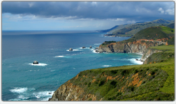
Ecosystem-based management is becoming increasingly significant in managing the vast expanse of the oceans and seas of the Asia Pacific region. Cooperative measures need to be taken in response to the pressing ocean and coastal issues in the region such as coastal degradation, loss of biodiversity, depletion of fisheries resources, and destruction of fish habitats, mangroves, and coral reefs. The potential impacts from this are compounded by current issues such as unsustainable use of coastal resources; coastal impacts from poor catchment management; population increase and urbanisation pressure.
GIS is a key technology for visualizing sea level rise scenarios and its potential impacts such as potential flooding, coastal erosion, presence of dikes, impacts on wetlands, and others. GIS datasets, complemented with remotely sensed imagery, often with supplementary GIS decision support tools such as charts, photography, and other kinds of information, play an important role in informing regional decision in various issues, including climate change impacts, marine spatial planning, coastal conservation and protected areas management, and resource availability and extraction. The seminar shall demonstrate endless capabilities of geospatial technologies beyond terrestrial applications.
| Highlights | ||
|
|  |
Speakers
 Prof. Dato' Dr. Nor Aieni Haji Mokhtar Prof. Dato' Dr. Nor Aieni Haji MokhtarUndersecretary - National Oceanographic Directorate Ministry of Science Technology & Innovation Malaysia Bio | Abstract | Presentation | ||
 Commander Kamrul Fahmy Kamrudin RMN
 Head of Cartography Department National Hydrographic Centre Malaysia Bio | Presentation | Head of Center for Marine and Coastal Environment Mapping Geospatial Information Agency Indonesia Bio |  Dr. Thomas Heege
Chief Executive Officer EOMAP Germany |
 Dato Ir.Dr. Nik Mohd. Kamel Nik Hassan
Director Dr. Nik and Associates Sdn. Bhd. Malaysia Bio | Abstract |  Annacletus Ari Dartoyo
Head Parangtritis Coastal Geospatial Laboratory Indonesia Bio | Abstract | Presentation | Full Paper |  Dr. Baljeet Malhotra Dr. Baljeet MalhotraSenior Research Scientist SAP Research and Innovation Singapore Bio | Abstract | Presentation |
 Xu Shuo Xu ShuoResearch Associate Fishery Engineering Research Institute, Chinese Academy of Fishery Sciences, China Bio | Abstract | Presentation |
 Irvinia BA Irvinia BAGIS Specialist Niko Resources Indonesia Bio | Abstract | Presentation | Full Paper |
 Prof. Dr. Saleem Mustafa Prof. Dr. Saleem MustafaDirector Borneo Marine Research Institute, Universiti Malaysia Sabah Malaysia Bio | Abstract | Presentation |