Speaker Lineup

Flavia Tata Nardini began her career at the European Space Agency as Propulsion Test Engineer. She then joined TNO – the Netherlands Organisation for applied scientific research – to work on advanced space propulsion projects. In 2015, Flavia co-founded Fleet, a connectivity company set to maximise the resource efficiency of human civilisation. Fleet will launch the first of over 100 planned nanosatellites in 2018, enabling the next industrial revolution with a free, ubiquitous connectivity platform.

Ed Parsons is the Geospatial Technologist of Google, with responsibility for evangelising Google’s mission to organise the world’s information using geography, and tools including Google Earth and Google Maps. In this role he also maintains links with Universities, Research and Standards Organisations which are involved in the development of Geospatial Technology.
Abstract The Road to the Map of the FutureIn the last decade the use of mapping has exploded to the extent that maps are now part of our daily lives and have become almost invisible in their ubiquity. Ed Parsons will explore how this development occurred, and will illustrate how place is still important in technological development by taking a virtual industrial archaeology tour of Silicon Valley. Finally he poses the question will the map of the 21st-century be even be a map?

Cy joined the State of Oregon in 2000. He is responsible for statewide coordination of all GIS activities in state, regional and local governments, helping to assure the elimination of redundant activities. He is Past-President of the National States Geographic Information Council, Past-President of the Urban Regional Information Systems Association, and Founding Chair of the Coalition of Geospatial Organizations, a coalition of 13 geospatial professional organizations representing over 170,000 members. Cy was GIS Manager for Olathe, Kansas for four years, Kansas State GIS Coordinator for three years, and a GIS consultant for PlanGraphics, Inc. for four years.
Abstract Collaborative Governance is Essential for GIS SuccessGIS is usually most successful when multiple organizations can use shared geospatial data and technology to support business processes and make collaborative decisions together. But organizations, including government and large corporations, are typically structured in silos, which can make it difficult for data and technology to be shared. Collaborative governance is an organizational structure in which partners in different silos can make decisions together. The ultimate objective of this kind of approach is to provide consistent services across an entire jurisdiction or organization. Collaborative governance is particularly important when the silos that need to coordinate exist at different levels of the government or corporate organization. The State of Oregon in the U.S. has recently modified its collaborative governance model for GIS and provided that model with additional authority to enable greater success. The lessons learned in Oregon are applicable in other government and corporate situations.

Peter leads the South Australian Government's Office for Data Analytics and is also the state's Chief Data Officer. He has spent most of his career in or around data and analytics, and led innovative change in reporting, analytics and actuarial activities. Peter has held a number of leadership roles in operations and analytics in both public and private sector and is passionate about improving businesses understanding, efficiency and customer service.
Abstract Digital Governance for South AustraliaWelcome to Adelaide - a nexus of geographic beauty, world-class thinkers and economic and digital innovation. The South Australian Government is focussed on better service and connection with citizens, removing outdated ways of working, increasing digital literacy and interaction and better using our vast data to benefit citizens, businesses and the economy. Today’s data scientists work in an exciting era, connecting the data dots to make real and sustainable improvements to people's lives. The Office for Data Analytics (ODA) facilitates data sharing between agencies to improve efficiencies, drive improvements in policy and deliver measured change initially in the area of vulnerable children and their families. ODA integrates data siloed in separate agencies to build better pictures of citizens’ lives, drive improvements in policy and deliver measured change. Along with ICT & Digital Government (IDG), ODA helps to position South Australia as a world leader in efficient, accountable and citizen-centric government practice.

Jerry Johnston has extensive experience in building and sustaining enterprise technology solutions for global problems across the public and private sectors. He previously served as an executive in the Office of the Chief Information Officer, U.S. Department of Interior. During this tenure, he led the National Geospatial Platform initiative, a cloud-based shared collaborative data exploitation and sharing environment that is utilized by the whole of U.S. government. Johnston served as a charter member and vice chair of the National Geospatial Advisory Committee, a body comprised of U.S. geospatial leaders from federal, state, local governments and tribal nations, as well as academia and the private sector.
Abstract Location Enabled Risk SensingRisk sensing – using human insights and advanced analytics capabilities to identify, analyze and monitor emerging risks – has become a key component of many organizations’ arsenals for managing risk. Risk sensing aims to detect emerging risks so that organizations can mitigate risks before they generate potentially significant impacts. While the spatial dimensions of risk to organizations and facilities have been thoroughly explored across many domains (weather hazards, geopolitical events and activities, etc.), location intelligence and risk sensing can be leveraged to illuminate other types of risk, including risks to reputation, supply chain, safety and sustainability. State of the art risk sensing platforms take full advantage of geospatial data and technology, and use the power of location to help organizations identify, predict and manage strategic risks.

Ben is currently employed as the Athlete Development Manager at the South Australian National Football League and has been involved in the physical preparation of athletes since 1999. His coaching experience extends across a wide range of sports including professional sports (Australian Rules Football and cricket) and Olympic sports. He has also led the physical preparation for the Australian Beach Volleyball team for 2013/15 World Championships and the Rio Olympics.
AbstractBen will discuss the use of GPS technology in Australian Rules Football. Specifically, the use of GPS in high performance coaching, fitness and in preparation of South Australian junior players and promising state players for recruitment into the Australian Rules Football (AFL) national competition.

Rebecca gained a degree in architecture from the Louis Laybourne-Smith School of Architecture & Design at the University of South Australia in Adelaide, graduating in 2002.
She founded Conceptual Node two years after her time at University; a consultancy in Australia focused on digitising construction. Conceptual Node was the start of what is now known as Digital Node which she founded in 2013, providing advice and insight to construction professionals all over the world on advanced digital solutions and BIM implementation and management processes.
Rebecca works with Building Smart UK, BSI, CIOB and many training organisations, sits on the Autodesk Developer Network and feedback community and supports the London BIM initiative within the BIM Regions. She is also a strong advocate for diversity and young people (having been part of a future focused industry group, BIM2050) and also teaches, mentors and trains young people regarding future processes and BIM
As the founder of the global community Women in BIM (WiB), Rebecca saw a need to create a group where like-minded construction professionals with an interest in BIM methodology could share best practice, ideas and insights. Beginning as a not-for-profit community on LinkedIn, by 2016, it had grown to over 500 members, extending to women in Europe, the US, Australia, the Middle East, and south-east Asia.
www.digital-node.com
The world as we know it will change. Access and manipulation of data relating to our assets will be common place in the near future and the possibilities to be able to upskill an entire industry in these skills is endless.
This keynote discussion will discuss how a global workforce relating to the construction industry will fail should we chose to ignore digital techniques and how these evolve both in the world of buildings, infrastructure and geo spatial. It will touch on key global players in digitizing asset management and discuss how the next generation of construction professionals will work and interact with the assets we design, build and manage. It will challenge the existing processes as well as the way our organisations currently function and are managed.
Industry uptake of processes like BIM and Digital Engineering are only one part of the puzzle when it comes to enforcing change and the way in which we understand the development of these processes, both in industry and via policy is critical to the successful and productive future of our industry.
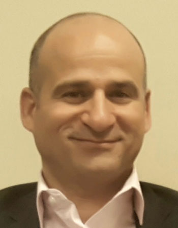
As a GIS expert, and project manager working for the Public Authority for Civil Information (PACI) in Kuwait, Maher is working in the last 20 years in GIS field. He worked in multiple disciplines in many organizations which vary from esri distributors, private consultancy, and government organizations. Maher worked under the umbrella of international donors support for different countries including Jordan, Yemen, Egypt, and Syria.
Maher is taking care of many innovative projects for PACI which include the implementation of Big Data, and machine learning projects the empower the GIS services provided by PACI. Maher has a GISP, PMI-PMP, PMI-RMP, PMI-PBA, and esri enterprise system design associate professional certificates.
Abstract Value realization from Geo-enabling government servicesGovernment services are often served based on available data to provide a specific verify to consumers. Providing a public GIS based search engine using the organization business and address data opened new opportunities. One important opportunity is the encouragement of startup businesses to build new apps, and offer better services.
The Public Authority for Civil Information (PACI) has released Kuwait Finder web and mobile app. This app, and the shared partners apps allowed PACI to innovate a new government service which is the creation of live traffic map for State of Kuwait.
This innovation has implemented a real-time, and Big Data technology augmented with machine learning algorithms to predict and generate the traffic map.
This exercise proved the benefit of using GIS based apps to government services and demonstrated the business value of such approach.

Professor Elanor Huntington is the first female Dean of Engineering and Computer Science at the Australian National University and still one of the few in the world. She is committed to growing the profile of Engineering in the community and passionate about attracting more young women to take up careers that draw on STEM skills.
Elanor is excited to be leading a project to reimagine a new type of engineering and computing, fit for the middle of the 21st century, which is all about understanding and shaping large-scale systems of people acting and interacting with each other through their digital and physical environments. She has a PhD (2000) in experimental quantum optics from the ANU and her current research interests are in the control of quantum systems, with a particular interest in the interface between theory and applications. Elanor is also a program manager in the ARC Centre of Excellence for Quantum Computation and Communication Technology.
AbstractAs the boundaries between the physical, digital, economic, biological, social and technological worlds blur, we are at the beginning of a wave of disruptive and rapid societal transformation. Some of the largest opportunities and challenges of the 21st Century - including rapid urbanisation, climate change, ageing populations, the ever-increasing “solidity” of cyberspace and the rise of artificial intelligence – come from the convergence of those worlds.
Much of the disruption comes from technologies developed by engineers and computer scientists, often from within traditional disciplinary silos and without anticipation of the impacts beyond the original applications. We must now step up and partner beyond the traditional disciplinary boundaries to seize the opportunities and respond to the challenges that are facing us.
In her talk, Prof Elanor Hungtinton will talk about how the convergence of technical and social science skills will be needed in the geospatial community over the coming decades. She will look to the roots of map-making and draw a line towards geo in the age of big data.

Dr. Este Geraghty leads the health and human services sector whose mission is to transform health through the strategic implementation of a GIS platform that improves decision-making, increases efficiencies, and facilitates collaboration at local and global scales.
Formerly the Deputy Director of the Center for Health Statistics and Informatics with the California Department of Public Health, Dr. Geraghty led the state vital records and public health informatics programs. There she engaged in statewide initiatives in meaningful use, health information exchange, and interoperability. She also led the development and launch of the state’s first health open data portal which now hosts more than 330 datasets from 12 health and human services departments.
Dr. Geraghty received her medical degree from UC Davis in 2002. She completed an internal medicine internship at the University of Utah and her residency at California Pacific Medical Center in San Francisco, CA. She has been graduated from two fellowship programs, one in primary care outcomes research and the other in health leadership. Dr. Geraghty also has degrees in Medical Informatics (MS) and Public Health (MPH), is a certified public health professional (CPH), and a Geographic Information Systems Professional (GISP).
Abstract Applying the Science of WhereTM to Improve HealthBuilding a healthy community goes well beyond the need to manage illness. It requires universal and equitable access to quality healthcare and social resources like education, transportation, housing and employment opportunities. Geographic Information Systems (GIS) play a central role in creating understanding and supporting the data-driven decisions that improve human health. Dr. Geraghty will discuss the breadth of a location-based approach and demonstrate how it can be applied to a complex problem: homelessness. How can governments and their partners act together, at the community level, to provide direct intervention, outreach, and education to both the people affected by homelessness as well as at-risk communities? How can organizations maximize limited budgets to increase the utilization of homeless services and transition more people out of homelessness by addressing their needs? Successfully getting to these kinds of focused actions requires stakeholder collaboration, community engagement and access to accurate and timely data. GIS provides a toolset that can enable these activities to maximize impact and transform how organizations operate.
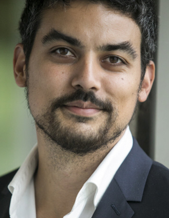
Sunbirds’ story started when Laurent was working on the SPOT6 satellite program as a young aerospace engineer. After he saw the first images sent by the satellite, he came up with the disruptive idea of a more flexible, accurate and cost-effective aerial imaging solution : a solar drone.
Laurent has spent the next five years designing the world’s first light solar-powered drone. Now at the cutting edge of aerospace and energy innovation, Sunbirds has just opened its Australian office. Sunbirds aims at becoming the leader of large scale aerial inspection thanks to the unrivalled endurance of its solar drones.

Sharon has a knack for making the complex simple. She believes that ‘passionate people persuade’ and that to make your message stick, you need to balance information with delivery style.
Sharon excels at helping people shine. With a background in science, sales and marketing, Sharon delivers keynotes and workshops on presentation skills, persuasion and influence, networking and corporate storytelling. Sharon coaches senior people ranging from CEO’s and entrepreneurs, to Professors and PhD’s helping them to be engaging and persuasive presenters and enabling them to win pitches, tenders, fellowships and grants.
Abstract The art of communication
In today’s world we all ‘sell’ three things: our organisation, our product or service and most importantly ourselves.
But how do we do that? How do we promote ourselves and our superpowers without being pushy and feeling like a fraud? If the simple question “So, what is it you do?” strikes fear into your heart, then this workshop is for you.
You will learn:
• How to increase your confidence fitness
• What your value proposition is and how to communicate it
• Building your personal brand
• Self-promotion without boasting
• How to incorporate stories to be persuasive
• How to ask for what you want and need

Joe Bruno PLS is Executive Vice President of Surveys and Emerging Technologies at ESP Associates, PA, where he has worked since 1988. He is responsible for managing and providing executive oversight for 350 employees with over $43 million dollars in annual professional fees. He has served as ESP's principle-in-charge for all state DOT and Federal contracts. Mr. Bruno was introduced to surveying in 1980 while studying mining engineering at West Virginia University. He became professional licensed as a surveyor in 1991 in North Carolina. Mr. Bruno has led the Mobile Lidar/ Scanning and aerial LiDAR and photogrammetry programs since their introduction at ESP. Joe and his wife Charlotte have four children and reside in Charlotte, North Carolina.
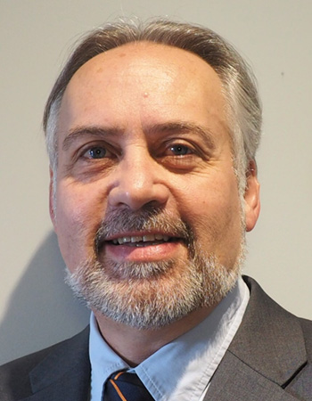
Neil is Associate Professor of Health Geography in the Health Research Institute, University of Canberra in the Spatial Epidemiology Group. He is concurrently appointed Adjunct Fellow in the School of Architecture and Built Environment, Healthy Cities Research Group, The University of Adelaide, Senior Research Fellow, College of Nursing and Health Sciences, Flinders University and Senior Research Fellow, Centre for Population Health Research, Health Science, at the University of South Australia.
Neil completed his doctorate in Geography at the University of Adelaide and has had a work history spanning academia, local and state government and private consulting Prior to the University of Canberra he was Deputy Head, Spatial Epidemiology and Evaluation Research Group and Senior Research Fellow, School of Population Health, University of South Australia, was a Lecturer, Geographical and Environmental Studies, University of Adelaide and Senior Research Associate at National Key Centre for Teaching and Research into the Social Applications of Geographic Information Systems, University of Adelaide, the South Australian State Demographer & Strategic Statistical Advisor, for the Department of Housing and Urban Development, Adelaide, the Principal Researcher, Tamar Region Master Planning Authority, Tasmania.
Neil has been involved in the application of GIS to population, urban, social and health for more than 30 years and was a part of the successful National Key Centre for Teaching and Research into the Social Applications of Geographic Information Systems at the University of Adelaide 1995-2000. His work has spanned many applications of GIS to social science and public health, the impact of the built environment on physical activity and obesity, developing socio-economic GIS databases and the use and adaptation of government collected and maintained administrative data for social and health research, and the integration of GIS into government systems. For the last 17 years Neil's work has focused on the impact of the built environment on physical activity, obesity and chronic disease. Neil helped develop the Australian walkability index as part of the PLACE project (part of the International Physical Activity and the Environment Network) which has researched walkability across 12 countries and continues to research place-health associations. Neil has published extensively across the different work sectors with more than 80 articles and reports and presented at local, state, national and international conferences.
Abstract Geohealth: The Importance of Place in Understanding Health.There is a simple concept in geography – Tobler's Law "everything is related to everything else, but near things are more related than distant things". This simple concept underpins the Place and Health work and extends analysis to explore not just traditional measures but aspects of the environment that people interact in. GIS is an "All Pervasive Enabler" and extends our capability to understand how "near things" might impact health.
Spatial technologies have made significant gains over the last 30 years. Spatial data availability has also improved over time. Spatial modelling has improved and the importance of "place" among health researchers has grown considerably. A quick check of place-health papers published outlines this interest. In 1983, 1 paper was published, 1 in 1962, 52 in 1971, by 2017 there were more than 1500 papers published. This presentation will focus on the gains and the challenges of doing "place-Health" better spatially.

The digital revolution that has engulfed most parts of the world has disrupted many industries across economies. Hardly any industry is left unscathed, for better or for worse. Transforming an industry to align it with current business climate requires innovative digital technologies. An example of such an industry is Construction, which has been slow in its uptake of digitalization. It embraced digitalization into project lifecycles only recently but it has already seen realized benefits.
Construction is known for its isolated stages within its project lifecycle. There is no harmonized platform that connects all stages. Construction projects have also become increasingly complex and expensive, and managing them is challenging. Having a digital project lifecycle eliminates interdependencies amongst the stages, and allows a single set of data to continuously build over the lifecycle. This set of data serves as the sole reference point, providing transparency and clarity during the course of the project.
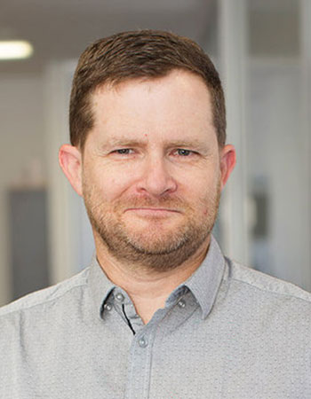
Simon is a recognised senior technology leader with a proven track record in delivering market-disrupting technologies and innovative products in the geospatial imagery sector, from prototype stage through to large-scale commercial production. He has a diverse blend of skills acquired and honed over 25 years working in the geospatial technology field, performing key roles in a range of organisational settings, from early stage start-ups to multi-nationals. These roles have included Chief Architect at Landgate, Western Australia’s primary source of land information and geographic data; Spatial Architect at Ajilon, a leading IT services consultancy; Chief Technical Officer at Nearmap Ltd; Chief Technologist at ERDAS LLC, a division of Leica Geosystems; Founder of fotoMuse Pty Ltd which was acquired by Leica Geosystems; and Chief Software Architect at Earth Resource Mapping Ltd which was acquired by Hexagon, a global provider of design, measurement and visualisation technologies.
Abstract Leveraging artificial intelligence to generate and apply insight from large data sets.Leveraging artificial intelligence to generate and apply insight from large data sets represents the greatest technology opportunity of a generation. Dubbed ‘Industry 4.0’, the arrival of AI holds the potential to fundamentally transform not only geospatial products and services, but the businesses that provide and use them, players in industries from all parts of the global economy and even society itself.
In this presentation, Simon cuts through the AI hyperbole to draw on the real-world experiences of pioneering companies deploying AI to treat cancer, assist call centre operators and instantly quote and claim on home insurance policies. From these diverse examples, Simon identifies the learnings that will shape the future of the geospatial sector, the products and services we offer and the data that powers them.