Surveyor's Workshop
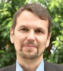
Speakers
Evolving User Needs

Founder
Platinum Survey Consultant, Malaysia

Business Development Manager – SE Asia, AAM, Australia
Adapting Survey Techniques for Smart City Requirements
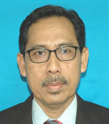
Modern Survey Tools

Licensed Land Surveyor
AJ Surveyors
Malaysia
Multi-functional of ground penentrating radar in diverse industries

Business Development Manager
MetaSensing, The Netherlands
Advanced High-Resolution Ground-Based and Airborne Radar Sensors for Geosurveying

Chief Techonology and Information Officer
Aerodyne Geospatial, Malaysia
Rapid Reality Capture with Autonomous UAV and Integration with Cloud Processing and Solution
The profession of Surveying is evolving, as the tools of data collection as well as the user needs undergo rapid advancements. More use of 3D technologies is driving the market, there's increasingly high need for real-time data and accuracy of data is a usual expectation. Professionals who are involved in this domain are under stiff competition and risk being left behind if they do not catch up with the current trend.
From the electronic total stations to 3D scanning, UAVs and LiDAR technologies are fast evolving for surveying. On the application front, survey-generated geospatial data is finding increasingly greater use in various sectors extending to land and property management, revenue collection, agriculture and plantations, building and construction, utilities, leisure, insurance, location-based apps etc.
Such changes are necessitating the need to relook at this practice. In order to stay competitive, relevant, and capitalize on business opportunities, surveying and mapping professionals need to stay abreast of these dynamics. This is only possible by expanding capabilities related to emerging technologies and innovations, keeping knowledge and technology up-to-date, enhancing skills holistically in the converging geospatial environment. Surveying professionals require skills in wide range of converging technologies such as GIS (geographic information system), BIM (building information modeling), 3D modeling, GPS, satellite imagery, laser scanning etc. Such convergence of technologies is facilitating newer business opportunities for surveyors. Meeting current and future requirements to ensure sustainability of their practice will significantly depend on capability building and capacity building.
Understanding this, Geospatial Media & Communications is organizing a Workshop for surveying and mapping professionals on Understanding Technology Trends & Meeting User Needs during GeoSmart Asia on 18 October 2016 at Berjaya Times Square Hotel, Kuala Lumpur, Malaysia. The interactive workshop, conducted by technology experts and global surveying practitioners who will bring in best practices, aims to expose surveyors to the latest technologies in their practice and the emerging business opportunities, and address their queries.
Who should attend- Geomatic and land surveyors
- Property management and valuation surveyors
- Quantity surveyors
- Building surveyors
Session on Modern Survey Tools: Modeling Software, UAVs, Laser Scanners and LiDAR, GNSS, Point Cloud Data, Photogrammetric Cameras
Exhibition Visit and Networking Tea followed by Lunch
Session on Evolving User Needs: Agriculture and Plantation sector, Land and Property Management and Infrastructure Development
Exhibition Visit and Networking Tea
Case study exchange and open house discussion
Mr. Wasim Akhtar
Assistant Manager APAC
Geospatial Media and Communications
Email: wasim@geospatialmedia.net
Tel: +60 17 211 9818


